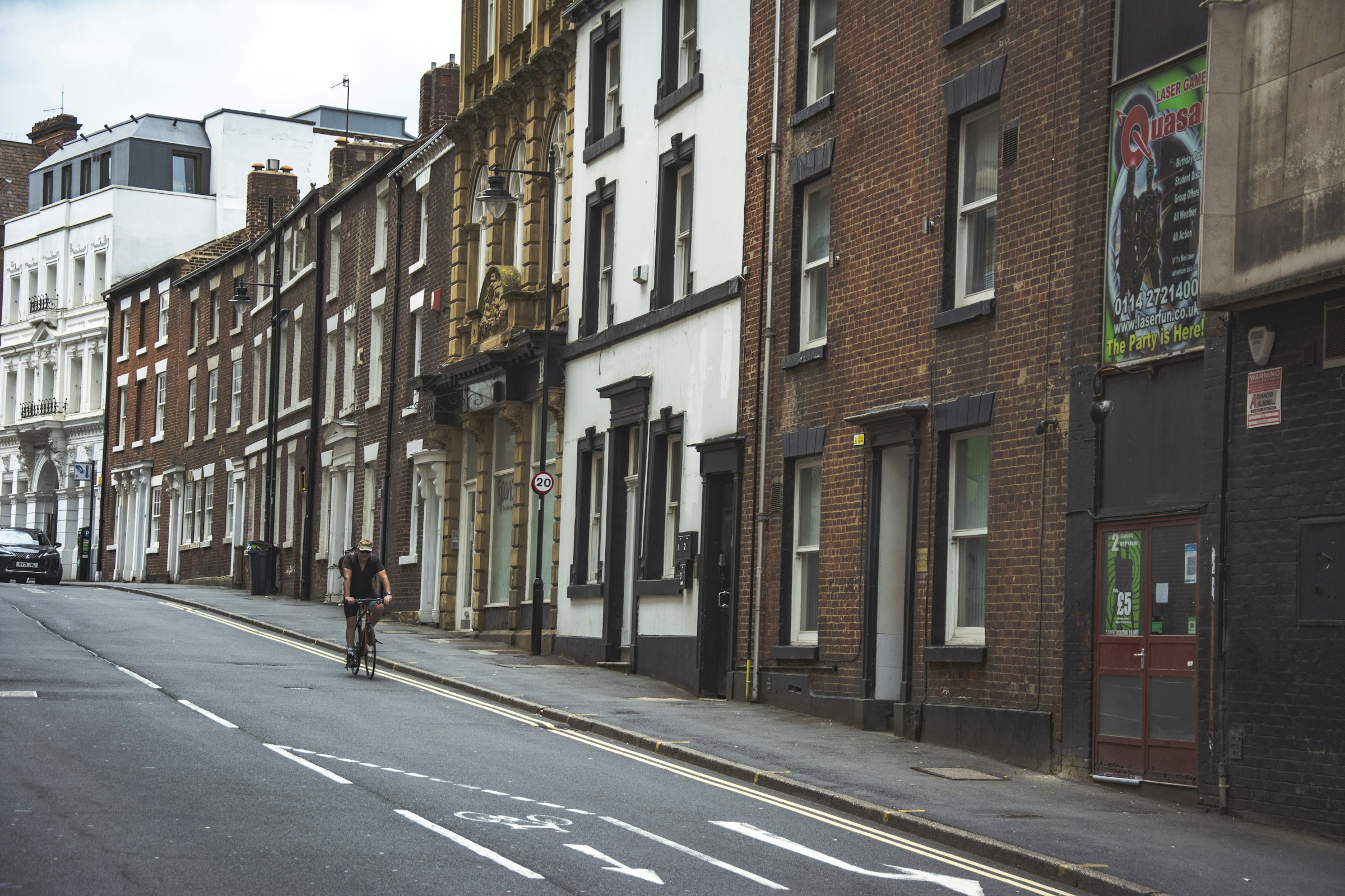
Photograph: Tak Kei Wong on Unsplash
Fresh air, close to home
Sheffield Outdoors
The outdoor city on one page: what the air, sun, rain and rivers are doing today, where the parks, woods and paths are, and the walks, rides and outdoor sessions coming up.
Today: pollen low, UV low, air quality moderate.
Before you go
Conditions now
Read from the last stored snapshot of each public source, so it is honest about its time rather than live to the second.
- PollenLowNothing much in the air today
- UVLowPeak index 0.8
- Air qualityModerateEuropean AQI up to 51
- Daylight07:00 to 16:389h 37m of daylight; dusk at 17:14
- Environment Agency62.5 mm of rain at Redmires in the last 7 days
- Environment AgencyRiver Don at Sheffield Lady's Bridge 0.45 m, falling
- Environment AgencyRiver Sheaf at Highfield 0.22 m, falling
- Where the ISS at?ISS passes nearby Fri 30 Oct, 23:52, about 19° up to the S (in shadow)
- BGSEarthquake Mon 12 Oct: M 2.6 Buttercrambe, N Yorks, 81 km from Sheffield
- Natural England67 sites of special scientific interest within reach of Sheffield
- Natural England35 local nature reserves to explore
- Natural England583 patches of ancient woodland over 2 hectares
- Yorkshire Water2 storm overflows discharging now (River Rother (+ Ps Eo), The Moss)
- Yorkshire Water461 storm overflow monitors watched around the city
- Sensor.CommunityCitizen sensors: PM2.5 10.9 µg/m³ across the city, within who guideline
- Sensor.Community27 citizen air sensors reporting around Sheffield
- British Geological Survey121 neighbourhoods sit on the Pennine Lower Coal Measures Formation
- Yorkshire Water via StreamSheffield's reservoirs are 30.5% full together, week of 19 Oct
- Canal & River Trust11 locks to climb and 30 bridges to pass on the Sheffield and Tinsley Canal towpath
- Walk Wheel Cycle Trust121 km of National Cycle Network through Sheffield, 65% of it traffic-free
- Walk Wheel Cycle Trust3 National Cycle Network segments in Sheffield are closed right now
- National Forest Inventory, OGLSheffield has 4,080 ha of woodland, about 14.8% of the city
- OS Open Greenspace, OGLSheffield has 100 allotment sites, 54 bowling greens and 49 tennis court sites on the Ordnance Survey map
- Global Meteor Network, CC BY 4.085 meteors tracked over Sheffield in the seven nights to 28 Oct; the brightest reached magnitude -3.2
Green space
Parks, woods and green spaces
Find a park
Choose a park to see its location. Use the layers above to explore green spaces, walking and cycling routes.
71 parks
- Abbeyfield Park
- Angram Bank Recreation Ground
- Arbourthorne Playing Field
- Arbourthorne Pond
- Bingham Park
- Bolehill Recreation Ground
- Bowman Drive Recreation Ground
- Busk Meadow Park
- Carterhall Recreation Ground
- Carterknowle Park
- Chapeltown Park
- Chelsea Park
- Colley Park
- Concord Park
- Cookson Park
- Crookes Valley Park
- Darnall Neighbourhood Park
- Deer Park
- Dore Recreation Ground
- Earl Marshall Recreation Ground
- Ecclesfield Park
- Endcliffe Park
- Firth Park
- Flockton Park
- Forge Dam
- Foxhill Recreation Ground
- Frecheville Pond/Community Centre
- Gleadless Common Playing Fields
- Glen Howe Park
- Graves Park
- Greenhill Park
- Green Oak Recreation Ground
- Grenoside Recreation Ground
- Handsworth Recreation Ground
- Herdings Park
- High Hazels Park
- Hillsborough Park
- Hollinsend Recreation Ground
- Jaunty Park
- Longley Park
- Lowfield Park
- Manor Fields Park
- Mather Road Recreation Ground
- Meersbrook Park
- Middlewood Park
- Millhouses Park
- Mortomley Park
- Mount Pleasant Park
- Norfolk Heritage Park
- Oxley Park
- Parkwood Springs North
- Parkwood Springs South
- Parson Cross Park
- Phillimore Park
- Ponderosa
- Richmond Park
- Rivelin Valley Park
- Rolling Acres
- Seventy Acre Hill
- Sky Edge Playing Fields
- Stannington Park
- Sycamore Park
- Thorncliffe Recreation Ground
- Tinsley Recreation Ground
- Totley Hall Park
- Wadsley Park
- Waterthorpe Park
- Weston Park
- Westwood Country Park
- Whirlow Brook Park
- Woodthorpe Recreation Ground
About this map
The council data shown here includes 419 named parks and green spaces, 2,511 sections of public rights of way, 429 cycle route sections and 2,361 grit bins.
Boundaries are simplified and some small sites are omitted. A mapped green space does not necessarily have public access. Check signs and conditions when visiting.
Contains public sector information licensed under the Open Government Licence v3.0. Source: Sheffield City Council open data. Map tiles © Esri.
On foot and by bike
Walks and rides
Our walking and cycling hubs carry the led walks, group rides and the communities behind them. The parks map draws every public right of way and signed cycle route from the council's own data.
Walking
Led walks, guided history strolls and the Sheffield Round Walk in sections.
Cycling
Group rides, family loops on the Trans Pennine Trail and the city's cycle routes.
Rights of way and cycle routes
Every footpath and bridleway on the definitive map, with the signed cycle network, drawn on the parks map.
Get out there
Outdoor events and classes
Also: classes and sessions · sport · parkour · running
Beyond the ring road
The Peak District and the edges
A third of Sheffield sits inside the national park. These are the organisations that look after it, with their own opening times, events and route notes.
Peak District National Park
The national park authority: visitor centres, walks, cycle hire and what is open.
Sheffield Round Walk
The 15-mile circuit through the city's southern parks and woods, in sections.
The Outdoor City
Sheffield's own guide to climbing, trail running, mountain biking and the people who do it here.
Sheffield Ramblers
Led walks most weeks, from short local strolls to full days on the moors.
CycleSheffield
The city cycling campaign, with route advice and group rides.
Eastern Moors Partnership
Blacka Moor, Totley Moss and the gritstone edges on the city's doorstep.
Yorkshire Water reservoirs
Damflask, Redmires, Langsett and the other reservoir walks.
Dig in
Allotments and green volunteering
Allotments
30 allotment sites in the council's green space data. Apply through the council allotments service, where the waiting lists are published.
Volunteer outdoors
Friends groups, conservation days and litter picks listed by the charities and community groups that run them.
Environment charities
Sheffield and Rotherham Wildlife Trust, the river trusts and the friends of every park, from the Charity Commission register.
On the map
Open it on the live map
Getting around 1 card
National Cycle Network
Signed cycle routes through Sheffield
4 numbered National Cycle Network routes run through Sheffield, 120.9 km of signed route of which 65% is traffic-free and 26% is lit. The Walk Wheel Cycle Trust, which used to be Sustrans, maps every segment with its surface and lighting and flags closures.
- Numbered routes
- 4
- Km in Sheffield
- 120.9
- Traffic-free
- 65%
- Closed now
- 3
Route by route
- 130 segments Route 6751.9 km in Sheffield · 66% traffic-free · 29% lit · mostly asphalt, firm unsealed, loose unsealed
- 120 segments Route 641.3 km in Sheffield · 46% traffic-free · 27% lit · mostly asphalt, firm unsealed, block paving · 3 segments closed (0.6 km)
- 37 segments Route 62723.0 km in Sheffield · 90% traffic-free · 21% lit · mostly firm unsealed, asphalt, block paving
- 6 segments Trans Pennine Trail (Route 62)2.5 km in Sheffield · 92% traffic-free · 9% lit · mostly asphalt, paving slabs
- 8 segments Unnumbered links2.2 km in Sheffield · 100% traffic-free · 13% lit · mostly asphalt, firm unsealed, other
Closures the trust has recorded
- Temporary Closure Route 6traffic-free · bare earth · unlit · 0.1 km · temporary closure · near Attercliffe
- Temporary Closure Route 6traffic-free · asphalt · unlit · 0.4 km · temporary closure · near Attercliffe
- Temporary Closure Route 6traffic-free · asphalt · partly lit · 0.1 km · temporary closure · near Attercliffe
The council's own signed cycle routes and the Trans Pennine Trail's local spurs are on the parks map; this layer is the national network as the trust records it. Council cycle routes
National Cycle Network data from the Walk Wheel Cycle Trust (formerly Sustrans) under the Open Government Licence v3.0. Contains Ordnance Survey data © Crown copyright and database rights 2018. Open Government Licence v3.0. Checked 26 Oct 2026. The dataset on ArcGIS · All data sources
Environment and sky 12 cards
Rain and river levels
49.7 mm of rain on average across 12 Sheffield gauges in the last 7 days. Wettest Redmires (62.5 mm), driest Wombwell (27.0 mm). Wettest day at Redmires: Saturday 24 Oct, 28.8 mm.
- River Don at Sheffield Lady's Bridge 0.45 m, falling (week 0.40 to 0.83 m)
- River Sheaf at Highfield 0.22 m, falling (week 0.17 to 0.60 m)
- Porter Brook at Sheffield Station 0.08 m, falling (week 0.07 to 0.27 m)
- River Loxley at Malinbridge 0.24 m, steady (week 0.19 to 0.40 m)
- River Rivelin at Sheffield Hollins Bridge 0.19 cubic metres a second daily mean, steady
ISS passes nearby
Closest approaches of the International Space Station to Sheffield in the next 48 hours. Night-time passes with the station sunlit are the ones worth stepping outside for; look towards the compass point given.
- Fri 30 Oct, 23:52, about 19° up to the S, 971 km away, night, station in shadow
- Sat 31 Oct, 01:29, about 50° up to the SE, 328 km away, night, station in shadow
- Sat 31 Oct, 03:05, about 55° up to the SW, 272 km away, night, station in shadow
- Sat 31 Oct, 04:42, about 31° up to the SW, 618 km away, night, station in shadow
- Sun 1 Nov, 00:41, about 41° up to the S, 449 km away, night, station in shadow
- Sun 1 Nov, 02:18, about 66° up to the S, 180 km away, night, station in shadow
Aurora chance tonight
Green green, no significant activity. Planetary K index 1.67 at 03:00. AuroraWatch UK updated Fri 30 Oct, 08:54.
Stargazing tonight
- Friday night: patchy cloud, gaps likely, about 50% cloud on average (best 25%), seeing average, transparency hazy
- Saturday night: mostly clear, worth a look, about 17% cloud on average (best 13%), seeing average, transparency clear
- Sunday night: mostly clear, worth a look, about 25% cloud on average (best 25%), seeing average, transparency poor
Earthquakes nearby
- M 2.6 Buttercrambe, N Yorks Mon 12 Oct, 11:42, 81 km from Sheffield
Protected land within reach
Natural England designations inside the Sheffield box, from the moors on the western edge to pockets of ancient woodland in the valleys.
- 67 sites of special scientific interest
- 1 national nature reserve
- 35 local nature reserves
- 583 ancient woodlands
- 652 areas of open access land
- 1 national park
About 43,300 hectares of open access land where you can walk freely under the right to roam.
Largest SSSIs: Dark Peak SSSI · Eastern Peak District Moors SSSI · Castleton SSSI · Dearne Valley Wetlands SSSI · The Wye Valley SSSI · Abney & Bretton Cloughs SSSI
Storm overflows right now
2 storm overflows are discharging into Sheffield watercourses right now. 461 monitors on the Don, Sheaf, Porter, Rivelin, Loxley, Rother and their brooks; 12 offline.
- ⚠️ Discharging now River Rother (+ Ps Eo) Discharging now · since 28 Oct 10:03
- ⚠️ Discharging now The Moss Discharging now · since 28 Oct 15:48
- 🟠 Discharged in the last 48 hours Knoll Beck Discharged in the last 48 hours · last discharge ended 29 Oct 10:28
- 🟠 Discharged in the last 48 hours Unnamed tributary of Hooton Beck Discharged in the last 48 hours · last discharge ended 30 Oct 07:46
- 🟠 Discharged in the last 48 hours River Don Discharged in the last 48 hours · last discharge ended 29 Oct 18:31
- 🟠 Discharged in the last 48 hours River Dearne Discharged in the last 48 hours · last discharge ended 29 Oct 13:20
- 🟠 Discharged in the last 48 hours Ditch To River Dearne Discharged in the last 48 hours · last discharge ended 29 Oct 00:01
- 🟠 Discharged in the last 48 hours Rakes Dyke Discharged in the last 48 hours · last discharge ended 29 Oct 13:42
All overflows on the map · checked 30 Oct 08:55
Pollen and UV today
- Pollen: LowAll six pollen types low
- UV: Lowpeak index 0.8
- Air quality: ModerateEuropean AQI up to 51
- Tomorrowpollen low, UV low
Citizen air sensors
27 low-cost particulate sensors report from around Sheffield; 27 have read in the last three hours. Median PM2.5 10.9 and PM10 23.5 µg/m³ (WHO 24-hour guidelines: 15 and 45).
- ● 20 within who guideline
- ● 5 above who guideline
- ● 2 poor
British Geological Survey
The ground beneath Sheffield
Bedrock looked up at the centre of 147 neighbourhoods on the BGS 1:625 000 map: 135 on the Coal Measures (mudstone, siltstone, sandstone, coal, ironstone and ferricrete, Carboniferous); 12 on the Millstone Grit (the gritstone of the western moors and edges, Carboniferous).
- Pennine Lower Coal Measures Formation: mudstone, siltstone, sandstone, coal, ironstone and ferricrete, Carboniferous, Langsettian (Westphalian A), about 316 to 314 million years ago. 121 neighbourhoods (Lowedges, Batemoor, Jordanthorpe, …)
- Pennine Middle Coal Measures Formation: mudstone, siltstone, sandstone, coal, ironstone and ferricrete, Carboniferous, Duckmantian (Westphalian B) to Bolsovian (Westphalian C), about 314 to 309 million years ago. 14 neighbourhoods (Holbrook, Westfield, Waterthorpe, …)
- Millstone Grit Group: mudstone, siltstone and sandstone, Carboniferous, Namurian, about 327 to 316 million years ago. 12 neighbourhoods (Oughtibridge, Rivelin, Wharncliffe Side, …)
The 1:625 000 map is a regional overview generalised from more detailed sheets: it describes the ground under a neighbourhood as a whole and is not a site investigation. Radon potential is a licensed BGS and UKHSA product rather than open data, so it is left out here.
Contains British Geological Survey materials © UKRI 2026. Open Government Licence v3.0. Checked 10 Oct 2026. BGS Geology 625k bedrock · All data sources
Yorkshire Water via Stream
Sheffield reservoirs this week
Yorkshire Water's weekly readings for 11 reservoirs in the Sheffield catchment, week of 19 Oct 2026. The Rivelin and Redmires chains, the Loxley valley (Agden, Dale Dike, Strines), Broomhead on the Ewden and Langsett and Midhope on the Little Don. Damflask, Underbank and More Hall are not in the published set.
- All eleven together
- 30.5%6,947 of 22,775 thousand m³ stored
- Same week last year
- 38.9%week of 20 Oct 2025
- Fullest
- 94.7%Rivelin Upper
- Lowest
- 6.4%Redmires Middle
- Rivelin Upper · 94.7% full
94.7% full Rivelin · capacity 200 thousand m³ · week of 19 Oct · 39.5% this week last year - Rivelin Lower · 86.6% full
86.6% full Rivelin · capacity 616 thousand m³ · week of 19 Oct · 83.3% this week last year - Redmires Upper · 7.8% full
7.8% full Redmires · capacity 1,382 thousand m³ · week of 19 Oct · 23.6% this week last year - Redmires Middle · 6.4% full
6.4% full Redmires · capacity 769 thousand m³ · week of 19 Oct · 18.8% this week last year - Redmires Lower · 51.1% full
51.1% full Redmires · capacity 628 thousand m³ · week of 19 Oct · 33.4% this week last year - Agden · 51.1% full
51.1% full Loxley valley · capacity 2,902 thousand m³ · week of 19 Oct · 40.9% this week last year - Dale Dike · 36.0% full
36.0% full Loxley valley · capacity 2,049 thousand m³ · week of 19 Oct · 33.0% this week last year - Strines · 18.1% full
18.1% full Loxley valley · capacity 1,923 thousand m³ · week of 19 Oct · 41.2% this week last year - Broomhead · 20.9% full
20.9% full Ewden valley · capacity 4,937 thousand m³ · week of 19 Oct · 36.8% this week last year - Langsett · 21.3% full
21.3% full Little Don · capacity 5,492 thousand m³ · week of 19 Oct · 40.3% this week last year - Midhope · 52.2% full
52.2% full Little Don · capacity 1,877 thousand m³ · week of 19 Oct · 47.7% this week last year
These are context, not a notice. A low reservoir here does not mean a hosepipe ban and a full one does not rule one out: Yorkshire Water decides restrictions across its whole region and announces them itself. Saving water and any current restrictions · Yorkshire Water announcements · Visiting the reservoirs
Reservoir levels: Yorkshire Water, published on Stream, CC BY 4.0. Checked 26 Oct 2026. Dataset: Yorkshire Water Reservoir Levels 2026 · All data sources
Forestry Commission, National Forest Inventory
Sheffield's woods
The National Forest Inventory maps every wood of half a hectare or more in England from aerial photography. Its 2025 release counts 4,080 ha of woodland in 980 parcels inside Sheffield, about 14.8% of the city's land.
- Woodland
- 4,080 ha980 parcels
- Share of the city
- 14.8%of the land inside the neighbourhoods
- Broadleaved
- 73%of the woodland
- Felled or being replanted
- 233 hafelled, blown down or prepared for planting
What kind of woodland
- Broadleaved · 2,990 ha · 73.3%oak, birch, beech, ash and other trees that drop their leaves
- Conifer · 627 ha · 15.4%pine, larch, spruce and other needle trees, mostly planted
- Mixed · 94 ha · 2.3%broadleaved and conifer trees growing together
- Young trees · 58 ha · 1.4%newly planted or regrowing, not yet a closed canopy
- Felled or being replanted · 233 ha · 5.7%recently felled, blown down or ground prepared for planting
- Other woodland · 78 ha · 1.9%coppice, scrub, sparse trees and parcels the survey assumes are woodland
The largest woods
- Wharncliffe Wood · 374 ha51% broadleaved · Wharncliffe Side, Bradfield, Ewden and Bolsterstone · 62 parcels
- Greno Woods · 277 ha58% broadleaved · Grenoside, Burncross, High Green · 24 parcels
- Ecclesall Woods · 201 hamostly broadleaved · Whirlow, Millhouses, Ringinglow · 12 parcels
- Hesley and Thorncliffe Woods · 200 hamostly broadleaved · High Green, Chapeltown · 14 parcels
- Fox Hagg and Rivelin Rough · 172 ha74% broadleaved · Rivelin, Lodge Moor, Bradfield · 16 parcels
- Woodland near Bradfield · 164 hamostly conifer · Bradfield · 15 parcels
- Ewden valley plantations · 132 ha53% broadleaved · Bradfield · 32 parcels
- Beeley Wood · 108 hamostly broadleaved · Oughtibridge, Wadsley Bridge · 5 parcels
- Hagg and Reaps Woods · 98 hamostly broadleaved · Rivelin, Lodge Moor · 9 parcels
- Oak Wood, Stocksbridge · 75 ha55% broadleaved · Stocksbridge, Midhopestones · 10 parcels
Parcels that touch are counted as one wood, and a parcel counts as Sheffield's when its centre falls inside a Sheffield neighbourhood, so a wood on the city edge can be counted in part. The inventory carries no names: the names here are ours, added from the map. Every wood by type on the Local Map
National Forest Inventory: © Forestry Commission copyright. Contains Ordnance Survey data © Crown copyright and database right 2026. Open Government Licence v3.0. Checked 12 Oct 2026. Dataset: National Forest Inventory England 2025 · All data sources
Ordnance Survey, OS Open Greenspace
Pitches, courts and greens near you
Ordnance Survey maps 100 allotment sites, 54 bowling greens, 49 tennis court sites, 117 playing fields and 163 play spaces inside Sheffield, with 1,186 gates and entrances into them. Parks are on the parks page, from the council's own layer.
- Allotments and community growing spaces
- 100
- Bowling greens
- 54
- Tennis courts
- 49
- Playing fields
- 117
- Golf courses
- 13
- Play spaces
- 163
- Other sports grounds
- 145
- Gates and entrances
- 1,186
Allotments and community growing spaces
- Aldene Road Allotment GardensWisewood · 1.9 ha · 2 entrances
- Archer Lane Allotment Home and Garden SocietyCarterknowle / Carter Knowle · 3.5 ha · 5 entrances
- Belmont Avenue Allotment GardensChapeltown · 0.1 ha · 1 entrance
- Bolehill Quarry Allotment GardensCrookes · 0.4 ha
- Bracken Moor Allotments SiteStocksbridge · 0.3 ha · 1 entrance
- Brushes Allotment GardensGrimesthorpe · 0.7 ha · 1 entrance
- Burncross Road Allotment GardensChapeltown · 0.6 ha · 1 entrance
- Corker Bottoms Lane Allotment GardensManor / Manor Lodge / Manor Top · 1.8 ha · 1 entrance
- Crookes Marsh Lane Allotment GardensCrookes · 1.5 ha · 3 entrances
- Crookes Quarry Allotment GardensCrookes · 1.3 ha · 1 entrance
- Cross Hill Allotment GardensEcclesfield · 1.2 ha · 10 entrances
- Ecclesall Allotment GardensEcclesall · 0.5 ha · 1 entrance
- Edgefield Road Allotment GardensNether Edge · 0.3 ha · 1 entrance
- Elm Crescent Allotment GardensMosborough · 0.5 ha · 1 entrance
- Ferncroft Avenue Allotment GardensMosborough · 0.2 ha · 1 entrance
- Finchwell Road Allotment GardensHandsworth · 0.9 ha · 2 entrances
- Francis Fields Allotment GardensTotley · 0.8 ha · 1 entrance
- Grimesthorpe AllotmentsOsgathorpe · 3.8 ha · 2 entrances
- Hagg Lane AllotmentsCrosspool · 5.7 ha · 8 entrances
- Handras AllotmentsHandsworth · 3.9 ha · 3 entrances
- Hangingwater Road Allotment GardensNether Green / Hangingwater · 3.2 ha · 5 entrances
- Harris Road Allotment GardensWadsley · 0.9 ha · 1 entrance
- Hawthorne Avenue AllotmentStocksbridge · 0.1 ha · 1 entrance
- Heeley Allotment GardensHeeley / Heeley Green · 0.9 ha · 1 entrance
- Herdings View Allotment GardensHerdings · 2.5 ha · 2 entrances
- High Storrs AllotmentBents Green · 2.2 ha · 5 entrances
- Highcliffe Road Allotment GardensHigh Storrs · 1.6 ha · 3 entrances
- Holberry Gardens Allotment GardensBroomhall · 0.2 ha · 1 entrance
- Hollinsend Allotment GardensHollinsend · 0.2 ha
- Hollinsend Recreation Ground Allotment GardensBase Green · 1.0 ha · 1 entrance
- Infield Lane Allotment GardensDarnall · 5.8 ha · 3 entrances
- Lambcroft Allotment GardensWoodhouse · 1.2 ha · 3 entrances
- Longley Allotment GardensLongley · 2.2 ha · 2 entrances
- Malin Bridge AllotmentMalin Bridge · 0.5 ha · 2 entrances
- Manor Allotment GardensManor / Manor Lodge / Manor Top · 2.3 ha · 1 entrance
- Meersbrook Allotment GardensMeersbrook · 15 ha · 4 entrances
- Mickley Lane AllotmentTotley · 0.9 ha · 1 entrance
- Moor Crescent Allotment GardensMosborough · 0.1 ha · 1 entrance
- Morley Street AllotmentWalkley · 5.0 ha · 10 entrances
- Morley Street Gas AllotmentHillsborough · 1.8 ha · 4 entrances
- Moss Way Allotment GardensMosborough · 2.5 ha · 1 entrance
- Mouse Hole Forge Allotment GardensMalin Bridge · 0.3 ha · 1 entrance
- Norton Lees Allotment GardensMeersbrook · 1.8 ha · 1 entrance
- Norton St Pauls Allotment GardensMeersbrook · 0.7 ha · 1 entrance
- Norwood Allotment GardensOsgathorpe · 1.5 ha · 2 entrances
- Orchard Lane Allotment GardensBeighton · 3.6 ha · 4 entrances
- Ouse Road Allotment GardensDarnall · 0.6 ha · 2 entrances
- Oxley Park Allotment GardensStocksbridge · 0.2 ha · 1 entrance
- Park Rifles Allotment GardensWybourn · 1.2 ha · 2 entrances
- Plumbley Lane Allotment GardensMosborough · 0.7 ha · 4 entrances
- Richmond AllotmentRichmond · 0.3 ha · 1 entrance
- Rivelin Park Road Allotment GardensRivelin / Rivelin Valley · 0.2 ha · 2 entrances
- Rodney Hill Allotment GardensLoxley / Loxley Valley · 3.1 ha · 1 entrance
- Roscoe Bank Allotment GardensRivelin / Rivelin Valley · 0.7 ha · 1 entrance
- Roscoe Plantation Allotment GardensRivelin / Rivelin Valley · 4.8 ha · 11 entrances
- Rustlings Road Allotment GardensGreystones · 1.4 ha · 1 entrance
- Sharrard Road Allotment GardensIntake · 1.7 ha · 2 entrances
- Shirecliffe Allotment GardensShirecliffe · 1.5 ha · 1 entrance
- Soap House Lane Allotment GardensWoodhouse · 1.2 ha · 2 entrances
- Sothall Green Allotment GardensBeighton · 0.4 ha · 1 entrance
- Stanley Road Allotment GardensStocksbridge · 0.6 ha · 2 entrances
- Stubbin Allotment GardensFirth Park · 1.0 ha · 2 entrances
- The Hagg Allotment GardensRivelin / Rivelin Valley · 5.4 ha · 5 entrances
- Truman Grove Allotment GardensDeepcar · 0.2 ha · 1 entrance
- Tye Road Allotment GardensBeighton · 0.2 ha · 1 entrance
- Vicarage Lane Allotment GardensDore · 0.6 ha · 1 entrance
- Vickers Road Allotment GardensFirth Park · 0.8 ha · 1 entrance
- Victoria Road Allotment GardensBeighton · 0.8 ha · 4 entrances
- Victoria Road AllotmentsWoodhouse · 2.6 ha · 3 entrances
- Walkley Bank Plantation Allotment GardensRivelin / Rivelin Valley · 1.0 ha · 1 entrance
- Warminster Road AllotmentNorton Lees · 0.1 ha · 1 entrance
- Warminster Road Allotment GardensNorton Lees · 1.1 ha · 3 entrances
- Wellcarr Road Allotment GardensWoodseats · 1.4 ha · 1 entrance
- Windmill Lane Allotment GardensFirth Park · 3.2 ha · 2 entrances
- Woodland View Allotment SocietyStannington East and Deer Park · 0.9 ha · 2 entrances
- Woodseats Allotment GardensBeauchief · 5.9 ha · 5 entrances
24 more allotment sites have no name on the map. Plots are let by the council or by each site's own association; ask the site for its waiting list.
Neighbourhoods with the most pitches, courts and greens
- Fulwood2 bowling greens, 8 tennis court sites, 1 play space
- Stocksbridge6 playing fields, 2 bowling greens, 2 tennis court sites, 6 allotment sites, 4 play spaces
- Darnall5 playing fields, 1 bowling green, 1 tennis court site, 2 allotment sites, 3 play spaces
- Millhouses1 playing field, 1 bowling green, 5 tennis court sites, 3 play spaces
- Firth Park3 playing fields, 2 bowling greens, 4 allotment sites, 1 play space
- Shiregreen2 playing fields, 1 bowling green, 1 tennis court site, 1 play space
- Totley4 playing fields, 1 bowling green, 1 tennis court site, 2 allotment sites, 2 play spaces
- Ecclesfield1 playing field, 2 bowling greens, 4 allotment sites, 1 play space
Allotments, greens, courts and pitches on the Local Map · Gates and entrances · Parks
Contains OS data © Crown copyright and database right 2026. OS Open Greenspace, Open Government Licence v3.0. Checked 12 Oct 2026. Dataset: OS Open Greenspace, 2026-04 release · All data sources
Global Meteor Network · UK Meteor Network
Meteors over Sheffield this week
Cameras of the UK Meteor Network, part of the Global Meteor Network, triangulated 85 meteors that began or ended within 65 km of Sheffield in the seven nights to 28 Oct: 35 from known showers, the rest sporadic. The brightest, at 01:53 on 28 Oct, reached absolute magnitude -3.2.
- Meteors
- 85
- From showers
- 35
- Sporadic
- 50
- Brightest (magnitude)
- -3.2
- Fireballs
- 0
Showers seen
- Orionids (ORI)19 meteors
- Shower LCT4 meteors
- Southern Taurids (STA)2 meteors
- Shower DAT1 meteor
- epsilon Geminids (EGE)1 meteor
- Leonis Minorids (LMI)1 meteor
- Shower NOA1 meteor
- Shower NUE1 meteor
- Shower OAT1 meteor
- Shower OER1 meteor
- Shower STS1 meteor
- Shower TOL1 meteor
- Shower XDR1 meteor
The brightest
- Wed 28 Oct, 01:53: Shower TOLmagnitude -3.2 · 114 km to 94 km up · 64.3 km/s · 12 cameras
- Wed 28 Oct, 01:59: Orionids (ORI)magnitude -2.7 · 109 km to 90 km up · 67.1 km/s · 8 cameras
- Sat 24 Oct, 04:37: Orionids (ORI)magnitude -2.6 · 114 km to 93 km up · 66.6 km/s · 2 cameras
- Sun 25 Oct, 22:05: Sporadicmagnitude -2.6 · 116 km to 85 km up · 63.0 km/s · 2 cameras
- Fri 23 Oct, 03:38: epsilon Geminids (EGE)magnitude -2.5 · 111 km to 95 km up · 69.2 km/s · 2 cameras
Magnitudes are absolute (as if the meteor were 100 km overhead); lower is brighter, and -4 or brighter is a fireball. A night under cloud shows none. Ground tracks on the Local Map
Meteor trajectories from the Global Meteor Network, with cameras of the UK Meteor Network, CC BY 4.0 CC BY 4.0. Checked 30 Oct 2026. Global Meteor Network data · UK Meteor Network · All data sources
Heritage and culture 1 card
Canal & River Trust
Walk the Sheffield and Tinsley Canal
The Trust's asset register places 11 locks, 30 bridges and 8 pipe crossings along the canal between Victoria Quays in the city centre and the top of the Tinsley flight, about four miles of towpath. The locks are all at the Tinsley end, where the canal climbs from the River Don; the walk from the basin is flat until then.
- Locks to climb
- 11
- Bridges to pass
- 30
- Pipe crossings
- 8
- Wharves, weirs and slipways
- 3
The Tinsley flight
- Lock 1 TinsleyLock · FT-005-002
- Tinsley No.2 LockLock · FT-005-005
- Tinsley No.3 LockLock · FT-005-007
- Tinsley No.4 LockLock · FT-005-010
- Tinsley No.5 LockLock · FT-005-011
- Tinsley No.6 LockLock · FT-005-013
- Tinsley No.7/8 (Deep) LockLock · FT-005-017
- Tinsley No.9 (Plumpers) LockLock · FT-006-002
- Tinsley No.10 (Wharf Road) LockLock · FT-006-007
- Tinsley No.11 LockLock · FT-007-001
- Tinsley No.12 LockLock · FT-007-002
Bridges from Victoria Quays to Tinsley
- Sheffield Basin Swing BridgeTowpath or swing bridge · FT-001-006
- Site Of Old Railway BridgeRemains of a former bridge · FT-001-007
- Sheffield Inner Ring Road BridgeRoad bridge · FT-001-008
- Sheffield Victoria Railway ViaductRailway bridge · FT-001-009
- Bridge 3, Cadman Street BridgeRoad bridge · FT-001-013
- Midland Railway Bridge 4Railway bridge · FT-001-014
- Sheffield Bernard Road Bridge 5Road bridge · FT-001-015
- Footbridge over Drydock GatesFootbridge · FT-001-032-01
- Cadman Street Gas Pipe BridgePipe crossing · FT-001-050
- Bacon Lane BridgeRoad bridge · FT-002-001
- Attercliffe Footbridge 6AFootbridge · FT-002-002
- Attercliffe Staniforth Rd Bridge 7Road bridge · FT-003-001
- Supertram Bridge 7ARailway bridge · FT-003-002
- Supertram Footbridge 7BFootbridge · FT-003-003
- Attercliffe Shirland Lane FootbridgeFootbridge · FT-003-004
- Attercliffe Shirland Lane Bridge 8Road bridge · FT-003-005
- Attercliffe FootbridgeFootbridge · FT-003-006
- Attercliffe Railway Bridge 9Railway bridge · FT-003-007
- Brown Bayley Bridge 10AFootbridge · FT-004-001
- Tinsley Coleridge Road Bridge 11Road bridge · FT-004-002
- And 18 more, all on the map. Local Map
Wharf, weir and slipway
- Sheffield Basin WharfWharf · FT-001-001
- Fixed Overflow WeirOverflow weir · FT-006-006
- Sheffield Boatyard SlipwaySlipway · FT-001-012
The Sheffield and Tinsley Canal on the Canal & River Trust site · Every lock and bridge on the Local Map
Lock, bridge, wharf, weir and slipway locations from the Canal & River Trust asset register, published on the Trust's open data hub under the Open Government Licence v3.0. Open Government Licence v3.0. Checked 26 Oct 2026. The dataset on the Trust's open data hub · All data sources