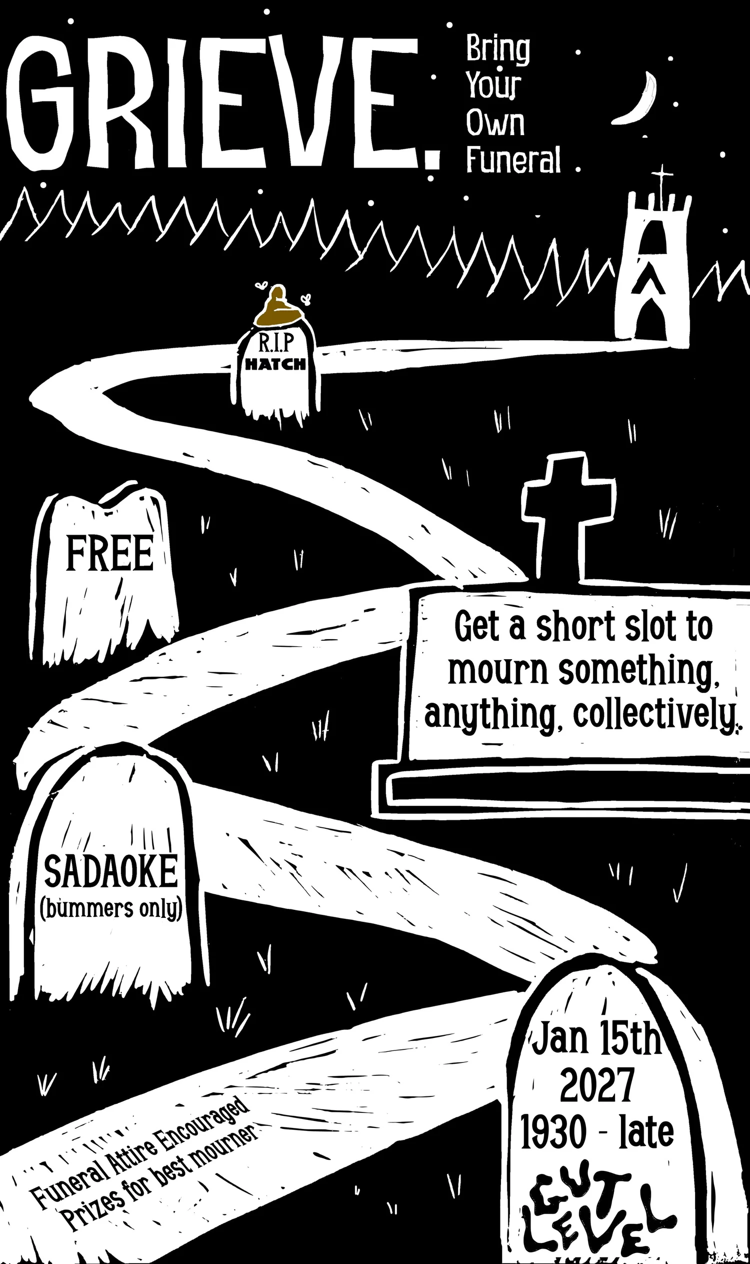
15 January 2027 · 19:30 – 02:00
Grieve (+ Sadaoke)
Gut Level
Grieve is a “Bring Your Own Funeral” night offering you the chance to have a small ceremony to mark the loss of something like:
Your hairline
A “beloved” local DIY venue
Your deadname
Your ability to piss in public toilets
Dead fly you found on a windowsill
Your pre-twink death body
Your online friend who has been offline for the last 5078 days
Or something else
You can sign up in advance and get a short slot to present something to a room full of sympathetic mourners. PowerPoint slides, video, or just a eulogy set to music, whatever you like*. Sign up sheet here:
https://forms.gle/odU4bLmgayPdvfBXA
After the funerals, there will be Sadaoke (which is like regular karaoke except you can only sing bummers) until 2am.
Dressing in appropriate funeral attire is encouraged. The most convincing mourner will win a prize.
For fans of: Carbonara, powerpoint based humour, cardboard decorations, and irreverent Hatch (RIP) bullshit.
*within reason. We maintain the right to veto your grievance for vague reasons we won’t explain, soz xox
Free entry – You must be a Gut Level member to attend
Getting there and what to expect
Weather
- No forecast yet for this date (Weather data from MET Norway, CC BY 4.0)
- Sunset 16:17, dark from 16:57 (Sunset and dusk computed for the venue)
Getting there
- Stops: High Street (HS3) (80 m, 30 30A X30 120 120K); Arundel Gate (AG3) (95 m, 24 25 785); High Street (HS2) (97 m, 6 181 779) (Stops: NaPTAN, Department for Transport (OGL v3); lines: bustimes.org / Bus Open Data (OGL v3))
- Sheffield Rail Station 500 m away, tram at Cathedral 110 m away (Stops: NaPTAN, Department for Transport (OGL v3); lines: bustimes.org / Bus Open Data (OGL v3))
- Parking: Arundel Gate 160 m (OpenStreetMap contributors (ODbL))
- Cycle parking 40 m, EV charger 370 m (OpenStreetMap contributors (ODbL))
- On the roads within 1 km: Road closed: Closed; Road closed: Closed; Road closed B6074: Closed (Traffic: TomTom)
- About 3 min walk from the city centre (190 m, straight-line estimate) (Straight-line estimate at 5 km/h; streets are longer)
- Open on the main map with this event pinned (Sheffield Events live map)
- Can I get there and back? Put your postcode into the tool below for the last bus and tram, the walk home, and the car parks. (Timetables: Bus Open Data Service (Department for Transport). Contains public sector information licensed under the Open Government Licence v3.0.)
Around the venue
- Air quality above WHO guideline (PM2.5 21.8, PM10 45.9 µg/m³, sensor 2.3 km away) (Air quality: Sensor.Community (ODbL, indicative) and DEFRA UK-AIR (OGL v3))
- Defibrillator 170 m, toilets 60 m (OpenStreetMap contributors (ODbL))
- No storm overflow discharging within 1 km (Storm overflows: Yorkshire Water (CC BY 4.0))
What is on around it
- Sheffield Audio Tour: A Sheffield Sound Odyssey (12:00, 120 m away) (Sheffield Events listings)
- Sheffield Audio Tour: Crucible and Hull (12:00, 210 m away) (Sheffield Events listings)
- Sheffield Audio Tour: Iconic Heart (12:00, 240 m away) (Sheffield Events listings)
Can I get there and back
The last bus and tram, the walk, what is recorded about step-free access and the car parks.
- Nearest defibrillator Defibrillator 170 m away · 24/7
- Nearest toilets Toilets 60 m away · free
- Nearest cycle parking Cycle parking 40 m away · free · 6 spaces · Sheffield City Council
- Nearest EV charger EV charger 370 m away · Franklin Energy /Sheffield City Council
Read about this area on Wikipedia
- Victoria Hall, Sheffield
- Cathedral Church of St Marie, Sheffield
The Cathedral Church of St Marie is the Roman Catholic cathedral in Sheffield, England.
- City of Sheffield
The City of Sheffield is a metropolitan borough with city status in South Yorkshire, England.
- Coles Corner
- Adelphi Hotel, Sheffield
Article titles and extracts from Wikipedia, CC BY-SA 4.0; each links to its article.
- 6 to Millhouses 0.1 km away, 3 min early
- 52A to Woodhouse 0.1 km away, on time
- 20 to Hemsworth 0.1 km away, 2 min early
- 25 to Woodhouse 0.1 km away, on time
Around the same time
Staying over?
Make a night of it – find a place to stay near Gut Level.
- Cutlers Hotel Sheffield 74 m away
- easyHotel Sheffield 208 m away
- Mercure Sheffield St Paul’s Hotel and Spa 222 m away
- Premier Inn Sheffield City Centre (Angel Street) 245 m away
- Leopold Hotel Sheffield 272 m away
Also at Gut Level
You might also like
Your event memories
Check in, add a photo and build your Sheffield journey.