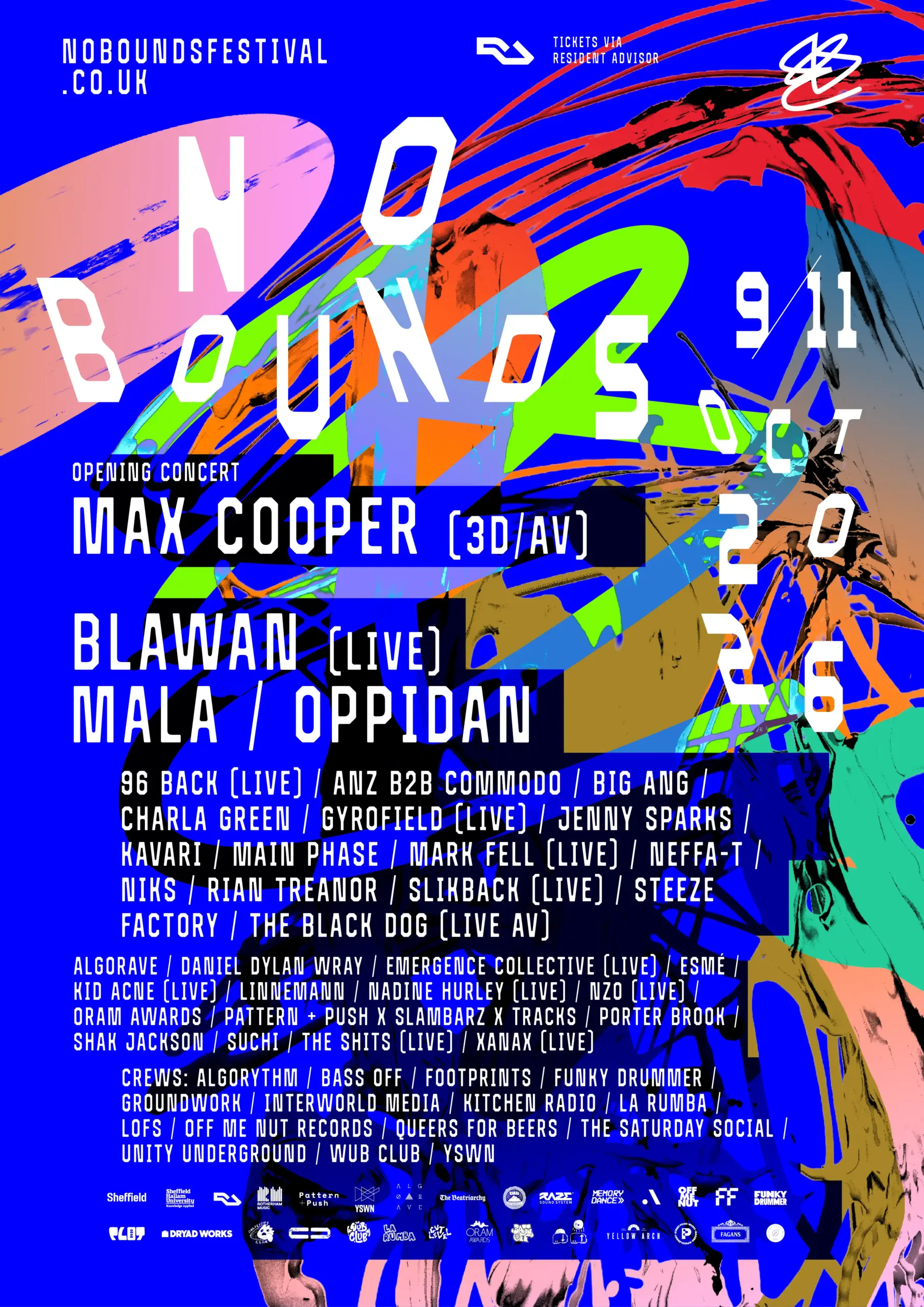
11 October 2026 · 13:00 – 20:00
No Bounds 2026: Electronic Music Club at ROAR, Hope Centre, Rotherham
Hope Centre, Grove Road, Rotherham S60 2ER
Curated by Mark Fell & Rian Treanor (EMC). Following last year’s success, Electronic Music Club returns with a Sunday community celebration – food, music, talks, and a get-together with local performances from Rotherham’s finest. An EMC showcase features live music from the Recovery Community, alongside a first listen to an upcoming release: two and a half hours of hardcore, Roma-inspired, genre-bending new music. Plus an exhibition and installation created by EMC’s young people, with drop-in workshops and activities running throughout the day. www.electronic-music.club Top Floor:
13:00: Auriel Majumdar (DJ)
14:00: From Do It Yourself To Do It Together (panel discussion)
15:00: Huniya’s Kitchen (food)
15:00: ViS (DJ)
16:00: Henry 808th (Live), Sober Social (DJs), M4f0 (DJ)
16:45: Mun Sing (DJ)
17:30: Nikolas Band (Live)
18:15: DJ Jozik, DJ Bryan, Relentless Youth Showcase (Live)
19:00: Slikback (DJ)
20:00: Close Workshop Space:
13:00: Blawan (artist talk)
15:00: Slikback (workshop)
17:00: Electronic Music Club (workshop) Garage Gallery:
13:00 – 20:00: Electronic Music Club exhibition You will need one of these tickets: Weekend Pass / Weekend + Opening Concert / Sunday only / Sunday Closing Party. Box office and wristband exchange: R.O.A.R, Hope Centre, 12:00 – 20:00.
Getting there and what to expect
Weather
- No forecast yet for this date (Weather data from MET Norway, CC BY 4.0)
- Sunset 18:19, dark from 18:54 (Sunset and dusk computed for the venue)
Getting there
- Stops: Moorgate Street/Ship Hill (at) (128 m); Westgate/Main Street (nr) (141 m); Westgate/Unity Place (adj) (173 m) (Stops: NaPTAN, Department for Transport (OGL v3); lines: bustimes.org / Bus Open Data (OGL v3))
- Rotherham Central Rail Station 590 m away, tram at Rotherham Platform Both Directions 600 m away (Stops: NaPTAN, Department for Transport (OGL v3); lines: bustimes.org / Bus Open Data (OGL v3))
- Parking: Wellgate 230 m (OpenStreetMap contributors (ODbL))
- Cycle parking 130 m (OpenStreetMap contributors (ODbL))
- About 110 min walk from the city centre (9.2 km, straight-line estimate) (Straight-line estimate at 5 km/h; streets are longer)
- Open on the main map with this event pinned (Sheffield Events live map)
- Can I get there and back? Put your postcode into the tool below for the last bus and tram, the walk home, and the car parks. (Timetables: Bus Open Data Service (Department for Transport). Contains public sector information licensed under the Open Government Licence v3.0.)
Around the venue
- Air quality within WHO guideline (PM2.5 0.0, PM10 0.0 µg/m³, sensor 2.6 km away) (Air quality: Sensor.Community (ODbL, indicative) and DEFRA UK-AIR (OGL v3))
- Defibrillator 130 m, toilets 400 m (OpenStreetMap contributors (ODbL))
- No storm overflow discharging within 1 km (Storm overflows: Yorkshire Water (CC BY 4.0))
Can I get there and back
The last bus and tram, the walk, what is recorded about step-free access and the car parks.
- Nearest defibrillator Defibrillator 130 m away · 24/7
- Nearest toilets Toilets 400 m away
- Nearest cycle parking Cycle parking 130 m away · 6 spaces
Read about this area on Wikipedia
- South Grove Comprehensive School
- Rotherham Town Hall
- Rotherham Westgate railway station
Rotherham Westgate railway station was the eastern terminus of the five-mile-long Sheffield and Rotherham Railway, the first passenger-carrying railway in the Sheffield/Rotherham area.
- Rotherham
- Kiveton Park Rural District
Kiveton Park was a rural district in the West Riding of Yorkshire from 1894 to 1974.
Article titles and extracts from Wikipedia, CC BY-SA 4.0; each links to its article.
- 221 to Rotherham Town Centre 0.6 km away
- X3 to Doncaster Town Centre 0.7 km away
- 114 to Herringthorpe 0.7 km away
- 116 to Ravenfield Common 0.8 km away
Around the same time
You might also like
Your event memories
Check in, add a photo and build your Sheffield journey.