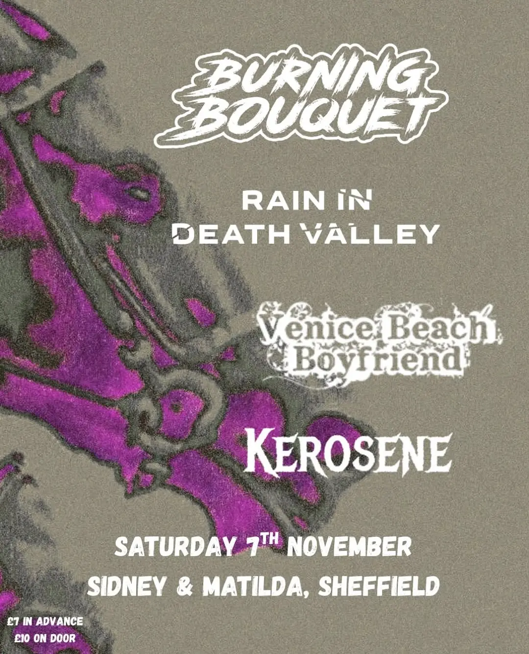
7 November 2026
Rain in Death Valley with Kerosene, Venice Beach Boyfriend and Burning Bouquet
Sidney and Matilda, Sheffield
Rain in Death Valley play Sidney and Matilda with Kerosene, Venice Beach Boyfriend and Burning Bouquet in support.
Getting there and what to expect
Getting there
- Stops: Leopold Street/Orchard Lane (27633) (87 m); Church Street/High Street (HS5) (201 m); City Hall (Sw Entrance) towards City Centre (208 m) (Stops: NaPTAN, Department for Transport (OGL v3); lines: bustimes.org / Bus Open Data (OGL v3))
- Sheffield Rail Station 540 m away, tram at City Hall 210 m away (Stops: NaPTAN, Department for Transport (OGL v3); lines: bustimes.org / Bus Open Data (OGL v3))
- Parking: Charles Street 240 m, 530 spaces (OpenStreetMap contributors (ODbL))
- Cycle parking 40 m, EV charger 240 m (Carver Lane Charge Point) (OpenStreetMap contributors (ODbL))
- On the roads within 1 km: Road closed: Closed; Road closed: Closed; Road closed: Closed (Traffic: TomTom)
- In the city centre (Straight-line estimate at 5 km/h; streets are longer)
- Open on the main map with this event pinned (Sheffield Events live map)
- Can I get there and back? Put your postcode into the tool below for the last bus and tram, the walk home, and the car parks. (Timetables: Bus Open Data Service (Department for Transport). Contains public sector information licensed under the Open Government Licence v3.0.)
Around the venue
- Air quality within WHO guideline (PM2.5 12.5, PM10 16.6 µg/m³, sensor 2.1 km away) (Air quality: Sensor.Community (ODbL, indicative) and DEFRA UK-AIR (OGL v3))
- Defibrillator 50 m, toilets 160 m (OpenStreetMap contributors (ODbL))
- No storm overflow discharging within 1 km (Storm overflows: Yorkshire Water (CC BY 4.0))
What is on around it
- Sheffield Audio Tour: Iconic Heart (12:00, 80 m away) (Sheffield Events listings)
- Sheffield Audio Tour: Crucible and Hull (12:00, 220 m away) (Sheffield Events listings)
- Lou Lou’s vintage Market (11:00, 240 m away) (Sheffield Events listings)
Can I get there and back
The last bus and tram, the walk, what is recorded about step-free access and the car parks.
- Nearest defibrillator Defibrillator 50 m away · 24/7
- Nearest toilets Toilets 160 m away · free
- Nearest cycle parking Cycle parking 40 m away · free · 8 spaces · Sheffield City Council
- Nearest EV charger Carver Lane Charge Point 240 m away · charge to use · Sheffield City Council
Read about this area on Wikipedia
- Seven Hills Shul
- Sheffield
Sheffield is a city in South Yorkshire, England, 29 miles (47 km) south of Leeds and 32 miles (51 km) east of Manchester.
- Wheel of Sheffield
- Sheffield Town Hall
Sheffield Town Hall is a municipal building on Pinstone Street in the City of Sheffield, England.
- Heart of the City, Sheffield
The Heart of the City was a £130 million major re-development in Sheffield, England begun in 2004, and completed in 2016 and one of the 12 official quarters of Sheffield City Centre.
Article titles and extracts from Wikipedia, CC BY-SA 4.0; each links to its article.
- X1 to Sheffield Centre 0.3 km away, 3 min early
- 95 to Sheffield Centre 0.3 km away, on time
- 20 to Hemsworth 0.3 km away, 3 min early
- 9A to Manor Top 0.4 km away, 3 min late
Around the same time
Staying over?
Make a night of it – find a place to stay near Sidney and Matilda, Sheffield.
- Mercure Sheffield St Paul’s Hotel and Spa 138 m away
- Leopold Hotel Sheffield 172 m away
- Novotel Sheffield Centre 225 m away
- Cutlers Hotel Sheffield 291 m away
- easyHotel Sheffield 431 m away
You might also like
Plan around this event Pub first? Food afterwards?
Build a little day or night out from the venue. Add a few stops, put them in order and check the walk.
Your event memories
Check in, add a photo and build your Sheffield journey.