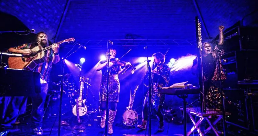
4 November 2026 · 19:30
The Poozies
Greystones Road, Sheffield S11 7BS
From £24.20Tickets via WeGotTickets
Buy ticketsThe Poozies play The Greystones, presented by Boardwalk Live.
Getting there and what to expect
Weather
- Sunset 16:28, dark from 17:05 (Sunset and dusk computed for the venue)
- Yellow warning (Weather warnings: Met Office, Crown copyright)
Getting there
- Stops: Greystones Road/Greystones Drive (opp) (71 m); Greystones Road/Greystones Drive (adj) (83 m); Greystones Road/Greystones Grange Road (adj) (103 m) (Stops: NaPTAN, Department for Transport (OGL v3); lines: bustimes.org / Bus Open Data (OGL v3))
- Cycle parking 460 m (OpenStreetMap contributors (ODbL))
- On the roads within 1 km: Road works: Roadworks (Traffic: TomTom)
- About 43 min walk from the city centre (3.5 km, straight-line estimate) (Straight-line estimate at 5 km/h; streets are longer)
- Open on the main map with this event pinned (Sheffield Events live map)
- Can I get there and back? Put your postcode into the tool below for the last bus and tram, the walk home, and the car parks. (Timetables: Bus Open Data Service (Department for Transport). Contains public sector information licensed under the Open Government Licence v3.0.)
Around the venue
- Air quality within WHO guideline (PM2.5 1.3, PM10 2.5 µg/m³, sensor 320 m away) (Air quality: Sensor.Community (ODbL, indicative) and DEFRA UK-AIR (OGL v3))
- Defibrillator 80 m, toilets 680 m (OpenStreetMap contributors (ODbL))
- No storm overflow discharging within 1 km (Storm overflows: Yorkshire Water (CC BY 4.0))
Can I get there and back
The last bus and tram, the walk, what is recorded about step-free access and the car parks.
- Nearest defibrillator Defibrillator 80 m away · 24/7
- Nearest toilets Toilets 680 m away · free
- Nearest cycle parking Cycle parking 460 m away · free · 2 spaces
- Nearest EV charger EV Rapid Charger 2.0 km away · charge to use · Sheffield City Council
Read about this area on Wikipedia
- Bingham Park
- Banner Cross Methodist Church
- Endcliffe Park
- Shepherd Wheel
Shepherd Wheel is a working museum in a former water-powered grinding workshop situated on the Porter Brook in the south-west of the City of Sheffield, England.
- Riverdale House
Article titles and extracts from Wikipedia, CC BY-SA 4.0; each links to its article.
- 120 to Fulwood 0.9 km away, 22 min late
- 120 to Halfway 0.9 km away, 5 min early
- 120 to Fulwood 0.9 km away, 3 min late
- 88 to Ecclesfield 1.8 km away, on time
Around the same time
Staying over?
Make a night of it – find a place to stay near Greystones Road, Sheffield S11 7BS.
- Brocco on the Park 960 m away
- Halifax Hall Hotel 1.0 km away
- Mercure Sheffield Kenwood Hall Hotel and Spa 1.6 km away
- Beech House Hotel Sheffield 1.7 km away
- The Rutland Hotel 1.9 km away
You might also like
Your event memories
Check in, add a photo and build your Sheffield journey.