3 October 2026 · 19:30
Sniff ‘n’ the Tears Acoustic at Cafe No9
9 Nether Edge Road, Sheffield S7 1RU
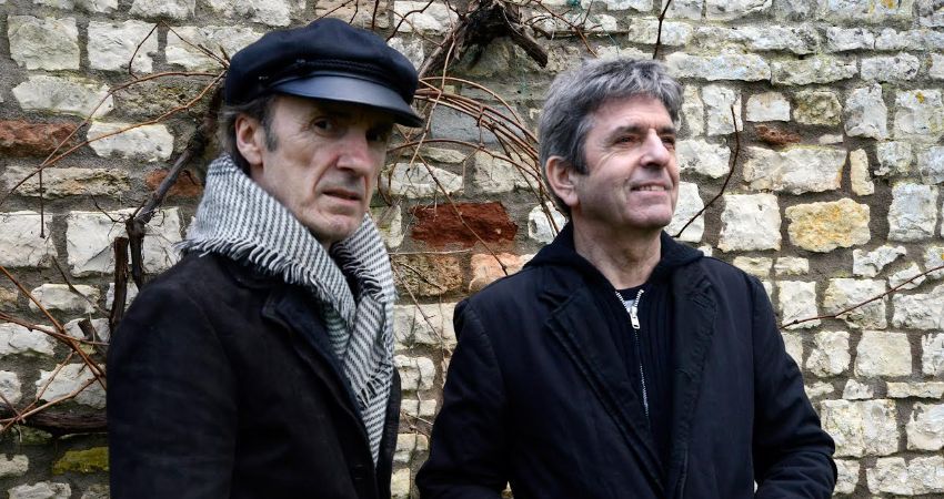
Frontman Paul Roberts and original guitarist Les Davidson play Sniff ‘n’ the Tears songs acoustically. BYOB venue, doors 7pm.
Getting there and what to expect
Weather
- Sunset 18:38, dark from 19:13 (Sunset and dusk computed for the venue)
Getting there
- Stops: Sheldon Road/Nether Edge Road (adj) (115 m); Machon Bank Road/Moncrieffe Road (nr) (139 m); Moncrieffe Road/Sheldon Road (opp) (139 m) (Stops: NaPTAN, Department for Transport (OGL v3); lines: bustimes.org / Bus Open Data (OGL v3))
- Tram at Park Grange Croft 2.3 km away (Stops: NaPTAN, Department for Transport (OGL v3); lines: bustimes.org / Bus Open Data (OGL v3))
- Parking: Car park 750 m (OpenStreetMap contributors (ODbL))
- Cycle parking 110 m (OpenStreetMap contributors (ODbL))
- About 34 min walk from the city centre (2.8 km, straight-line estimate) (Straight-line estimate at 5 km/h; streets are longer)
- Open on the main map with this event pinned (Sheffield Events live map)
- Can I get there and back? Put your postcode into the tool below for the last bus and tram, the walk home, and the car parks. (Timetables: Bus Open Data Service (Department for Transport). Contains public sector information licensed under the Open Government Licence v3.0.)
Around the venue
- Air quality within WHO guideline (PM2.5 4.0, PM10 5.9 µg/m³, sensor 600 m away) (Air quality: Sensor.Community (ODbL, indicative) and DEFRA UK-AIR (OGL v3))
- Defibrillator 580 m (OpenStreetMap contributors (ODbL))
- No storm overflow discharging within 1 km (Storm overflows: Yorkshire Water (CC BY 4.0))
Can I get there and back
The last bus and tram, the walk, what is recorded about step-free access and the car parks.
- Nearest defibrillator Defibrillator 580 m away
- Nearest toilets Toilets 1.4 km away · free
- Nearest cycle parking Cycle parking 110 m away · 4 spaces
- Nearest EV charger LifeEV 1.7 km away
Read about this area on Wikipedia
- Abbeydale Road
- Abbeydale, Sheffield
Abbeydale is an area of Sheffield in South Yorkshire, England that follows the valley of the River Sheaf.
- Nether Edge and Sharrow (ward)
Nether Edge and Sharrow Ward, which includes the districts of Nether Edge, Sharrow, Abbeydale, Brincliffe and parts of Banner Cross, Heeley and Highfield, is one of the 28 electoral wards in the City of Sheffield, England.
- Abbeydale Picture House
Abbeydale Picture House (later Abbeydale Cinema) is a former cinema in Sheffield, South Yorkshire, England.
- Nether Edge Hospital
Article titles and extracts from Wikipedia, CC BY-SA 4.0; each links to its article.
- 20 to Hemsworth 0.7 km away
- 98 to Totley Brook 1.4 km away
- 76E to Lowedges 1.4 km away
- 56 to Nether Edge 1.6 km away
Around the same time
Staying over?
Make a night of it – find a place to stay near 9 Nether Edge Road, Sheffield S7 1RU.
- Mercure Sheffield Kenwood Hall Hotel and Spa 650 m away
- Brocco on the Park 1.4 km away
- Beech House Hotel Sheffield 1.5 km away
- DoubleTree by Hilton Sheffield City 1.7 km away
- Halifax Hall Hotel 1.8 km away
Also at 9 Nether Edge Road, Sheffield S7 1RU
You might also like
Your event memories
Check in, add a photo and build your Sheffield journey.