15 November 2026 · 02:00 – 21:00
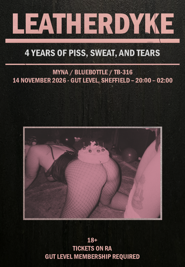
LEATHERDYKE – 4 YEARS OF PISS, SWEAT, AND TEARS
Gut Level
WE CAN’T BELIEVE IT’S BEEN 4 WHOLE YEARS SINCE WE WERE TIT DEEP IN SWEAT, SEX, AND MUSHY PEAS AT DELICIOUS CLAM!
WE’RE THRILLED TO BE CELEBRATING ANOTHER YEAR ROUND THE SUN WITH YOU! AS PER, WE’LL BE KEEPING IT LOCAL W/ OUR TRUSTED FAVES MYNA, TB-316, AND BLUEBOTTLE TO BRING THE TUNES, ALONGSIDE SOME VERY SPECIAL BIRTHDAY CLOWNING. BRING US A BIRTHDAY PRESENT AND U MIGHT BE REWARDED 😉
All proceeds going towards Pervert in Chief Noa’s gender-affirming surgery costs. PS – if you can’t afford tickets, please DM us on Instagram or drop us an email – [email protected], ty 🙂
Our parties are for dykes of all gender expressions and persuasions. You don’t need to be a leatherdyke to attend, but this is a club night centred around the dyke leather community and anyone who IDs as FLINTA and is a bit freaky, so we encourage wearing leather, latex, denim, harnesses, fetishwear – whatever gets you going!
We will never police gender identity or sexuality at the door, but this is not a space for cis men.
This event is strictly 18+! Gut Level is a members-only space! Make sure to sign up in advance for quick access to the event!
Getting there and what to expect
Weather
- No forecast yet for this date (Weather data from MET Norway, CC BY 4.0)
- Sunset 16:09, dark from 16:48 (Sunset and dusk computed for the venue)
Getting there
- Stops: High Street (HS3) (80 m); Arundel Gate (AG3) (95 m); High Street (HS2) (97 m) (Stops: NaPTAN, Department for Transport (OGL v3); lines: bustimes.org / Bus Open Data (OGL v3))
- Sheffield Rail Station 500 m away, tram at Cathedral 110 m away (Stops: NaPTAN, Department for Transport (OGL v3); lines: bustimes.org / Bus Open Data (OGL v3))
- Parking: Arundel Gate 160 m (OpenStreetMap contributors (ODbL))
- Cycle parking 40 m, EV charger 370 m (OpenStreetMap contributors (ODbL))
- About 3 min walk from the city centre (190 m, straight-line estimate) (Straight-line estimate at 5 km/h; streets are longer)
- Open on the main map with this event pinned (Sheffield Events live map)
- Can I get there and back? Put your postcode into the tool below for the last bus and tram, the walk home, and the car parks. (Timetables: Bus Open Data Service (Department for Transport). Contains public sector information licensed under the Open Government Licence v3.0.)
Around the venue
- Defibrillator 170 m, toilets 60 m (OpenStreetMap contributors (ODbL))
- Storm overflow discharging within 1 km into the River Don right now (Storm overflows: Yorkshire Water (CC BY 4.0))
What is on around it
- Sheffield Audio Tour: A Sheffield Sound Odyssey (12:00, 120 m away) (Sheffield Events listings)
- Sheffield Audio Tour: Crucible and Hull (12:00, 210 m away) (Sheffield Events listings)
- Sheffield Audio Tour: Iconic Heart (12:00, 240 m away) (Sheffield Events listings)
Can I get there and back
The last bus and tram, the walk, what is recorded about step-free access and the car parks.
- Nearest defibrillator Defibrillator 170 m away · 24/7
- Nearest toilets Toilets 60 m away · free
- Nearest cycle parking Cycle parking 40 m away · free · 6 spaces · Sheffield City Council
- Nearest EV charger EV charger 370 m away · Franklin Energy /Sheffield City Council
Read about this area on Wikipedia
- Victoria Hall, Sheffield
- Cathedral Church of St Marie, Sheffield
The Cathedral Church of St Marie is the Roman Catholic cathedral in Sheffield, England.
- City of Sheffield
The City of Sheffield is a metropolitan borough with city status in South Yorkshire, England.
- Coles Corner
- Adelphi Hotel, Sheffield
Article titles and extracts from Wikipedia, CC BY-SA 4.0; each links to its article.
- 52A to Woodhouse 0.1 km away, 5 min late
- 82 to Millhouses 0.1 km away, 1 min early
- 120 to Halfway 0.1 km away, 2 min early
- 75 to Jordanthorpe 0.2 km away, 3 min early
Around the same time
Also at Gut Level
You might also like
Your event memories
Check in, add a photo and build your Sheffield journey.