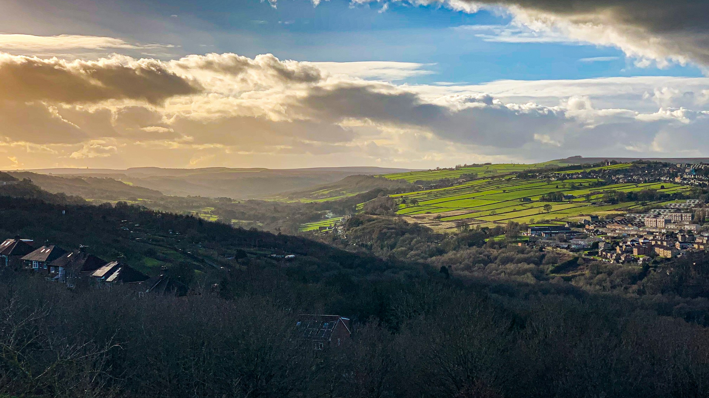
Photograph: Shane Rounce on Unsplash
All Sheffield areas · Open on the neighbourhood map
Sheffield neighbourhood
Crookes, Sheffield
Inside the Crookes boundary: 7 upcoming events, 3 businesses, 3 places, 11 charities.
Crookes is a hilltop suburb north-west of the universities, with a busy high street of independents along Crookes Road, Crookes Social Club for live music and comedy, and the Bole Hills with views across the Rivelin and Loxley valleys. Student and family life overlap here, which keeps the pubs, cafes and clubs busy year-round.
Coming up in this neighbourhood
Event
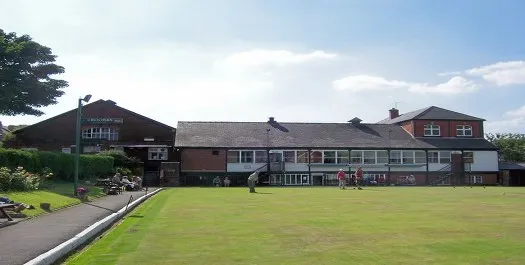
Halloween Spooktacular at Crookes Club
Halloween night at Crookes Social Club with live music from Turning Point, fancy dress, a raffle and prizes. Tickets £8, kids and concessions £5.

Event
Eyam Bonfire and Firework Display
Eyam's bonfire night with a procession from Eyam Square to the bonfire and fireworks. Full details still to be announced.

Event
Comedy Club at Crookes Social Club – November
A night of stand-up comedy in the concert room at Crookes Social Club.

Event
The Mortuary Live November
Affordable drinks, good company, live music! This is The Mortuary Events' second-ever live gig, and we are so excited to welcome you all back!
Event
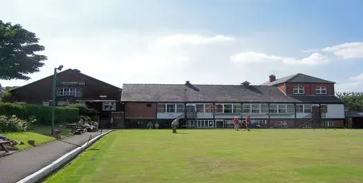
Westside Cowboy
Alt-country band Westside Cowboy live at Crookes Social Club, presented by Futuresound.

Event
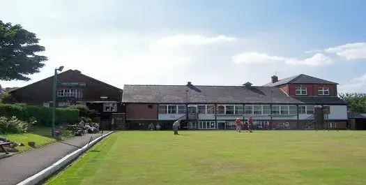
Wig-Or-Mortis: A Court of Wh*res and Roses
Brand new drag show from Miss Connie-Dom at Crookes Social Club.
Businesses and places
Place
Crookes Social Club
Place
Crookes Social Club
Place
Sheffield S6 Foodbank Crookes
Foodbank distribution centre providing emergency food (voucher needed).
Charities based here
Charity
Joseph Kaye’S Almshouses
The Trust rehouses women of at least 55 years of age. Our definition of a woman for this purpose is a person assigned female at birth…
Charity
79th Sheffield (St Timothy’S) Scout Group
Scout group with activities for Beavers, Cubs and Scouts.
Charity
Stothard Supported Living Limited
Stothard Court is a sheltered independent living scheme for people with physical and/or mental impairment.
Charity
Sheffield Hallam District Scout Council
TO PROMOTE THE DEVELOPMENT OF YOUNG PEOPLE IN ACHIEVING THEIR FULL PHYSICAL, INTELLECTUAL, SOCIAL AND SPIRITUAL POTENTIALS AS INDIVIDUALS, AS RESPOSIBLE CITIZENS AND AS MEMBERS OF…
Charity
Slinn Street Starters Community Pre-School
An independent community run Pre-school providing a wide range of activities suited to 3 to 4 year olds. The Pre-school welcomes children from all cultures and…
Charity
Friends of Westways
Activities to improve the community of the school through social activities and money raising.
Charity
St Thomas Crookes
St Thomas Crookes is an Anglican/Baptist LEP church in Sheffield. The vision of the church, as it stands alongside others in serving the city of Sheffield,…
Charity
Wesley Hall Methodist Church
1 Provision of regular public acts of worship open to all2 Provision of a sacred space3 Teaching of Christianity (sermons & groups)4 Pastoral work including visiting…

Charity
The Parochial Church Council of the Ecclesiastical Parish of St Timothy’S Crookes
St Timothy's is a family friendly Parish Church. There are service on a Sunday and midweek and lots of community activities and events both during the…
Charity
Sheffield Korean Church
To advance the Christianity religion in UK for the benefit of the public through the holding of prayer meeting, lectures, Worship and public celebration of religious…
Scorecard 1 card
How Crookes scores
Overall 48 out of 100, ranked 87 of 147 neighbourhoods, from 6 of 7 dimensions. Each score is a percentile rank against the other neighbourhoods, not a measurement.
- 100Quiet 3 inputs
- 44Green 4 inputs
- 16Connected 5 inputs
- 25Affordable 4 inputs
- –Safe not scored
- 46Lively 4 inputs
- 54Served 7 inputs
How these scores are worked out
Each input is a percentile rank: the share of the other neighbourhoods this one is at least as good as (direction per input). A dimension is the percentile rank of the mean of its available input ranks and needs at least two inputs; the overall score is the mean of the scored dimensions. Points are placed by point-in-polygon against the Data for Action boundaries; per-head figures use Census 2021 residents for neighbourhoods with their own census areas; noise shares sample an even grid of points inside each polygon against the Defra Lden bands; distances are straight lines from the polygon centre. Crookes covers 1.35 km² with 10,267 residents (Census 2021); noise was sampled at 87 points.
| Dimension | Input | Value | Rank | Better | Source | Licence |
|---|---|---|---|---|---|---|
| Quiet | Sampled points inside a Defra road-noise band (55 dB Lden and over) | 0.0% | 100 | lower | noise | Open Government Licence v3.0 |
| Quiet | Sampled points inside a Defra rail-noise band (55 dB Lden and over) | 0.0% | 100 | lower | noise | Open Government Licence v3.0 |
| Quiet | Daily vehicles at DfT count points inside the boundary (sum of AADT; 0 when no counted major road is inside) | 0 vehicles a day | 100 | lower | roads | Open Government Licence v3.0 |
| Green | Nature and green sites inside the boundary: Natural England reserves, SSSIs, ancient woodland and open access land, plus council historic parks | 0 per km² | 49 | higher | land, council_more | Open Government Licence v3.0 |
| Green | Council community-forestry trees planted inside the boundary | 1.48 per km² | 58 | higher | council_more | Open Government Licence v3.0 |
| Green | Recent wildlife observations inside the boundary (iNaturalist and GBIF; counts only) | 0.74 per km² | 82 | higher | nature | Per record: CC0, CC BY or CC BY-NC |
| Green | Playgrounds, sports pitches and dog parks on OpenStreetMap | 1.17 per 1,000 residents | 52 | higher | osm_amenities | ODbL 1.0 |
| Connected | NaPTAN bus and coach stops inside the boundary | 12.57 per km² | 26 | higher | naptan | Open Government Licence v3.0 |
| Connected | NaPTAN bus and coach stops inside the boundary | 1.66 per 1,000 residents | 4 | higher | naptan | Open Government Licence v3.0 |
| Connected | Straight-line distance from the neighbourhood centre to the nearest tram stop | 1,650 m | 47 | lower | naptan | Open Government Licence v3.0 |
| Connected | Straight-line distance from the neighbourhood centre to the nearest rail station entrance | 3,132 m | 41 | lower | naptan | Open Government Licence v3.0 |
| Connected | Premises able to get gigabit broadband (Ofcom Connected Nations) | 96.1% | 42 | higher | connectivity | Open Government Licence v3.0 |
| Affordable | Median sold price over the last twelve months (standard sales, at least five) | £266,700 | 26 | lower | pricepaid | Open Government Licence v3.0 |
| Affordable | Median sold price against the Sheffield median for the same mix of property types (1.0 = Sheffield) | 1.37 | 21 | lower | pricepaid | Open Government Licence v3.0 |
| Affordable | Median sold price of a terraced house (at least five sales) | £260,000 | 9 | lower | pricepaid | Open Government Licence v3.0 |
| Affordable | Households renting (council, other social and private), Census 2021, as a proxy for rented supply | 42.6% | 53 | higher | census_more | Open Government Licence v3.0 |
| Safe | Recorded street-level crimes over the last twelve months | – No street-level crime rows are stored. | – | lower | police | Open Government Licence v3.0 |
| Safe | Violence and sexual offences over the last twelve months | – No street-level crime rows are stored. | – | lower | police | Open Government Licence v3.0 |
| Safe | Burglaries over the last twelve months | – No street-level crime rows are stored. | – | lower | police | Open Government Licence v3.0 |
| Safe | Anti-social behaviour reports over the last twelve months | – No street-level crime rows are stored. | – | lower | police | Open Government Licence v3.0 |
| Safe | The stored police data holds neighbourhood meetings and priorities only; street-level crime counts are deliberately not stored, so no neighbourhood has a safety score yet. | |||||
| Lively | Upcoming events and classes on Sheffield Events located inside the boundary | 0.78 per 1,000 residents | 73 | higher | neighbourhoods | CC BY 4.0 (Sheffield Events listings inside Data for Action boundaries) |
| Lively | Businesses and places in the Sheffield Events directory located inside the boundary | 0.58 per 1,000 residents | 51 | higher | neighbourhoods | CC BY 4.0 (Sheffield Events listings inside Data for Action boundaries) |
| Lively | Real ale pubs on OpenStreetMap | 0.10 per 1,000 residents | 85 | higher | osm_amenities | ODbL 1.0 |
| Lively | Community centres on OpenStreetMap | 0 per 1,000 residents | 50 | higher | osm_amenities | ODbL 1.0 |
| Served | Straight-line distance from the neighbourhood centre to the nearest GP practice (NHS ODS) | 485 m | 54 | lower | nhs | Open Government Licence v3.0 |
| Served | Community pharmacies inside the boundary (NHS ODS) | 0.19 per 1,000 residents | 55 | higher | nhs | Open Government Licence v3.0 |
| Served | Open primary and all-through schools inside the boundary (Get Information about Schools) | 0.86 per 1,000 under-15s | 42 | higher | schools | Open Government Licence v3.0 |
| Served | Straight-line distance from the neighbourhood centre to the nearest library (Sheffield City Council) | 963 m | 53 | lower | council | Open Government Licence v3.0 |
| Served | Public defibrillators on OpenStreetMap inside the boundary | 2.22 per km² | 70 | higher | osm_amenities | ODbL 1.0 |
| Served | Public toilets inside the boundary (OpenStreetMap and the Toilet Map) | 0 per km² | 60 | higher | osm_amenities | ODbL 1.0 and CC BY 4.0 |
| Served | Electric vehicle chargers on OpenStreetMap inside the boundary | 0.74 per km² | 90 | higher | osm_amenities | ODbL 1.0 |
Areas like this
- Nether Green 48
- Greystones 45
- Carterknowle 33
- Sandygate 34
- Stannington West 53
Neighbourhood scorecards by Sheffield Events, CC BY 4.0, derived from Defra noise mapping, DfT traffic counts, Natural England, Sheffield City Council, iNaturalist and GBIF, OpenStreetMap contributors (ODbL), the Toilet Map, NaPTAN, Ofcom, HM Land Registry, ONS Census 2021, NHS ODS, Get Information about Schools and the Data for Action neighbourhood boundaries; each input keeps its own licence. CC BY 4.0 · All data sources · Download the scores (API)
Living here 6 cards
Census 2021
How people here live
Travel, homes, origins, faith, qualifications and health for the 10,275 residents of Crookes, with the Sheffield figure beside each, from 7 census areas.
- Most common way to work
- Working from home 41.2% Sheffield Driving 45.2%
- Owner-occupied homes
- 57.4% Sheffield 58.6%
- Households without a car
- 26.3% Sheffield 29.2%
- Born outside the UK
- 11.4% Sheffield 14.9%
- Most common answer on religion
- No religion 56.7% Sheffield No religion 43.4%
- Degree-level qualified, 16 and over
- 52.5% Sheffield 33.4%
- In very good health
- 51.9% Sheffield 46.7%
Source: Office for National Statistics, Census 2021, via Nomis, Open Government Licence v3.0. Neighbourhood figures sum the census areas whose population-weighted centres (ONS Open Geography, contains OS data © Crown copyright and database right 2026) fall inside each boundary. Census 2021 on Nomis · All data sources
Deprivation here
7 small areas (LSOAs) have their population centre inside this boundary; their average IMD 2019 decile is 8.4 (1 is most deprived, 10 least).
Deprivation: English Indices of Deprivation 2019 by LSOA (MHCLG) with ONS population-weighted centroids, Open Government Licence v3.0. Decile 1 is the most deprived tenth of England. Indices of Deprivation 2019 · ONS Open Geography Portal · All data sources
Schools here
1 open nursery, school or college whose registered position is inside this boundary, from the Department for Education register.
- Primary Westways Primary School ages 3 to 11 · Community school · S10 1NE Website
Ofcom Connected Nations 2025
Broadband and mobile in Crookes
5,049 premises in 38 census output areas whose population centres fall inside this boundary, as reported to Ofcom for July 2025.
Fixed broadband availability
- Gigabit-capable
- 96% Sheffield 93%
- 300 Mbit/s or faster
- 96% Sheffield 94%
- Superfast (30 Mbit/s or faster)
- 100% Sheffield 98%
- Cannot get 10 Mbit/s
- 0% Sheffield 0%
- Below the broadband USO
- 0% Sheffield 0%
Mobile signal
Mobile coverage is published for Sheffield as a whole: outdoor 4G from all four operators reaches 99.8% of premises, 5G from at least one operator 99.7%, and a good outdoor 4G or 5G signal from every operator 96.1%.
Availability means a service could be ordered at the address in July 2025; it is not a measured speed. Data edition: Ofcom Connected Nations 2025, published 19 November 2025.
Source: Ofcom Connected Nations 2025 data downloads (data for July 2025, published 19 November 2025), Ofcom copyright, reproduced under Ofcom's terms of use and the Open Government Licence v3.0. Output areas placed with ONS Open Geography lookups and population-weighted centroids, contains OS data © Crown copyright and database right 2026. Ofcom Connected Nations 2025 data · All data sources
Homes and prices
What sold in Crookes
Completed sales registered from 27 Oct 2025 to 28 Aug 2026. 123 standard sales inside this boundary.
- Median price
- £266,700
- Middle half of sales
- £223,250 to £310,050
- Sheffield median
- £215,000
- Semi-detached
- £326,750 24 sales
- Terraced
- £260,000 85 sales
- Flat or maisonette
- £177,000 12 sales
Most recent registered sales
- Aug 2026 Western Road Terraced £276,000
- Aug 2026 Netherfield Road Terraced, leasehold £200,000
- Aug 2026 Bute Street Terraced, leasehold £260,000
- Aug 2026 Netherfield Road Terraced, leasehold £245,000
- Jul 2026 Lydgate Lane Terraced, leasehold £345,000
- Jul 2026 Stothard Road Terraced, leasehold £260,000
- Jul 2026 Tasker Road Semi-detached £328,500
- Jul 2026 Blakeney Road Terraced, leasehold £293,000
Contains HM Land Registry data © Crown copyright and database right 2026. This data is licensed under the Open Government Licence v3.0. Medians use standard sales only; the Land Registry’s additional category (for example buy-to-let and repossessions) is excluded. These are actual registered sales, not the mix-adjusted UK House Price Index estimate. Data is published one to two months in arrears and does not include every sale. Checked 25 Oct 2026. Price Paid Data · All data sources
Census 2021
Who lives in Crookes
10,267 residents in 4,552 households, from 7 census areas whose population centres fall inside this boundary.
Ages
- Under 15
- 11% Sheffield 17%
- 15 to 24
- 25% Sheffield 16%
- 25 to 44
- 33% Sheffield 26%
- 45 to 64
- 18% Sheffield 24%
- 65 and over
- 13% Sheffield 17%
Homes
- Owned
- 57% Sheffield 59%
- Social rented
- 8% Sheffield 23%
- Private rented
- 35% Sheffield 19%
- One-person households
- 31% Sheffield 33%
- Detached
- 5% Sheffield 15%
- Semi-detached
- 16% Sheffield 38%
- Terraced
- 65% Sheffield 26%
- Flats
- 14% Sheffield 21%
Work and study, residents aged 16 and over
- In work
- 58% Sheffield 53%
- Full-time students
- 24% Sheffield 14%
- Retired
- 15% Sheffield 20%
- Unemployed
- 4% Sheffield 4%
Source: Office for National Statistics licensed under the Open Government Licence v.3.0. Census 2021 tables via Nomis; population-weighted centroids from ONS Open Geography, contains OS data © Crown copyright and database right 2026. Census 2021 on Nomis · All data sources
People and health 3 cards
Pharmacy hours here
The usual opening hours of the NHS pharmacies placed in this neighbourhood, from the Consolidated Pharmaceutical List. Bank holidays differ; ring ahead for anything urgent.
- Open now Crookes Pharmacy 219 School Road S10 1GN · Friday 09:00-18:00 · Open now, until 18:00
- Open now Day Lewis Pharmacy 150 Crookes S10 1UH · Friday 09:00-18:00 · Open now, until 18:00
NHS England
GP practice list sizes here
1 GP practice has its registered address in this neighbourhood, with 8,188 patients on its list in October 2026. That is -40 on the month before. Patients register where they choose, so a list is not the neighbourhood's population.
- Crookes Practice8,188 patients · -40 on the month · -3.4% on the year
Contains information from NHS England, licenced under the current version of the Open Government Licence (Open Government Licence). Checked 26 Oct 2026. Patients registered at a GP practice · All data sources
NHS services here
GP practices, pharmacies and dentists whose postcode centre is inside this boundary, from the NHS organisation register. For urgent help call 999 or 111.
- GP practice Crookes Practice 203 School Road, Sheffield S10 1GN
- Pharmacy Crookes Pharmacy 219 School Road, Crookes, Sheffield S10 1GN
- Pharmacy Day Lewis Pharmacy 150 Crookes, Crookes, Sheffield S10 1UH
- Dental practice Dental Surgery 257 School Road, Sheffield S10 1GQ
Getting around 1 card
Department for Transport STATS19
Road collisions here, 2021 to 2025
21 road collisions with someone hurt were recorded in this neighbourhood, 2021 to 2025: 0 fatal, 7 serious and 14 slight. 10 pedestrians and 3 cyclists were among the 22 people hurt.
- Collisions
- 21
- Fatal
- 0
- Serious
- 7
- Slight
- 14
- People hurt
- 22
- Pedestrians hurt
- 10
- Cyclists hurt
- 3
- 2021: 0 fatal, 0 serious, 3 slight3 hurt (pedestrians 2, cyclists 1)
- 2022: 0 fatal, 4 serious, 1 slight5 hurt (pedestrians 3, cyclists 1)
- 2023: 0 fatal, 2 serious, 3 slight6 hurt (pedestrians 1, cyclists 1)
- 2024: 0 fatal, 0 serious, 6 slight6 hurt (pedestrians 3, cyclists 0)
- 2025: 0 fatal, 1 serious, 1 slight2 hurt (pedestrians 1, cyclists 0)
Road collisions across Sheffield · On the Local Map
Road collision data from the Department for Transport (STATS19 road safety open data), Open Government Licence v3.0 Open Government Licence v3.0. Checked 12 Oct 2026. Road safety open data · All data sources
Environment and sky 8 cards
Rain and rivers here
Nearest rain gauge: Ringinglow, 4.4 km away. 55.8 mm of rain in the last 7 days, wettest day Saturday 24 Oct with 27.3 mm.
Air quality here
No sensor inside this boundary; the nearest is shown.
- Within WHO guideline Sensor 68956 PM2.5 10.4, PM10 26.6 µg/m³ · 710 m from the centre of the area · read 30 Oct 08:53
British Geological Survey
The ground beneath Crookes
At the centre of Crookes the bedrock is the Pennine Lower Coal Measures Formation: mudstone, siltstone, sandstone, coal, ironstone and ferricrete, Carboniferous, Langsettian (Westphalian A), about 316 to 314 million years ago, on the BGS 1:625 000 bedrock map (unit PSLCM). The 1:625 000 map is a regional overview generalised from more detailed sheets: it describes the ground under a neighbourhood as a whole and is not a site investigation.
Contains British Geological Survey materials © UKRI 2026. Open Government Licence v3.0. Checked 10 Oct 2026. BGS Geology 625k bedrock · All data sources
Forestry Commission, National Forest Inventory
Woodland here
- Woodland
- 8.3 ha3 parcels
- Tree cover
- 6.2%of the neighbourhood
- Rank
- 72of 147 neighbourhoods for woodland cover
- Tofts Wood · 4.5 ha here, 22.0 ha in allmostly broadleaved · Rivelin, Crookes · 6 parcels
Sheffield's woods · On the Local Map
National Forest Inventory: © Forestry Commission copyright. Contains Ordnance Survey data © Crown copyright and database right 2026. Open Government Licence v3.0. Checked 12 Oct 2026. Dataset: National Forest Inventory England 2025 · All data sources
Ordnance Survey, OS Open Greenspace
Pitches, courts and greens here
- Allotments and community growing spaces
- 3
- Bowling greens
- 2
- Playing fields
- 1
- Play spaces
- 2
- Other sports grounds
- 3
- Gates and entrances
- 27
- Bolehill Quarry Allotment Gardens · Allotment site0.4 ha
- Crookes Marsh Lane Allotment Gardens · Allotment site1.5 ha · 3 entrances
- Crookes Quarry Allotment Gardens · Allotment site1.3 ha · 1 entrance
- Bolehill Recreation Ground · Playing field15 ha · 9 entrances
- Bolehills BMX Track · Sports ground0.4 ha · 2 entrances
Across Sheffield · On the Local Map
Contains OS data © Crown copyright and database right 2026. OS Open Greenspace, Open Government Licence v3.0. Checked 12 Oct 2026. Dataset: OS Open Greenspace, 2026-04 release · All data sources
Mining Remediation Authority
Coal mining legacy here
About 16.3% of Crookes, roughly 22.0 hectares, lies in a coal mining Development High Risk Area: recorded shafts, adits or shallow workings are at or near the surface, so new building there needs a coal mining risk assessment.
- Land in a high risk area
- 16.3%about 22.0 hectares
- Sheffield as a whole
- 17.1%
This is a planning designation drawn from recorded features, not a survey of any one property, and being in an area does not mean the ground there is unsafe. Buying or building? Ask the authority itself. Check if a property is affected by coal mining · Coal mining risk assessments for planning · Report a coal mine hazard (24 hours)
Contains Mining Remediation Authority data, Crown copyright, Open Government Licence v3.0. Checked 26 Oct 2026. Dataset: Coal mining Development High Risk Area · All data sources
Wildlife recorded here
1 dated observation inside this boundary in the last twelve months, from GBIF and iNaturalist. Each is a sighting on the day shown by the person credited; it is not a guarantee that the species is still there.
- Fungus Pink Waxcap Porpolomopsis calyptriformis 26 Oct 2026 · butapackofcards · iNaturalist, CC BY-NC 4.0
Benches and geocaches here
7 memorial benches with their inscriptions from OpenBenches, at recorded positions inside this boundary.
- Bench JERRY'D'SPRINGER 24/08/05 TO 10/3/21 Rip poopie KEITH 'PARKY' HUDSON A MIGHTY OA… JERRY'D'SPRINGER 24/08/05 TO 10/3/21 Rip poopie KEITH 'PARKY' HUDSON A MIGHTY OAK HAS FALLEN recorded Jan 2023
- Bench For Brian and Marilyn Sylvia Gregory Together in our Hearts recorded Jan 2023
- Bench Happy memories of Mike Elwood, who enjoyed coming here with his 3 whippets recorded Mar 2023
- Bench IN MEMORY, GEORGE, EDITH AUDREY, GRANT AND LESLIE & EVELYN SCOTHORNE recorded May 2025
- Bench IN FONDEST MEMORY OF LIZ LANCASTER recorded Mar 2023
- Bench IN LOVING MEMORY OF CHARLES HOWARTH REST IN PEACE recorded Mar 2023
- Bench PLEASE ENJOY THE VIEW AS WE DID PAUL AND SUE CRESSEY 2002 recorded Mar 2023
Heritage and culture 2 cards
On Wikipedia and Commons
5 Wikipedia articles, placed inside this boundary.
- Crookes & Crosspool (ward) Crookes & Crosspool ward-which includes the districts of Crookes, Steelbank, Crosspool, and Sandygate -is one of the 28 electoral wards in City of Sheffield, England.
- Bolehill Recreation Ground
- Crookes
- Crookes Cemetery
- St Thomas' Church, Crookes
Landmarks and heritage
13 listed buildings, landmarks and plaques whose recorded position is inside this boundary, from Wikidata and Open Plaques.
- Listed or scheduled Bolehill Primary School And Adjoining Boundary Wall And Shelter Grade II listed building building in Sheffield, South Yorkshire, England, UK Heritage List entry
- Listed or scheduled Boundary walls railings and outbuilding at Bole Hill Primary School Grade II listed building Grade II listed building in Sheffield, South Yorkshire, England, UK Photo on Commons · Heritage List entry
- Listed or scheduled Cemetery Chapel At Crookes Cemetery Grade II listed building cemetery chapel in Sheffield, South Yorkshire, England, UK Photo on Commons · Heritage List entry
- Listed or scheduled Crookes Congregational Church And Attached Hall And Railings Grade II listed building architectural structure in Sheffield, South Yorkshire, England, UK Heritage List entry
- Listed or scheduled Hale Court And Attached Wall And Railings Grade II listed building architectural structure in Sheffield, South Yorkshire, England, UK Photo on Commons · Heritage List entry
- Listed or scheduled Sewer gas lamp at junction with Stannington View Road Grade II listed building sewer gas destructor lamp in Sheffield, South Yorkshire, England, UK Photo on Commons · Heritage List entry
- Listed or scheduled Sewer gas lamp opposite junction with Glebe Road Grade II listed building sewer gas destructor lamp in Sheffield, South Yorkshire, England, UK Photo on Commons · Heritage List entry
- Listed or scheduled Wesley Hall Grade II listed building house in Sheffield, South Yorkshire, England, UK Photo on Commons · Heritage List entry
- Landmark Bolehill Recreation Ground Recreation area open space in Sheffield, England Wikipedia
- Landmark Crookes Cemetery Cemetery cemetery in South Yorkshire, England Wikipedia · Photo on Commons
- Landmark Sheffield Student Housing Co-operative Student housing · since 2014 student housing co-operative in Sheffield, England Wikipedia · Photo on Commons
- Landmark St. Thomas' Church, Crookes Church church in Crookes, Sheffield, South Yorkshire, England, UK Wikipedia · Photo on Commons
- Plaque Jack Hunter blue plaque Blue plaque · Jack Hunter · erected 2026 Jack Hunter 1851-1903 Footballer, First Working Class Captain of England & 1883 FA Cup Winner Was born at 4. Crookes opposite this site Open Plaques record


Council and democracy 5 cards
Council data for this area
What Sheffield City Council's open data records inside this boundary.
- Trees 2 community forestry trees mostly Abies fraseri, Acer campestre
- 20 mph zone Steel Bank, Crookesmoor SW02
- Local heritage Princess Royal PH
- Polling station Cabin at The Unity Centre, 85 Bole Hill Road, Sheffield, S6 5DD Walkley Ward · district ZA
- Polling station Church Hall 136 Slinn Street Sheffield S10 1NZ Crookes & Crosspool Ward · district HF
- Polling station Hallamshire Rugby Union Clubhouse 116 Northfield Road Sheffield S10 1QS Crookes & Crosspool Ward · district HG
- Polling station St Vincents Church Pickmere Road Sheffield S10 1GY Crookes & Crosspool Ward · district HB
- Polling station Wesley Hall Crookes S10 1UD Crookes & Crosspool Ward · district HE
- School crossing Lydgate Infants LYDGATE LN/SCHOOL GATES / ZEBRA
- Litter bins 36 council litter bins on the streets here
Planning applications here
3 applications lodged in the last 12 weeks, 2 still undecided.
- Undecided54 Mona Road Sheffield S10 1NH
- Undecided76 Bole Hill Lane Sheffield S10 1SB
- Rejected76 Bole Hill Lane Sheffield S10 1SB
Planning applications: UK PlanIt, aggregated from Sheffield City Council. Check the council record before relying on any detail; documents are linked, never copied. UK PlanIt · All data sources
Planning constraints
Conservation areas and brownfield land here
10 sites on the brownfield land register sit here, 2.0 hectares in all put forward for housing.
- Hadfield Service Reservoir, off Glebe Road/ Blakeney Road, Crookes
- Former Bole hill residential Home, Bole hill View, S10 1QL
- Twigg Bros 51 Toyne Street
- Site Of 148 – 154 Western Road
- Land Adjacent 240 Springvale Road Sheffield S10 1LH
- 145 Cobden View Road Sheffield S10 1HT
- 36 Stannington View Road Sheffield S10 1SR
- Garage Block Adjacent 111 Bole Hill Lane Sheffield S10 1SD
- And 2 more on the register. Brownfield land across Sheffield
Contains planning.data.gov.uk data published by Sheffield City Council and neighbouring planning authorities under the Open Government Licence v3.0; conservation area boundaries © Historic England, containing Ordnance Survey data © Crown copyright and database right. Open Government Licence v3.0. Checked 10 Oct 2026. planning.data.gov.uk · All data sources
Valuation Office Agency
Council tax bands here
The 7 small areas (LSOAs) whose population centres fall in this neighbourhood hold about 4,850 homes on the council tax list; 57% are in Band A, against 58% across Sheffield. The average full bill across these homes before discounts is about £1,859 a year in 2026-27, worked out from the Band D figure. A few very small counts are withheld by the VOA, so the bands add up to slightly fewer homes than the total.
| Area | Band A | Band B | Band C | Bands D to H |
|---|---|---|---|---|
| Crookes | 56% | 26.6% | 14.3% | 3.1% |
| Sheffield | 58% | 16.3% | 12.7% | 13% |
- Homes
- 4,850
- Band A
- 57%
- Band B
- 27%
- Band C
- 14%
- Bands D to H
- 3%
- Band A: 2,740 homes (56.5%)Valued up to £40,000 in 1991 · £1,673.44 full bill, 2026-27
- Band B: 1,300 homes (26.8%)Valued £40,001 to £52,000 in 1991 · £1,952.35 full bill, 2026-27
- Band C: 700 homes (14.4%)Valued £52,001 to £68,000 in 1991 · £2,231.25 full bill, 2026-27
- Band D: 110 homes (2.3%)Valued £68,001 to £88,000 in 1991 · £2,510.16 full bill, 2026-27
- Band E: 30 homes (0.6%)Valued £88,001 to £120,000 in 1991 · £3,067.97 full bill, 2026-27
- Band F: 10 homes (0.2%)Valued £120,001 to £160,000 in 1991 · £3,625.79 full bill, 2026-27
- Band G: 0 homes (0.0%)Valued £160,001 to £320,000 in 1991 · £4,183.60 full bill, 2026-27
- Band H: 0 homes (0.0%)Valued over £320,000 in 1991 · £5,020.32 full bill, 2026-27
Council tax bands across Sheffield · On the Local Map
Council tax stock of properties (table CTSOP1.1) from the Valuation Office Agency, Open Government Licence v3.0 Open Government Licence v3.0. Checked 12 Oct 2026. Valuation Office council tax statistics · Background notes · All data sources
Draft Sheffield Plan
Sites the plan allocates here
2 sites in this neighbourhood are allocated in the draft Sheffield Plan, with room for 49 new homes in all. It is a draft at Main Modifications stage with a further round of changes still to settle, so sites and numbers can change. About the Sheffield Plan
- NWS19 Former Bolehill Residential Home, Bolehill View, S10 1QLHousing Site · 36 homes · 0.38 ha · brownfield
- NWS08 Land At Junction With Cobden View Road, Northfield S10 1QQMixed Use Site · 13 homes · 0.06 ha · greenfield
Site allocations: Sheffield City Council, Main Modifications Sheffield Plan Policies Map, under the Open Government Licence v3.0. Contains Ordnance Survey data © Crown copyright and database right. Checked 12 Oct 2026. Dataset: Site Allocation · All data sources
Money and energy 3 cards
National Lottery grant database
Lottery money in Crookes and Crosspool ward
Awards filed to recipients in Crookes and Crosspool ward, the ward this area sits in. Awards to individuals are counted in the figures and never named.
- Awards since 1995
- 68
- Awarded in total
- £1.6m
- Awards since 2022
- 6
- Awarded since 2022
- £205,594
Latest awards to organisations here
- Jon Pullins Amusements Sheffield Limited · £120,247The Showmen of Sheffield · The National Lottery Heritage Fund · 9 Jun 2026
- Football For Foodbanks CIC · £10,000Football For Foodbanks · The National Lottery Community Fund · 24 Jan 2023
- Read Easy Sheffield · £2,458Read Easy Sheffield – Adult reading coaching · The National Lottery Community Fund · 7 Feb 2022
Lottery money across Sheffield
National Lottery grant data from the Department for Culture, Media and Sport, Open Government Licence v3.0. Checked 28 Oct 2026. National Lottery grant database · Sheffield export (CSV) · All data sources
Office for National Statistics via Nomis
Work in this area
Crookes sits in Crookes and Crosspool ward. The claimant count is the number of people there on Universal Credit or Jobseeker's Allowance who are required to look for work, as a share of residents aged 16 to 64; the ward series begins in January 2026.
- Claimants in Crookes and Crosspool ward
- 155Sep 2026
- Share of residents aged 16 to 64
- 1.3%Sep 2026
- Sheffield
- 4.4%16,785 claimants, Sep 2026
| Month | Crookes and Crosspool | Sheffield |
|---|---|---|
| Jan 2026 | 1.3 % | 4.2 % |
| Feb 2026 | 1.4 % | 4.3 % |
| Mar 2026 | 1.4 % | 4.3 % |
| Apr 2026 | 1.3 % | 4.3 % |
| May 2026 | 1.3 % | 4.3 % |
| Jun 2026 | 1.3 % | 4.3 % |
| Jul 2026 | 1.3 % | 4.3 % |
| Aug 2026 | 1.2 % | 4.3 % |
| Sep 2026 | 1.3 % | 4.4 % |
Source: Office for National Statistics licensed under the Open Government Licence v3.0, via Nomis. Ward boundaries from ONS Open Geography, OGL v3.0. Checked 26 Oct 2026. Claimant count on Nomis · Nomis · All data sources
Sheffield City Council business rates
Rated business premises here
139 premises in Crookes are on the business rates list, with a combined rateable value of £1,879,275.
- Rated premises
- 139
- Total rateable value
- £1,879,275
- Middle rateable value
- £8,100
- Shops and retail
- 87
- Offices
- 13
- Workshops, warehouses and industry
- 6
- Pubs, restaurants, cafes and hotels
- 17
Commonest kinds
- Shop And Premises83 premises
- Offices And Premises12 premises
- Public House And Premises7 premises
- Restaurant And Premises5 premises
- Surgery And Premises4 premises
Streets with the most premises
- Crookes, S1092 rated premises
- Northfield Road, S1019 rated premises
- School Road, S109 rated premises
- Mulehouse Road, S103 rated premises
- Blakeney Road, S102 rated premises
- Western Road, S102 rated premises
Highest rateable values here
- Ball Inn, 173 Crookes, S10 1UDPublic House And Premises · rateable value £124,000 · rates paid by Greene King Brewing And Retailing Limited
- 198 Crookes, S10 1TGShop And Premises · rateable value £103,000 · rates paid by Co-Operative Group Ltd
- Westways Nursery First & Middle Scho, Ol Western Road, S10 1LASchool And Premises · rateable value £100,000 · rates paid by Westways Primary School
- 194 Crookes, S10 1TGShop And Premises · rateable value £82,000 · rates paid by J Sainsbury P L C
- Punch Bowl, 236 Crookes, S10 1THPublic House And Premises · rateable value £78,500 · rates paid by True North Brew Co Ltd
Business premises across Sheffield · On the Local Map
Business rates public dataset from Sheffield City Council via Data Mill North, Open Government Licence v3. Checked 12 Oct 2026. Business rates on Data Mill North · All data sources
Sport and facilities 1 card
Somewhere to play here
3 sites inside this boundary, with 5 facilities between them.
- Bolehill Recreation Ground Cycling, Grass Pitches · pay and play
- The Derek Dooley Sports & Community Centre 2 × Artificial Grass Pitch · Sports Club
- Max Fitness Centre (Sheffield) Health and Fitness Gym · pay and play
Community 3 cards
Around here
59 everyday places mapped inside this boundary by OpenStreetMap volunteers and the Toilet Map.
- 22 cycle parking stands
- 10 sports pitches
- 7 post boxes
- 3 public artworks
- 3 cash machines
- 3 defibrillators
- 3 viewpoints
- 2 memorials
- 2 playgrounds
- 1 public bookcase
- 1 ev charger
- 1 real ale pub
- 1 well
- Nearest defibrillator Defibrillator 190 m away from the centre of the area
- Nearest toilets Toilets 860 m away from the centre of the area
- Nearest drinking water Drinking water 2.1 km away from the centre of the area
- Nearest cycle parking Cycle parking 30 m away from the centre of the area
- Nearest ev charger EV charger 110 m away from the centre of the area
Co-operatives UK open data
Co-operatives and societies registered here
1 co-operative, society or community business on the Co-operatives UK register gives a postcode in this neighbourhood.
- South Yorkshire Country Markets · Wiki · CrookesSociety · Produce markets · founded 1986 · Crookes and Crosspoolturnover £181k, 97 members (accounts to Jan 2024)
Co-operative register and economy data from Co-operatives UK open data, ODC-By v1.0. Checked 12 Oct 2026. Co-operatives UK open data · All data sources
Ofsted management information
School inspections near here
The newest Ofsted inspection of 1 state-funded school or college registered inside this boundary, as at 30 Sep 2026, with any earlier inspection Ofsted still lists.
- Primary Westways Primary SchoolUngraded inspection: School remains Good · inspected 1 May 2024, published 9 Jun 2024
School inspections across Sheffield · Schools here on the Local Map
Inspection outcomes from Ofsted management information on state-funded schools and further education and skills providers, Open Government Licence v3.0. Checked 26 Oct 2026. School inspection management information · FE and skills management information · All data sources
Charts 1 card
In numbers
Crookes in numbers
The same census and Land Registry figures shown above, drawn so the shape is easier to see, and set against every other Sheffield neighbourhood. Hover or tab to a bar for its value; every chart has its data as a table.
Ages
Homes
| Area | Owned | Social rented | Private rented |
|---|---|---|---|
| Crookes | 57.4% | 8% | 34.6% |
| Sheffield | 58.6% | 22.6% | 18.8% |
| Area | Detached | Semi-detached | Terraced | Flats |
|---|---|---|---|---|
| Crookes | 4.7% | 16% | 65.3% | 13.9% |
| Sheffield | 15% | 38% | 26% | 21% |
Sold prices by month
| Month | Sales | Median price |
|---|---|---|
| Nov 25 | 9 | £250,000 |
| Dec 25 | 17 | £285,000 |
| Jan 26 | 13 | £245,000 |
| Feb 26 | 14 | £305,500 |
| Mar 26 | 18 | £269,250 |
| Apr 26 | 14 | £257,350 |
| May 26 | 3 | £205,000 |
| Jun 26 | 10 | £239,075 |
| Jul 26 | 12 | £283,800 |
| Aug 26 | 4 | £252,500 |
| Area | Lower quartile | Median | Upper quartile | Sales |
|---|---|---|---|---|
| Crookes | £223,250 | £266,700 | £310,050 | 123 |
| Sheffield | £161,875 | £215,000 | £300,000 | 4,388 |
How this neighbourhood compares
Each measure is compared across the 126 Sheffield neighbourhoods that have their own census area; r is the correlation from -1 to 1. A pattern across neighbourhoods is not a cause, and it says nothing about any one street or household.
Full-time students and private renting
Crookes ranks 19th of 126 for full-time students (24.3%) and 21st of 126 for private renting (34.6%). Across 126 neighbourhoods there is a strong link between full-time students and private renting (r = 0.85): the two rise together. Student areas are let by the room and by the year, so a high student share usually means a high private-renting share.
| Neighbourhood | Full-time students | Private renting |
|---|---|---|
| Stocksbridge | 4.8% | 13% |
| Deepcar | 5.2% | 10.8% |
| High Green | 5.2% | 10.1% |
| Burncross | 3.3% | 7.6% |
| Chapeltown | 4.5% | 10.9% |
| Grenoside | 3.7% | 7.9% |
| Ecclesfield | 4.7% | 14.2% |
| Colley | 6.5% | 8.4% |
| Shiregreen | 7.2% | 12.1% |
| Worral | 5.3% | 4.9% |
| Wharncliffe Side | 7.8% | 8.9% |
| Oughtibridge | 5.3% | 9.8% |
| Middlewood | 6.2% | 14.7% |
| Foxhill | 5.6% | 13.4% |
| Parson Cross | 7.1% | 9.3% |
| Firth Park | 11.1% | 19.2% |
| Sheffield Lane Top | 9% | 11.1% |
| Birley Carr | 5.3% | 15.4% |
| Southey | 7.9% | 11.3% |
| Wadsley Bridge | 4.1% | 18.3% |
| Longley | 8.3% | 11.7% |
| Wincobank | 6.3% | 17.3% |
| Brightside | 9.7% | 15.7% |
| Grimesthorpe | 7.5% | 32.4% |
| Wadsley | 6% | 10.8% |
| Hillsborough | 5.7% | 25.6% |
| Winn Gardens | 9.8% | 20.9% |
| Owlerton | 6.1% | 36.3% |
| Tinsley | 11.2% | 29.9% |
| Darnall | 12.1% | 20.2% |
| Pitsmoor | 11.6% | 29.6% |
| Firshill | 10.6% | 10.5% |
| Shirecliffe | 7.3% | 11.9% |
| Osgathorpe | 11.5% | 18.4% |
| Fir Vale | 14.1% | 35.7% |
| Wisewood | 5.6% | 8.4% |
| Malin Bridge | 6% | 20.8% |
| Burngreave | 14.4% | 18.6% |
| Page Hall | 11.6% | 38% |
| Wicker | 14.4% | 57.5% |
| Stannington West | 5.2% | 6.7% |
| Loxley | 4.8% | 6.7% |
| Stannington East and Deer Park | 5% | 6.2% |
| Walkley | 8.9% | 26.8% |
| Crookes | 24.3% | 34.6% |
| Rivelin | 5.9% | 8.8% |
| Upperthorpe | 16.2% | 30% |
| Netherthorpe | 64.3% | 53.6% |
| Crookesmoor | 57.3% | 51.4% |
| Tapton | 10.8% | 21.7% |
| Broomhill | 50.1% | 51.1% |
| Handsworth | 5.5% | 12.8% |
| Littledale | 9.2% | 17.7% |
| Crosspool | 6.5% | 8.8% |
| Sandygate | 5.4% | 10.9% |
| Endcliffe | 64.5% | 30.2% |
| Hunters Bar | 35.7% | 48.2% |
| Broomhall | 57.9% | 48.4% |
| Ranmoor | 7.5% | 25.3% |
| Nether Green | 7.2% | 21.6% |
| Woodthorpe | 8.9% | 15.3% |
| Manor | 7.5% | 16.6% |
| Sharrow | 44.1% | 50.1% |
| Sharrow Vale | 36% | 56.3% |
| Little Sheffield | 47.1% | 35.9% |
| Lodge Moor | 7.4% | 7.4% |
| Fulwood | 6.2% | 8.5% |
| Lowfield | 24.7% | 54.6% |
| Highfield | 61.8% | 54% |
| Nether Edge | 11.2% | 30.6% |
| Cultural Industries Quarter | 79.3% | 82.1% |
| Norfolk Park | 13.1% | 28.1% |
| Arbourthorne | 7.6% | 10.7% |
| Heeley | 7.4% | 17.3% |
| Woodhouse | 5.4% | 10.6% |
| Richmond | 5.6% | 9.8% |
| Intake | 4.8% | 13.8% |
| Carterknowle | 7.6% | 18.6% |
| Ecclesall | 6.2% | 4.2% |
| Greystones | 8.6% | 14.6% |
| Banner Cross | 11.7% | 31.6% |
| High Storrs | 5.6% | 3.9% |
| Hurlfield | 6.1% | 8.9% |
| Newfield Green | 8.8% | 8.1% |
| Gleadless Townend | 4.1% | 12.9% |
| Meersbrook | 6.4% | 26% |
| Gleadless | 6.3% | 11.2% |
| Parkhead | 6.7% | 5.4% |
| Millhouses | 6.5% | 7.6% |
| Bents Green | 6.2% | 8.3% |
| Beighton | 4.5% | 13.7% |
| Hackenthorpe | 4% | 9.8% |
| Woodseats | 5.5% | 23.7% |
| Herdings | 5.7% | 10.8% |
| Hemsworth | 7.6% | 12.4% |
| Owlthorpe | 5.6% | 7.8% |
| Charnock | 5.2% | 9.9% |
| Base Green | 6.9% | 12.7% |
| Sothall | 4.6% | 10.2% |
| Norton Lees | 4% | 8.2% |
| Meadowhead | 5.6% | 5.6% |
| Norton | 6.6% | 12.8% |
| Westfield | 5.9% | 9.3% |
| Waterthorpe | 3.1% | 10.1% |
| Halfway | 5% | 12.1% |
| Greenhill | 5.1% | 7.4% |
| Beauchief | 5.2% | 7% |
| Dore | 5.1% | 8.3% |
| Totley | 6% | 10.2% |
| Whirlow | 6.8% | 4.8% |
| Lowedges | 7.9% | 14% |
| Jordanthorpe | 7.3% | 9.8% |
| Batemoor | 8.4% | 11.9% |
| Bradway | 6.4% | 6.1% |
| Mosborough | 6.2% | 11.3% |
| Saint Vincent's and Shalesmoor | 64.5% | 69.4% |
| Neepsend | 29.3% | 64.7% |
| Cathedral Quarter | 44.6% | 73.4% |
| City Centre | 55% | 69.5% |
| Devonshire Quarter | 67.3% | 72.6% |
| Wybourn | 7% | 10.2% |
| Park Hill | 29.3% | 33.8% |
| Hyde Park | 12.1% | 9.8% |
| Frecheville | 4% | 10.5% |
| Birley | 5% | 12.8% |
| Birley Spa | 5.4% | 10% |
Median sold price and owner occupation
Crookes ranks 33rd of 120 for median sold price (£267k) and 67th of 120 for owner occupation (57.4%). Across 120 neighbourhoods there is a moderate link between median sold price and owner occupation (r = 0.67): the two rise together. Where more homes are owned outright or with a mortgage, sold prices tend to be higher; renting-heavy areas cluster lower.
| Neighbourhood | Median sold price | Owner occupation |
|---|---|---|
| Stocksbridge | £183k | 71.5% |
| Deepcar | £189k | 79.5% |
| High Green | £203k | 71.7% |
| Burncross | £270k | 90.6% |
| Chapeltown | £217k | 78.7% |
| Grenoside | £288k | 86.3% |
| Ecclesfield | £200k | 66.9% |
| Colley | £208k | 60.3% |
| Shiregreen | £145k | 41% |
| Worral | £463k | 90.1% |
| Wharncliffe Side | £260k | 69.2% |
| Oughtibridge | £265k | 79.1% |
| Middlewood | £208k | 71.5% |
| Foxhill | £169k | 54.7% |
| Parson Cross | £177k | 40% |
| Firth Park | £160k | 41.6% |
| Sheffield Lane Top | £165k | 42.3% |
| Birley Carr | £155k | 80.5% |
| Southey | £136k | 37.9% |
| Wadsley Bridge | £171k | 47.9% |
| Longley | £137k | 34.1% |
| Wincobank | £155k | 67.5% |
| Grimesthorpe | £132k | 54.3% |
| Wadsley | £245k | 69.3% |
| Hillsborough | £220k | 60.6% |
| Owlerton | £150k | 55% |
| Tinsley | £84k | 55.4% |
| Darnall | £147k | 47.3% |
| Pitsmoor | £144k | 49.4% |
| Firshill | £90k | 40.9% |
| Shirecliffe | £155k | 35.6% |
| Osgathorpe | £73k | 41.7% |
| Fir Vale | £111k | 51.7% |
| Wisewood | £244k | 65.3% |
| Malin Bridge | £213k | 72.2% |
| Page Hall | £79k | 42.5% |
| Wicker | £84k | 16.4% |
| Stannington West | £300k | 82.9% |
| Loxley | £380k | 79.8% |
| Stannington East and Deer Park | £265k | 65.7% |
| Walkley | £240k | 65.7% |
| Crookes | £267k | 57.4% |
| Rivelin | £263k | 77.5% |
| Upperthorpe | £240k | 17.8% |
| Netherthorpe | £108k | 8.7% |
| Crookesmoor | £221k | 32.4% |
| Tapton | £209k | 71.6% |
| Broomhill | £280k | 41.4% |
| Handsworth | £208k | 73.6% |
| Littledale | £148k | 56.4% |
| Crosspool | £370k | 89.5% |
| Sandygate | £373k | 70.7% |
| Endcliffe | £306k | 65.3% |
| Hunters Bar | £335k | 48.3% |
| Broomhall | £171k | 20.9% |
| Ranmoor | £514k | 69.1% |
| Nether Green | £339k | 72% |
| Woodthorpe | £163k | 35.3% |
| Manor | £166k | 39.3% |
| Sharrow | £210k | 24% |
| Sharrow Vale | £325k | 39.8% |
| Lodge Moor | £450k | 90% |
| Fulwood | £545k | 90.3% |
| Lowfield | £118k | 34.7% |
| Highfield | £170k | 23.5% |
| Nether Edge | £253k | 62.3% |
| Cultural Industries Quarter | £109k | 9.7% |
| Norfolk Park | £222k | 43.8% |
| Arbourthorne | £133k | 33% |
| Heeley | £200k | 52.4% |
| Woodhouse | £190k | 54.8% |
| Richmond | £163k | 49.4% |
| Intake | £175k | 68.6% |
| Carterknowle | £335k | 78.6% |
| Ecclesall | £315k | 94.3% |
| Greystones | £329k | 82.3% |
| Banner Cross | £296k | 67.1% |
| High Storrs | £423k | 95.6% |
| Hurlfield | £175k | 59.6% |
| Newfield Green | £133k | 26.5% |
| Gleadless Townend | £183k | 79.6% |
| Meersbrook | £250k | 70.5% |
| Gleadless | £150k | 65% |
| Parkhead | £610k | 93.5% |
| Millhouses | £385k | 89.7% |
| Bents Green | £453k | 86.8% |
| Beighton | £195k | 66.1% |
| Hackenthorpe | £190k | 72.3% |
| Woodseats | £228k | 70.5% |
| Herdings | £130k | 38% |
| Hemsworth | £136k | 40.8% |
| Owlthorpe | £300k | 75.7% |
| Charnock | £223k | 81.3% |
| Base Green | £186k | 47.7% |
| Sothall | £230k | 89.3% |
| Norton Lees | £258k | 83.1% |
| Meadowhead | £345k | 81.2% |
| Norton | £400k | 71.9% |
| Westfield | £150k | 44.7% |
| Waterthorpe | £168k | 73.2% |
| Halfway | £236k | 76.3% |
| Greenhill | £324k | 80.8% |
| Beauchief | £424k | 81.5% |
| Dore | £575k | 86.7% |
| Totley | £440k | 77.3% |
| Whirlow | £658k | 92.9% |
| Lowedges | £150k | 31% |
| Jordanthorpe | £150k | 35.4% |
| Bradway | £425k | 87.6% |
| Mosborough | £248k | 79% |
| Saint Vincent's and Shalesmoor | £90k | 19.1% |
| Neepsend | £164k | 17.3% |
| Cathedral Quarter | £107k | 20.1% |
| City Centre | £130k | 13% |
| Devonshire Quarter | £111k | 13% |
| Wybourn | £163k | 30.9% |
| Park Hill | £219k | 32.4% |
| Frecheville | £183k | 84.2% |
| Birley | £183k | 65.5% |
| Birley Spa | £165k | 44.9% |
Median sold price and detached homes
Crookes ranks 33rd of 120 for median sold price (£267k) and 85th of 120 for detached homes (4.7%). Across 120 neighbourhoods there is a moderate link between median sold price and detached homes (r = 0.69): the two rise together. Home type drives price: a neighbourhood of detached houses sells for more than one of terraces and flats, whatever else is true of it.
| Neighbourhood | Median sold price | Detached homes |
|---|---|---|
| Stocksbridge | £183k | 21.7% |
| Deepcar | £189k | 39.8% |
| High Green | £203k | 30.4% |
| Burncross | £270k | 24.9% |
| Chapeltown | £217k | 24.1% |
| Grenoside | £288k | 32.3% |
| Ecclesfield | £200k | 21.2% |
| Colley | £208k | 7.9% |
| Shiregreen | £145k | 3.1% |
| Worral | £463k | 54.8% |
| Wharncliffe Side | £260k | 25.8% |
| Oughtibridge | £265k | 29% |
| Middlewood | £208k | 38.7% |
| Foxhill | £169k | 5.7% |
| Parson Cross | £177k | 4.3% |
| Firth Park | £160k | 6.6% |
| Sheffield Lane Top | £165k | 3.9% |
| Birley Carr | £155k | 11.4% |
| Southey | £136k | 4.5% |
| Wadsley Bridge | £171k | 6.8% |
| Longley | £137k | 5.3% |
| Wincobank | £155k | 6% |
| Grimesthorpe | £132k | 7.3% |
| Wadsley | £245k | 12.8% |
| Hillsborough | £220k | 3.8% |
| Owlerton | £150k | 2.2% |
| Tinsley | £84k | 9.2% |
| Darnall | £147k | 7.3% |
| Pitsmoor | £144k | 8.3% |
| Firshill | £90k | 17.3% |
| Shirecliffe | £155k | 6% |
| Osgathorpe | £73k | 7.6% |
| Fir Vale | £111k | 11% |
| Wisewood | £244k | 9.2% |
| Malin Bridge | £213k | 10.2% |
| Page Hall | £79k | 11.3% |
| Wicker | £84k | 0.8% |
| Stannington West | £300k | 40.9% |
| Loxley | £380k | 35.2% |
| Stannington East and Deer Park | £265k | 20.3% |
| Walkley | £240k | 11.6% |
| Crookes | £267k | 4.7% |
| Rivelin | £263k | 14.7% |
| Upperthorpe | £240k | 2.3% |
| Netherthorpe | £108k | 0.9% |
| Crookesmoor | £221k | 7.6% |
| Tapton | £209k | 7.8% |
| Broomhill | £280k | 10.2% |
| Handsworth | £208k | 9.7% |
| Littledale | £148k | 4.3% |
| Crosspool | £370k | 24.1% |
| Sandygate | £373k | 41.5% |
| Endcliffe | £306k | 15.3% |
| Hunters Bar | £335k | 9% |
| Broomhall | £171k | 4.6% |
| Ranmoor | £514k | 16.8% |
| Nether Green | £339k | 17.6% |
| Woodthorpe | £163k | 6.1% |
| Manor | £166k | 4.4% |
| Sharrow | £210k | 3.4% |
| Sharrow Vale | £325k | 6.5% |
| Lodge Moor | £450k | 44.7% |
| Fulwood | £545k | 41.1% |
| Lowfield | £118k | 4.2% |
| Highfield | £170k | 4.2% |
| Nether Edge | £253k | 14.4% |
| Cultural Industries Quarter | £109k | 0.2% |
| Norfolk Park | £222k | 4.7% |
| Arbourthorne | £133k | 4.8% |
| Heeley | £200k | 4% |
| Woodhouse | £190k | 15.4% |
| Richmond | £163k | 3.8% |
| Intake | £175k | 13.4% |
| Carterknowle | £335k | 15.7% |
| Ecclesall | £315k | 35% |
| Greystones | £329k | 6.5% |
| Banner Cross | £296k | 3.7% |
| High Storrs | £423k | 9.2% |
| Hurlfield | £175k | 4.1% |
| Newfield Green | £133k | 3.5% |
| Gleadless Townend | £183k | 12.9% |
| Meersbrook | £250k | 6.7% |
| Gleadless | £150k | 22.8% |
| Parkhead | £610k | 59.4% |
| Millhouses | £385k | 29% |
| Bents Green | £453k | 30.2% |
| Beighton | £195k | 22.6% |
| Hackenthorpe | £190k | 36.1% |
| Woodseats | £228k | 7.6% |
| Herdings | £130k | 3.1% |
| Hemsworth | £136k | 3.7% |
| Owlthorpe | £300k | 52.6% |
| Charnock | £223k | 7.8% |
| Base Green | £186k | 3.7% |
| Sothall | £230k | 61.7% |
| Norton Lees | £258k | 17.8% |
| Meadowhead | £345k | 18.5% |
| Norton | £400k | 36.2% |
| Westfield | £150k | 9.7% |
| Waterthorpe | £168k | 32.2% |
| Halfway | £236k | 39.7% |
| Greenhill | £324k | 23.4% |
| Beauchief | £424k | 30% |
| Dore | £575k | 61.7% |
| Totley | £440k | 27.7% |
| Whirlow | £658k | 63.4% |
| Lowedges | £150k | 1.5% |
| Jordanthorpe | £150k | 3.2% |
| Bradway | £425k | 41.9% |
| Mosborough | £248k | 41.2% |
| Saint Vincent's and Shalesmoor | £90k | 0.3% |
| Neepsend | £164k | 0.9% |
| Cathedral Quarter | £107k | 0.6% |
| City Centre | £130k | 0.2% |
| Devonshire Quarter | £111k | 1.1% |
| Wybourn | £163k | 5.3% |
| Park Hill | £219k | 3.2% |
| Frecheville | £183k | 4.4% |
| Birley | £183k | 5% |
| Birley Spa | £165k | 3.5% |
Aged 65 and over and one-person households
Crookes ranks 89th of 126 for aged 65 and over (12.7%) and 68th of 126 for one-person households (31.2%). Across 126 neighbourhoods there is a moderate link between aged 65 and over and one-person households (r = -0.52): the two move in opposite directions. Older residents are more likely to live alone, so the two shares tend to rise together; student areas are the usual exception.
| Neighbourhood | Aged 65 and over | One-person households |
|---|---|---|
| Stocksbridge | 24.7% | 30.9% |
| Deepcar | 23.5% | 29.6% |
| High Green | 21.7% | 28.9% |
| Burncross | 32.8% | 26% |
| Chapeltown | 28.3% | 28.1% |
| Grenoside | 30.1% | 28.6% |
| Ecclesfield | 26.2% | 38.1% |
| Colley | 17.1% | 29.7% |
| Shiregreen | 12.8% | 27.5% |
| Worral | 27.2% | 21% |
| Wharncliffe Side | 21.6% | 26.1% |
| Oughtibridge | 18.6% | 28.2% |
| Middlewood | 13.5% | 30.7% |
| Foxhill | 17.2% | 31.6% |
| Parson Cross | 14% | 29.5% |
| Firth Park | 13.9% | 31.8% |
| Sheffield Lane Top | 12.9% | 29.9% |
| Birley Carr | 23.6% | 35.2% |
| Southey | 12.6% | 30.3% |
| Wadsley Bridge | 17.8% | 40% |
| Longley | 17.4% | 35.8% |
| Wincobank | 20.6% | 34.1% |
| Brightside | 10.4% | 32.4% |
| Grimesthorpe | 11.7% | 33.5% |
| Wadsley | 20.4% | 27.8% |
| Hillsborough | 17.5% | 37.6% |
| Winn Gardens | 14.4% | 36.8% |
| Owlerton | 18.7% | 48.7% |
| Tinsley | 11.5% | 24.3% |
| Darnall | 10.9% | 27.9% |
| Pitsmoor | 13.1% | 35.7% |
| Firshill | 13.8% | 45.7% |
| Shirecliffe | 15.2% | 34.8% |
| Osgathorpe | 10.6% | 30.6% |
| Fir Vale | 8.2% | 23.8% |
| Wisewood | 20.9% | 31.2% |
| Malin Bridge | 17.3% | 30.9% |
| Burngreave | 8.9% | 34% |
| Page Hall | 8.1% | 25.5% |
| Wicker | 3% | 50.9% |
| Stannington West | 26.8% | 28.1% |
| Loxley | 28.5% | 26.9% |
| Stannington East and Deer Park | 24.3% | 35% |
| Walkley | 14.4% | 35.6% |
| Crookes | 12.7% | 31.2% |
| Rivelin | 21.2% | 33.5% |
| Upperthorpe | 12.6% | 47.5% |
| Netherthorpe | 2.8% | 53.6% |
| Crookesmoor | 7.8% | 32.6% |
| Tapton | 18.6% | 30.4% |
| Broomhill | 11.7% | 36.5% |
| Handsworth | 20.7% | 29.8% |
| Littledale | 18.3% | 32.7% |
| Crosspool | 21.7% | 21.2% |
| Sandygate | 29.6% | 39.5% |
| Endcliffe | 9.6% | 36.5% |
| Hunters Bar | 8% | 22.4% |
| Broomhall | 6.7% | 40% |
| Ranmoor | 20.7% | 41.6% |
| Nether Green | 19.3% | 30.2% |
| Woodthorpe | 12.3% | 31.4% |
| Manor | 12.5% | 36.9% |
| Sharrow | 5.6% | 45.1% |
| Sharrow Vale | 9.8% | 33.2% |
| Little Sheffield | 4.2% | 48.7% |
| Lodge Moor | 24.7% | 22.1% |
| Fulwood | 28% | 24.3% |
| Lowfield | 5.6% | 31% |
| Highfield | 5% | 35.3% |
| Nether Edge | 14.9% | 35.9% |
| Cultural Industries Quarter | 0.5% | 54.5% |
| Norfolk Park | 11.6% | 33.4% |
| Arbourthorne | 13.8% | 34.6% |
| Heeley | 16.1% | 36.6% |
| Woodhouse | 20.8% | 36.8% |
| Richmond | 17.1% | 32% |
| Intake | 24.8% | 33.8% |
| Carterknowle | 15.7% | 27.3% |
| Ecclesall | 26.2% | 22% |
| Greystones | 15.7% | 24.4% |
| Banner Cross | 7% | 23.7% |
| High Storrs | 21.2% | 20.3% |
| Hurlfield | 19.6% | 29% |
| Newfield Green | 15.9% | 41.1% |
| Gleadless Townend | 28.2% | 33.4% |
| Meersbrook | 12.4% | 32.5% |
| Gleadless | 20.2% | 30.4% |
| Parkhead | 29.7% | 21.9% |
| Millhouses | 23.2% | 25.1% |
| Bents Green | 24.9% | 25.4% |
| Beighton | 17.6% | 28.7% |
| Hackenthorpe | 27.9% | 31.8% |
| Woodseats | 15.6% | 33.3% |
| Herdings | 18.8% | 45.9% |
| Hemsworth | 15.2% | 35.5% |
| Owlthorpe | 18.4% | 26.3% |
| Charnock | 25.1% | 32.1% |
| Base Green | 17.7% | 34.4% |
| Sothall | 18.4% | 22.4% |
| Norton Lees | 23.5% | 28.5% |
| Meadowhead | 29.1% | 28.5% |
| Norton | 30.4% | 35.9% |
| Westfield | 17.2% | 35.2% |
| Waterthorpe | 34.9% | 36.5% |
| Halfway | 21.3% | 30.6% |
| Greenhill | 23.3% | 30.7% |
| Beauchief | 29.8% | 30.7% |
| Dore | 31% | 27.8% |
| Totley | 23% | 33.7% |
| Whirlow | 28.1% | 18.9% |
| Lowedges | 12% | 39.7% |
| Jordanthorpe | 17.7% | 45.8% |
| Batemoor | 11.9% | 40.6% |
| Bradway | 28.1% | 27.6% |
| Mosborough | 19.5% | 25.2% |
| Saint Vincent's and Shalesmoor | 1.2% | 52.7% |
| Neepsend | 2.3% | 50.1% |
| Cathedral Quarter | 1.3% | 53.1% |
| City Centre | 2.2% | 58.7% |
| Devonshire Quarter | 1.9% | 51.5% |
| Wybourn | 13.4% | 28.1% |
| Park Hill | 11.9% | 45.5% |
| Hyde Park | 6.4% | 33.6% |
| Frecheville | 18.9% | 24.8% |
| Birley | 19% | 29.8% |
| Birley Spa | 17.9% | 34.4% |
Source: Office for National Statistics licensed under the Open Government Licence v.3.0. Census 2021 tables via Nomis; population-weighted centroids from ONS Open Geography, contains OS data © Crown copyright and database right 2026. Contains HM Land Registry data © Crown copyright and database right 2026. This data is licensed under the Open Government Licence v3.0. All data sources
More 3 cards
Recorded crime here, August 2026
29 offences were recorded inside this boundary in August 2026.
| Offence type | Recorded |
|---|---|
| Anti-social behaviour | 13 |
| Other theft | 3 |
| Shoplifting | 3 |
| Vehicle crime | 3 |
| Violence and sexual offences | 3 |
| Burglary | 1 |
| Criminal damage and arson | 1 |
| Drugs | 1 |
Offences recorded by South Yorkshire Police in August 2026, counted into this neighbourhood. Locations published by the Home Office are approximate by design, so this is a count for the area, never for a street or an address.
Problems people reported here
6 problems reported to the council through FixMyStreet in the last 60 days. Each one is somebody's report, not a verified fact.
- Potholes still open on FixMyStreet · reported 2 days ago
- Rubbish (refuse and recycling) still open on FixMyStreet · reported 5 days ago
- Car parking still open on FixMyStreet · reported 3 weeks ago
- Car parking still open on FixMyStreet · reported 4 weeks ago
- Flytipping still open on FixMyStreet · reported 4 weeks ago
- Roads/highways still open on FixMyStreet · reported 4 weeks ago
Alerts
Follow Crookes and hear what happens here: new events and places listed, planning applications, roadworks, storm overflows, floods and poor air. Floods and overflows arrive straight away; the rest come as one round-up at 8am, grouped by area.
Yorkshire Water (CC BY 4.0), Environment Agency (OGL v3), UK PlanIt and TomTom via the live map.
38 listings have also been filed under the Crookes area tag.
Crookes: your questions answered
What is on in Crookes soon?
7 upcoming events are located inside the Crookes boundary, starting with Halloween Spooktacular at Crookes Club (31 October), Eyam Bonfire and Firework Display (7 November), Comedy Club at Crookes Social Club – November (12 November). Every listing has the venue, a map and the organiser's link.
Which venues and businesses are in Crookes?
6 directory entries sit inside Crookes, including Crookes Social Club, Crookes Social Club, UK, Crookes Folk Club, The Princess Royal, Crookes Social Club, Sheffield S6 Foodbank Crookes. Each has its address, opening details where published and its upcoming events.
Which areas are next to Crookes?
The areas nearest to Crookes are Crookesmoor, Walkley, Tapton, Broomhill, Crosspool. Each has its own page with the events and places inside it.
How is the Crookes boundary defined?
The boundary is the Crookes polygon from the Sheffield neighbourhoods dataset published by Data for Action, one of 147 across the city. Events, businesses, places and charities are placed inside it by their coordinates, so a venue just over the line appears on the neighbouring page instead.
Neighbouring areas
Neighbourhood boundaries by Data for Action, licensed CC BY 4.0 and used with credit. Snapshot 946d748, published 16 Dec 2025, last checked 13 Oct 2026. Records are placed by their stored coordinates; a point on a shared boundary belongs to the first neighbourhood in the source file. All data sources