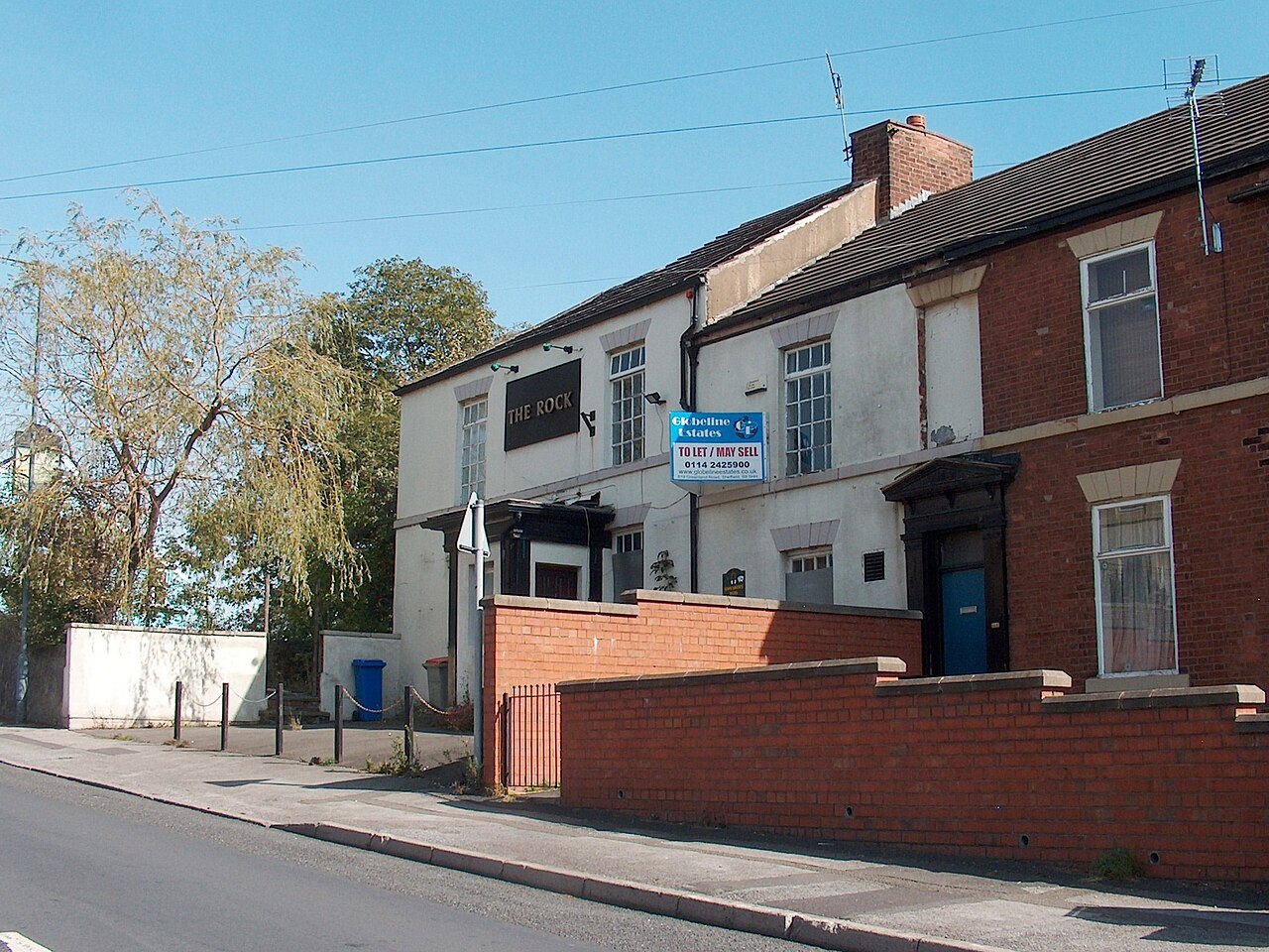
Photograph: Neil Theasby, CC BY-SA 2.0
All Sheffield areas · Open on the neighbourhood map
Sheffield neighbourhood
Burngreave, Sheffield
Inside the Burngreave boundary: 3 classes, 1 business, 1 place, 9 charities.
Coming up in this neighbourhood
No upcoming events are located inside this boundary yet.
Classes and regular sessions
Class
Rounders every Wednesday evening at Astrea Academy, 7pm
Join us for our beginner friendly indoor rounders sessions. It doesn't matter if you've not played since school, or never at all, we'd love for you…
Class
Rounders every Wednesday evening at Astrea Academy, 7pm
Join us for our beginner friendly indoor rounders sessions. It doesn't matter if you've not played since school, or never at all, we'd love for you…
Class
Rounders every Wednesday evening at Astrea Academy, 7pm
Join us for our beginner friendly indoor rounders sessions. It doesn't matter if you've not played since school, or never at all, we'd love for you…
Businesses and places
Place
Burngreave Cemetery
Charities based here
Charity
Reach Up Youth
provide training and education for local people particularly somalistudy support recreational and sporting activities
Charity
Agency for Culture and Change Management
Delivers: 1. Social responsibility, active citizenry, community cohesion. 2. combats inequality, xenophobia, homophobia, antisemitism, islamophobia, ageism, misogyny. 3. special needs inclusion play, learning with disabilities, autism.…
Charity
Yemeni Education and Relief Organisation
Training, Advocacy. Sport, Chilcare, Relief, Overseas, Human rights
Charity
Al-Taqwah Somali Centre
COMMUNITY MEETINGS ( WOMEN AND MEN )WORSHIPING SOMALI CULTURAL STUDIESOUT DOOR ACTIVITIES
Charity
Somaliland Education and Environmental Relief Organisation
SEERO Organisation is establish to improve the advancement of the Education for Somaliland's rural community through the provision of or assistance in providing funds for Educational…
Charity
Pitsmoor Adventure Playground
To manage and run a children's adventure playground in the Pitsmoor and Burngreave areas of Sheffield and surrounding areas.To provide facilities for the community in the…
Charity
Rock Christian Centre
1. The Object of the CIO is, for the public benefit, the advancement of the Christian faith in Sheffield and such other parts of the United…

Scorecard 1 card
How Burngreave scores
Overall 63 out of 100, ranked 25 of 147 neighbourhoods, from 5 of 7 dimensions. Each score is a percentile rank against the other neighbourhoods, not a measurement.
- 33Quiet 3 inputs
- 78Green 4 inputs
- 64Connected 5 inputs
- –Affordable not scored
- –Safe not scored
- 68Lively 4 inputs
- 73Served 7 inputs
How these scores are worked out
Each input is a percentile rank: the share of the other neighbourhoods this one is at least as good as (direction per input). A dimension is the percentile rank of the mean of its available input ranks and needs at least two inputs; the overall score is the mean of the scored dimensions. Points are placed by point-in-polygon against the Data for Action boundaries; per-head figures use Census 2021 residents for neighbourhoods with their own census areas; noise shares sample an even grid of points inside each polygon against the Defra Lden bands; distances are straight lines from the polygon centre. Burngreave covers 0.67 km² with 5,559 residents (Census 2021); noise was sampled at 61 points.
| Dimension | Input | Value | Rank | Better | Source | Licence |
|---|---|---|---|---|---|---|
| Quiet | Sampled points inside a Defra road-noise band (55 dB Lden and over) | 6.6% | 34 | lower | noise | Open Government Licence v3.0 |
| Quiet | Sampled points inside a Defra rail-noise band (55 dB Lden and over) | 0.0% | 100 | lower | noise | Open Government Licence v3.0 |
| Quiet | Daily vehicles at DfT count points inside the boundary (sum of AADT; 0 when no counted major road is inside) | 12,721 vehicles a day | 28 | lower | roads | Open Government Licence v3.0 |
| Green | Nature and green sites inside the boundary: Natural England reserves, SSSIs, ancient woodland and open access land, plus council historic parks | 1.49 per km² | 79 | higher | land, council_more | Open Government Licence v3.0 |
| Green | Council community-forestry trees planted inside the boundary | 11.96 per km² | 82 | higher | council_more | Open Government Licence v3.0 |
| Green | Recent wildlife observations inside the boundary (iNaturalist and GBIF; counts only) | 0 per km² | 75 | higher | nature | Per record: CC0, CC BY or CC BY-NC |
| Green | Playgrounds, sports pitches and dog parks on OpenStreetMap | 1.08 per 1,000 residents | 50 | higher | osm_amenities | ODbL 1.0 |
| Connected | NaPTAN bus and coach stops inside the boundary | 23.92 per km² | 70 | higher | naptan | Open Government Licence v3.0 |
| Connected | NaPTAN bus and coach stops inside the boundary | 2.88 per 1,000 residents | 13 | higher | naptan | Open Government Licence v3.0 |
| Connected | Straight-line distance from the neighbourhood centre to the nearest tram stop | 1,292 m | 54 | lower | naptan | Open Government Licence v3.0 |
| Connected | Straight-line distance from the neighbourhood centre to the nearest rail station entrance | 1,959 m | 73 | lower | naptan | Open Government Licence v3.0 |
| Connected | Premises able to get gigabit broadband (Ofcom Connected Nations) | 99.6% | 80 | higher | connectivity | Open Government Licence v3.0 |
| Affordable | Median sold price over the last twelve months (standard sales, at least five) | – Fewer than five sales in the window. | – | lower | pricepaid | Open Government Licence v3.0 |
| Affordable | Median sold price against the Sheffield median for the same mix of property types (1.0 = Sheffield) | – Fewer than five sales in the window. | – | lower | pricepaid | Open Government Licence v3.0 |
| Affordable | Median sold price of a terraced house (at least five sales) | – Fewer than five sales in the window. | – | lower | pricepaid | Open Government Licence v3.0 |
| Affordable | Households renting (council, other social and private), Census 2021, as a proxy for rented supply | 73.1% | 87 | higher | census_more | Open Government Licence v3.0 |
| Safe | Recorded street-level crimes over the last twelve months | – No street-level crime rows are stored. | – | lower | police | Open Government Licence v3.0 |
| Safe | Violence and sexual offences over the last twelve months | – No street-level crime rows are stored. | – | lower | police | Open Government Licence v3.0 |
| Safe | Burglaries over the last twelve months | – No street-level crime rows are stored. | – | lower | police | Open Government Licence v3.0 |
| Safe | Anti-social behaviour reports over the last twelve months | – No street-level crime rows are stored. | – | lower | police | Open Government Licence v3.0 |
| Safe | The stored police data holds neighbourhood meetings and priorities only; street-level crime counts are deliberately not stored, so no neighbourhood has a safety score yet. | |||||
| Lively | Upcoming events and classes on Sheffield Events located inside the boundary | 0.72 per 1,000 residents | 72 | higher | neighbourhoods | CC BY 4.0 (Sheffield Events listings inside Data for Action boundaries) |
| Lively | Businesses and places in the Sheffield Events directory located inside the boundary | 0.36 per 1,000 residents | 40 | higher | neighbourhoods | CC BY 4.0 (Sheffield Events listings inside Data for Action boundaries) |
| Lively | Real ale pubs on OpenStreetMap | 0 per 1,000 residents | 84 | higher | osm_amenities | ODbL 1.0 |
| Lively | Community centres on OpenStreetMap | 0.54 per 1,000 residents | 91 | higher | osm_amenities | ODbL 1.0 |
| Served | Straight-line distance from the neighbourhood centre to the nearest GP practice (NHS ODS) | 292 m | 77 | lower | nhs | Open Government Licence v3.0 |
| Served | Community pharmacies inside the boundary (NHS ODS) | 0 per 1,000 residents | 39 | higher | nhs | Open Government Licence v3.0 |
| Served | Open primary and all-through schools inside the boundary (Get Information about Schools) | 1.33 per 1,000 under-15s | 54 | higher | schools | Open Government Licence v3.0 |
| Served | Straight-line distance from the neighbourhood centre to the nearest library (Sheffield City Council) | 426 m | 84 | lower | council | Open Government Licence v3.0 |
| Served | Public defibrillators on OpenStreetMap inside the boundary | 2.99 per km² | 76 | higher | osm_amenities | ODbL 1.0 |
| Served | Public toilets inside the boundary (OpenStreetMap and the Toilet Map) | 0 per km² | 60 | higher | osm_amenities | ODbL 1.0 and CC BY 4.0 |
| Served | Electric vehicle chargers on OpenStreetMap inside the boundary | 0 per km² | 86 | higher | osm_amenities | ODbL 1.0 |
Areas like this
- Parson Cross 61
- Hunters Bar 61
- Millhouses 50
- Pitsmoor 74
- Heeley 62
Neighbourhood scorecards by Sheffield Events, CC BY 4.0, derived from Defra noise mapping, DfT traffic counts, Natural England, Sheffield City Council, iNaturalist and GBIF, OpenStreetMap contributors (ODbL), the Toilet Map, NaPTAN, Ofcom, HM Land Registry, ONS Census 2021, NHS ODS, Get Information about Schools and the Data for Action neighbourhood boundaries; each input keeps its own licence. CC BY 4.0 · All data sources · Download the scores (API)
Living here 6 cards
Census 2021
How people here live
Travel, homes, origins, faith, qualifications and health for the 5,559 residents of Burngreave, with the Sheffield figure beside each, from 3 census areas.
- Most common way to work
- Driving 38.3% Sheffield Driving 45.2%
- Owner-occupied homes
- 26.3% Sheffield 58.6%
- Households without a car
- 48.3% Sheffield 29.2%
- Born outside the UK
- 47.7% Sheffield 14.9%
- Most common answer on religion
- Muslim 62% Sheffield No religion 43.4%
- Degree-level qualified, 16 and over
- 22.1% Sheffield 33.4%
- In very good health
- 50.2% Sheffield 46.7%
Source: Office for National Statistics, Census 2021, via Nomis, Open Government Licence v3.0. Neighbourhood figures sum the census areas whose population-weighted centres (ONS Open Geography, contains OS data © Crown copyright and database right 2026) fall inside each boundary. Census 2021 on Nomis · All data sources
Deprivation here
3 small areas (LSOAs) have their population centre inside this boundary; their average IMD 2019 decile is 1.0 (1 is most deprived, 10 least).
Deprivation: English Indices of Deprivation 2019 by LSOA (MHCLG) with ONS population-weighted centroids, Open Government Licence v3.0. Decile 1 is the most deprived tenth of England. Indices of Deprivation 2019 · ONS Open Geography Portal · All data sources
Schools here
2 open nurseries, schools and colleges whose registered position is inside this boundary, from the Department for Education register.
- Primary Byron Wood Primary Academy ages 3 to 11 · Academy converter · S4 7EJ Website
- Primary Pye Bank CofE Primary School ages 3 to 11 · Academy converter · S3 9EF Website
Ofcom Connected Nations 2025
Broadband and mobile in Burngreave
1,667 premises in 11 census output areas whose population centres fall inside this boundary, as reported to Ofcom for July 2025.
Fixed broadband availability
- Gigabit-capable
- 100% Sheffield 93%
- 300 Mbit/s or faster
- 100% Sheffield 94%
- Superfast (30 Mbit/s or faster)
- 100% Sheffield 98%
- Cannot get 10 Mbit/s
- 0% Sheffield 0%
- Below the broadband USO
- 0% Sheffield 0%
Mobile signal
Mobile coverage is published for Sheffield as a whole: outdoor 4G from all four operators reaches 99.8% of premises, 5G from at least one operator 99.7%, and a good outdoor 4G or 5G signal from every operator 96.1%.
Availability means a service could be ordered at the address in July 2025; it is not a measured speed. Data edition: Ofcom Connected Nations 2025, published 19 November 2025.
Source: Ofcom Connected Nations 2025 data downloads (data for July 2025, published 19 November 2025), Ofcom copyright, reproduced under Ofcom's terms of use and the Open Government Licence v3.0. Output areas placed with ONS Open Geography lookups and population-weighted centroids, contains OS data © Crown copyright and database right 2026. Ofcom Connected Nations 2025 data · All data sources
Homes and prices
What sold in Burngreave
Only 3 standard sales were registered inside this boundary in the last twelve months, too few for a reliable local figure. Across Sheffield the median was £215,000.
Most recent registered sales
- Jan 2026 Burngreave Road Semi-detached, leasehold £160,000
- Nov 2025 Earldom Road Semi-detached, leasehold £107,499
- Nov 2025 Andover Street Terraced, leasehold £100,000
Contains HM Land Registry data © Crown copyright and database right 2026. This data is licensed under the Open Government Licence v3.0. Medians use standard sales only; the Land Registry’s additional category (for example buy-to-let and repossessions) is excluded. These are actual registered sales, not the mix-adjusted UK House Price Index estimate. Data is published one to two months in arrears and does not include every sale. Checked 25 Oct 2026. Price Paid Data · All data sources
Census 2021
Who lives in Burngreave
5,559 residents in 1,921 households, from 3 census areas whose population centres fall inside this boundary.
Ages
- Under 15
- 27% Sheffield 17%
- 15 to 24
- 16% Sheffield 16%
- 25 to 44
- 29% Sheffield 26%
- 45 to 64
- 19% Sheffield 24%
- 65 and over
- 9% Sheffield 17%
Homes
- Owned
- 26% Sheffield 59%
- Social rented
- 55% Sheffield 23%
- Private rented
- 19% Sheffield 19%
- One-person households
- 34% Sheffield 33%
- Detached
- 8% Sheffield 15%
- Semi-detached
- 29% Sheffield 38%
- Terraced
- 29% Sheffield 26%
- Flats
- 35% Sheffield 21%
Work and study, residents aged 16 and over
- In work
- 41% Sheffield 53%
- Full-time students
- 14% Sheffield 14%
- Retired
- 10% Sheffield 20%
- Unemployed
- 6% Sheffield 4%
Source: Office for National Statistics licensed under the Open Government Licence v.3.0. Census 2021 tables via Nomis; population-weighted centroids from ONS Open Geography, contains OS data © Crown copyright and database right 2026. Census 2021 on Nomis · All data sources
People and health 2 cards
NHS England
GP practice list sizes here
1 GP practice has its registered address in this neighbourhood, with 10,969 patients on its list in October 2026. That is -13 on the month before. Patients register where they choose, so a list is not the neighbourhood's population.
- The Burngreave Surgery10,969 patients · -13 on the month · +35.7% on the year
Contains information from NHS England, licenced under the current version of the Open Government Licence (Open Government Licence). Checked 26 Oct 2026. Patients registered at a GP practice · All data sources
NHS services here
GP practices, pharmacies and dentists whose postcode centre is inside this boundary, from the NHS organisation register. For urgent help call 999 or 111.
- GP practice Melrose Surgery 120A Burngreave Road, Sheffield S3 9DE
- GP practice Sheffield Medical Centre Spital Street Health Centre, Spital Street, Sheffield S3 9LB
- GP practice The Burngreave Surgery Spital Street Health Centre, Spital Street, Sheffield S3 9LB
Getting around 2 cards
Traffic counted here
1 DfT count point inside this boundary. Busiest: A6135 A6109 to A6102 with 12,721 motor vehicles a day in 2025. Most cyclists counted: A6135 A6109 to A6102, 183 a day.
- Count point A6135 A6109 to A6102 12,721 motor vehicles a day (2025) · 183 cyclists · estimated
Department for Transport STATS19
Road collisions here, 2021 to 2025
31 road collisions with someone hurt were recorded in this neighbourhood, 2021 to 2025: 0 fatal, 6 serious and 25 slight. 10 pedestrians and 2 cyclists were among the 50 people hurt.
- Collisions
- 31
- Fatal
- 0
- Serious
- 6
- Slight
- 25
- People hurt
- 50
- Pedestrians hurt
- 10
- Cyclists hurt
- 2
- 2021: 0 fatal, 2 serious, 4 slight10 hurt (pedestrians 2, cyclists 0)
- 2022: 0 fatal, 3 serious, 4 slight12 hurt (pedestrians 3, cyclists 0)
- 2023: 0 fatal, 1 serious, 8 slight12 hurt (pedestrians 2, cyclists 2)
- 2024: 0 fatal, 0 serious, 6 slight12 hurt (pedestrians 1, cyclists 0)
- 2025: 0 fatal, 0 serious, 3 slight4 hurt (pedestrians 2, cyclists 0)
Road collisions across Sheffield · On the Local Map
Road collision data from the Department for Transport (STATS19 road safety open data), Open Government Licence v3.0 Open Government Licence v3.0. Checked 12 Oct 2026. Road safety open data · All data sources
Environment and sky 6 cards
Noise here
About 4% of this area is mapped at 55 dB or more from road traffic; the loudest band here is 75 dB or more, covering about 2%.
Rain and rivers here
Nearest rain gauge: Ringinglow, 7.4 km away. 59.6 mm of rain in the last 7 days, wettest day Saturday 24 Oct with 27.3 mm.
British Geological Survey
The ground beneath Burngreave
At the centre of Burngreave the bedrock is the Pennine Lower Coal Measures Formation: mudstone, siltstone, sandstone, coal, ironstone and ferricrete, Carboniferous, Langsettian (Westphalian A), about 316 to 314 million years ago, on the BGS 1:625 000 bedrock map (unit PSLCM). The 1:625 000 map is a regional overview generalised from more detailed sheets: it describes the ground under a neighbourhood as a whole and is not a site investigation.
Contains British Geological Survey materials © UKRI 2026. Open Government Licence v3.0. Checked 10 Oct 2026. BGS Geology 625k bedrock · All data sources
Forestry Commission, National Forest Inventory
Woodland here
- Woodland
- 0.8 ha1 parcel
- Tree cover
- 1.2%of the neighbourhood
- Rank
- 116of 147 neighbourhoods for woodland cover
Sheffield's woods · On the Local Map
National Forest Inventory: © Forestry Commission copyright. Contains Ordnance Survey data © Crown copyright and database right 2026. Open Government Licence v3.0. Checked 12 Oct 2026. Dataset: National Forest Inventory England 2025 · All data sources
Ordnance Survey, OS Open Greenspace
Pitches, courts and greens here
- Playing fields
- 2
- Play spaces
- 4
- Other sports grounds
- 4
- Gates and entrances
- 13
- Pitsmoor Adventure Playground · Play space0.3 ha · 1 entrance
- Verdon Recreation Centre · Sports ground0.2 ha · 3 entrances
Across Sheffield · On the Local Map
Contains OS data © Crown copyright and database right 2026. OS Open Greenspace, Open Government Licence v3.0. Checked 12 Oct 2026. Dataset: OS Open Greenspace, 2026-04 release · All data sources
Mining Remediation Authority
Coal mining legacy here
About 10.8% of Burngreave, roughly 7.2 hectares, lies in a coal mining Development High Risk Area: recorded shafts, adits or shallow workings are at or near the surface, so new building there needs a coal mining risk assessment.
- Land in a high risk area
- 10.8%about 7.2 hectares
- Sheffield as a whole
- 17.1%
This is a planning designation drawn from recorded features, not a survey of any one property, and being in an area does not mean the ground there is unsafe. Buying or building? Ask the authority itself. Check if a property is affected by coal mining · Coal mining risk assessments for planning · Report a coal mine hazard (24 hours)
Contains Mining Remediation Authority data, Crown copyright, Open Government Licence v3.0. Checked 26 Oct 2026. Dataset: Coal mining Development High Risk Area · All data sources
Heritage and culture 4 cards
On Wikipedia and Commons
4 Wikipedia articles and 4 freely licensed photos on Wikimedia Commons, placed inside this boundary.
- Burngreave (ward) Burngreave ward-which includes the districts of Burngreave, Fir Vale, Grimesthorpe, Pitsmoor, and Shirecliffe-is one of the 28 electoral wards in Sheffield, England.
- Pitsmoor Pitsmoor is a former village, now a suburb of Sheffield, England.
- Burngreave Community Radio
- East House mass shooting


Landmarks and heritage
8 listed buildings, landmarks and plaques whose recorded position is inside this boundary, from Wikidata and Open Plaques.
- Listed or scheduled Burngreave Cemetery Grade II listed park and garden · since 1861 cemetery in Sheffield, England Photo on Commons · Heritage List entry
- Listed or scheduled Carr Wood House and attached wall and gate piers Grade II listed building Grade II listed house in Sheffield, South Yorkshire, England, UK Photo on Commons · Heritage List entry
- Listed or scheduled Lodges, Railings And Gate Piers At Burngreave Cemetery Grade II listed building gatehouse in Sheffield, South Yorkshire, England, UK Photo on Commons · Heritage List entry
- Listed or scheduled Pye Bank School With Caretakers House And Boundary Wall Grade II listed building building in Sheffield, South Yorkshire, England, UK Heritage List entry
- Listed or scheduled Seventh Day Adventist Church Adjoining School And Boundary Wall Grade II listed building building in Sheffield, South Yorkshire, England, UK Heritage List entry
- Listed or scheduled St Catherine of Alexandria, Sheffield Grade II listed building Grade II listed Catholic church in Sheffield Photo on Commons · Heritage List entry
- Listed or scheduled Vestry Offices And Attached Railings And Gates Grade II listed building architectural structure in Sheffield, South Yorkshire, England, UK Photo on Commons · Heritage List entry
- Listed or scheduled War Memorial 400 Metres North East of Chapel at Burngreave Cemetery Grade II listed building war memorial in Sheffield, United Kingdom Photo on Commons · Heritage List entry


On the National Heritage List here
1 listed building inside this boundary, from Historic England, in addition to the landmarks on the heritage map.
- Grade II War Memorial Cross 400 Metres North East of Chapel at Burngreave Cemetery Grade II · Listed building · listed 1995
Historic England
Heritage at risk here
1 site in this neighbourhood is on the 2025 Heritage at Risk Register.
- Seventh Day Adventist Church adjoining school and boundary wall, Andover StreetListed Building · Place of worship · Burngreave · List entry 1246453 · Wikidata
Heritage at Risk Register © Historic England 2026. Contains Ordnance Survey data © Crown copyright and database right 2026. Open Government Licence v3.0. Checked 12 Oct 2026. Heritage at Risk Register · All data sources
Council and democracy 5 cards
Council data for this area
What Sheffield City Council's open data records inside this boundary.
- Trees 8 community forestry trees mostly Platanus orientalis 'minaret', Apple Ellison's Orange, Pear Concorde
- 20 mph zone Andover NE16
- 20 mph zone Pitsmoor NE17
- Historic park Burngreave Cemetery G9
- Polling station Sheffield City Council First Point Sorby House 42 Spital Hill Sheffield S4 7LG Burngreave Ward · district FI
- Polling station St Peters Church Lyons Street Sheffield S4 7EP Burngreave Ward · district FC
- Polling station Verdon Recreation Centre 218 Verdon Street Sheffield S3 9QN Burngreave Ward · district FG
- Litter bins 36 council litter bins on the streets here
Planning applications here
3 applications lodged in the last 12 weeks, 1 still undecided.
- Undecided213 Grimesthorpe Road Sheffield S4 7EU
- Withdrawn53 Carlisle Street Sheffield S4 7LJ
- PermittedThe Burngreave Surgery 1 – 3 Burngreave Road Sheffield S3 9DA
Planning applications: UK PlanIt, aggregated from Sheffield City Council. Check the council record before relying on any detail; documents are linked, never copied. UK PlanIt · All data sources
Planning constraints
Conservation areas and brownfield land here
4 sites on the brownfield land register sit here, 0.6 hectares in all put forward for housing.
- Land at Somerset Road/ Richmond Street
- 19A And 19B Burngreave Road, Sheffield S3 9DA
- Flat Over 69 And 71 Burngreave Road Sheffield S3 9DF
- Land Between 38 And 44 Burngreave Street Sheffield S3 9DQ
Contains planning.data.gov.uk data published by Sheffield City Council and neighbouring planning authorities under the Open Government Licence v3.0; conservation area boundaries © Historic England, containing Ordnance Survey data © Crown copyright and database right. Open Government Licence v3.0. Checked 10 Oct 2026. planning.data.gov.uk · All data sources
Valuation Office Agency
Council tax bands here
The 3 small areas (LSOAs) whose population centres fall in this neighbourhood hold about 2,140 homes on the council tax list; 97% are in Band A, against 58% across Sheffield. The average full bill across these homes before discounts is about £1,684 a year in 2026-27, worked out from the Band D figure. A few very small counts are withheld by the VOA, so the bands add up to slightly fewer homes than the total.
| Area | Band A | Band B | Band C | Bands D to H |
|---|---|---|---|---|
| Burngreave | 96.7% | 2.8% | 0.5% | 0% |
| Sheffield | 58% | 16.3% | 12.7% | 13% |
- Homes
- 2,140
- Band A
- 97%
- Band B
- 3%
- Band C
- 1%
- Bands D to H
- 0%
- Band A: 2,070 homes (96.7%)Valued up to £40,000 in 1991 · £1,673.44 full bill, 2026-27
- Band B: 60 homes (2.8%)Valued £40,001 to £52,000 in 1991 · £1,952.35 full bill, 2026-27
- Band C: 10 homes (0.5%)Valued £52,001 to £68,000 in 1991 · £2,231.25 full bill, 2026-27
- Band D: 0 homes (0.0%)Valued £68,001 to £88,000 in 1991 · £2,510.16 full bill, 2026-27
- Band E: 0 homes (0.0%)Valued £88,001 to £120,000 in 1991 · £3,067.97 full bill, 2026-27
- Band F: 0 homes (0.0%)Valued £120,001 to £160,000 in 1991 · £3,625.79 full bill, 2026-27
- Band G: 0 homes (0.0%)Valued £160,001 to £320,000 in 1991 · £4,183.60 full bill, 2026-27
- Band H: 0 homes (0.0%)Valued over £320,000 in 1991 · £5,020.32 full bill, 2026-27
Council tax bands across Sheffield · On the Local Map
Council tax stock of properties (table CTSOP1.1) from the Valuation Office Agency, Open Government Licence v3.0 Open Government Licence v3.0. Checked 12 Oct 2026. Valuation Office council tax statistics · Background notes · All data sources
Council services here
Libraries, family hubs and housing offices whose published location is inside this boundary.
- Library Burngreave Library 42 Spital Hill, Sheffield, S4 7LG
- Council housing office First Point at Burngreave Sheffield City Council First Point Sorby House 42 Spital Hill Sheffield S4 7LG
Money and energy 3 cards
National Lottery grant database
Lottery money in Burngreave ward
Awards filed to recipients in Burngreave ward, the ward this area sits in. Awards to individuals are counted in the figures and never named.
- Awards since 1995
- 354
- Awarded in total
- £14.8m
- Awards since 2022
- 68
- Awarded since 2022
- £3.0m
Latest awards to organisations here
- Green City Action · £20,000Growing Together – GCA · National Lottery Awards for All England · The National Lottery Community Fund · 24 Sep 2026
- JUDOOR & JUSOOR (J&J) CIC · £20,000Raising Children Between Two Cultures · National Lottery Awards for All England · The National Lottery Community Fund · 21 Sep 2026
- Create Sheffield · £70,000Youth Proofing Sheffield Culture · National Lottery Project Grants · Arts Council England · 26 Aug 2026
Lottery money across Sheffield
National Lottery grant data from the Department for Culture, Media and Sport, Open Government Licence v3.0. Checked 28 Oct 2026. National Lottery grant database · Sheffield export (CSV) · All data sources
Office for National Statistics via Nomis
Work in this area
Burngreave sits in Burngreave ward. The claimant count is the number of people there on Universal Credit or Jobseeker's Allowance who are required to look for work, as a share of residents aged 16 to 64; the ward series begins in January 2026.
- Claimants in Burngreave ward
- 1,825Sep 2026
- Share of residents aged 16 to 64
- 9.7%Sep 2026
- Sheffield
- 4.4%16,785 claimants, Sep 2026
| Month | Burngreave | Sheffield |
|---|---|---|
| Jan 2026 | 8.8 % | 4.2 % |
| Feb 2026 | 9.2 % | 4.3 % |
| Mar 2026 | 9.3 % | 4.3 % |
| Apr 2026 | 9.3 % | 4.3 % |
| May 2026 | 9.4 % | 4.3 % |
| Jun 2026 | 9.5 % | 4.3 % |
| Jul 2026 | 9.9 % | 4.3 % |
| Aug 2026 | 9.6 % | 4.3 % |
| Sep 2026 | 9.7 % | 4.4 % |
Source: Office for National Statistics licensed under the Open Government Licence v3.0, via Nomis. Ward boundaries from ONS Open Geography, OGL v3.0. Checked 26 Oct 2026. Claimant count on Nomis · Nomis · All data sources
Sheffield City Council business rates
Rated business premises here
122 premises in Burngreave are on the business rates list, with a combined rateable value of £1,672,300.
- Rated premises
- 122
- Total rateable value
- £1,672,300
- Middle rateable value
- £7,050
- Shops and retail
- 44
- Offices
- 8
- Workshops, warehouses and industry
- 38
- Pubs, restaurants, cafes and hotels
- 13
Commonest kinds
- Shop And Premises44 premises
- Workshop And Premises15 premises
- Garage And Premises10 premises
- Cafe And Premises9 premises
- Offices And Premises7 premises
Streets with the most premises
- Spital Hill, S445 rated premises
- Carwood Road, S424 rated premises
- Burngreave Road, S39 rated premises
- Kilton Hill, S38 rated premises
- Lyons Street, S45 rated premises
- Andover Street, S34 rated premises
Highest rateable values here
- Sorby House, Spital Hill, S4 7LGOffices And Premises · rateable value £215,000 · rates paid by Sheffield City Council
- Byron Wood Primary School, Earldom Road, S4 7EJSchool And Premises · rateable value £171,000 · rates paid by Astrea Academy Trust
- Pye Bank Ce Primary School, Andover Street, S3 9EFSchool And Premises · rateable value £133,000 · rates paid by Diocese Of Sheffield Academies Trust
- 31 Lyons Street, S4 7QSWorkshop And Premises · rateable value £68,500 · rates paid by Gascoyne & Beever Eng Co Ltd
- 122 Burngreave Road, S3 9DEOffices And Premises · rateable value £33,500 · rates paid by Arches Housing Ltd
Business premises across Sheffield · On the Local Map
Business rates public dataset from Sheffield City Council via Data Mill North, Open Government Licence v3. Checked 12 Oct 2026. Business rates on Data Mill North · All data sources
Community 3 cards
Around here
25 everyday places mapped inside this boundary by OpenStreetMap volunteers and the Toilet Map.
- 7 cycle parking stands
- 4 playgrounds
- 3 community centres
- 2 public artworks
- 2 defibrillators
- 2 sports pitches
- 2 post boxes
- 1 cash machine
- 1 library
- 1 memorial
- Nearest defibrillator Defibrillator 500 m away from the centre of the area
- Nearest toilets Toilets 1.1 km away from the centre of the area
- Nearest drinking water Drinking water 1.0 km away from the centre of the area
- Nearest cycle parking Cycle parking 290 m away from the centre of the area
- Nearest ev charger EV charger 1.0 km away from the centre of the area
Co-operatives UK open data
Co-operatives and societies registered here
3 co-operatives, societies and community businesses on the Co-operatives UK register give a postcode in this neighbourhood.
- Brambles Housing Co-operative · Wiki · BurngreaveSociety · Housing · founded 1990 · Burngreaveturnover £13k, 9 members (accounts to Dec 2019)
- Burngreave Works And Wellbeing Community Interest Company · BurngreaveCommunity Interest Company · Other · founded 2011 · Burngreave3 employees (accounts to Mar 2020)
- Fireside Housing Co-operative · Wiki · BurngreaveSociety · Housing · founded 1995 · Burngreaveturnover £31k, 10 members (accounts to Dec 2023)
Co-operative register and economy data from Co-operatives UK open data, ODC-By v1.0. Checked 12 Oct 2026. Co-operatives UK open data · All data sources
Ofsted management information
School inspections near here
The newest Ofsted inspection of each of 2 state-funded schools and colleges registered inside this boundary, as at 30 Sep 2026, with any earlier inspection Ofsted still lists.
- Primary Byron Wood Primary AcademyGraded inspection, no overall grade: quality of education good · inspected 14 Jan 2025, published 6 Feb 2025
- Primary Pye Bank CofE Primary SchoolGraded inspection: Good · inspected 8 Jun 2022, published 25 Jul 2022
School inspections across Sheffield · Schools here on the Local Map
Inspection outcomes from Ofsted management information on state-funded schools and further education and skills providers, Open Government Licence v3.0. Checked 26 Oct 2026. School inspection management information · FE and skills management information · All data sources
Charts 1 card
More 3 cards
Recorded crime here, August 2026
47 offences were recorded inside this boundary in August 2026.
| Offence type | Recorded |
|---|---|
| Violence and sexual offences | 23 |
| Anti-social behaviour | 13 |
| Criminal damage and arson | 4 |
| Public order | 3 |
| Vehicle crime | 2 |
| Other theft | 1 |
| Theft from the person | 1 |
Offences recorded by South Yorkshire Police in August 2026, counted into this neighbourhood. Locations published by the Home Office are approximate by design, so this is a count for the area, never for a street or an address.
Problems people reported here
59 problems reported to the council through FixMyStreet in the last 60 days. Each one is somebody's report, not a verified fact.
- Rubbish (refuse and recycling) still open on FixMyStreet · reported 10 hours ago
- Rubbish (refuse and recycling) still open on FixMyStreet · reported 18 hours ago
- Flytipping still open on FixMyStreet · reported 18 hours ago
- Flytipping still open on FixMyStreet · reported 2 days ago
- Flytipping still open on FixMyStreet · reported 2 days ago
- Graffiti still open on FixMyStreet · reported 2 days ago
- Graffiti still open on FixMyStreet · reported 2 days ago
- Graffiti still open on FixMyStreet · reported 2 days ago
- Street cleaning still open on FixMyStreet · reported 2 days ago
- Street cleaning still open on FixMyStreet · reported 2 days ago
- Rubbish (refuse and recycling) still open on FixMyStreet · reported 4 days ago
- Street cleaning still open on FixMyStreet · reported 5 days ago
Alerts
Follow Burngreave and hear what happens here: new events and places listed, planning applications, roadworks, storm overflows, floods and poor air. Floods and overflows arrive straight away; the rest come as one round-up at 8am, grouped by area.
Yorkshire Water (CC BY 4.0), Environment Agency (OGL v3), UK PlanIt and TomTom via the live map.
32 listings have also been filed under the Burngreave area tag.
Burngreave: your questions answered
Which venues and businesses are in Burngreave?
2 directory entries sit inside Burngreave, including Andover St, Sheffield, Burngreave Cemetery. Each has its address, opening details where published and its upcoming events.
Which areas are next to Burngreave?
The areas nearest to Burngreave are Ellesmere, Pitsmoor, Wicker, Osgathorpe, Parkwood Springs. Each has its own page with the events and places inside it.
How is the Burngreave boundary defined?
The boundary is the Burngreave polygon from the Sheffield neighbourhoods dataset published by Data for Action, one of 147 across the city. Events, businesses, places and charities are placed inside it by their coordinates, so a venue just over the line appears on the neighbouring page instead.
Neighbouring areas
Neighbourhood boundaries by Data for Action, licensed CC BY 4.0 and used with credit. Snapshot 946d748, published 16 Dec 2025, last checked 13 Oct 2026. Records are placed by their stored coordinates; a point on a shared boundary belongs to the first neighbourhood in the source file. All data sources