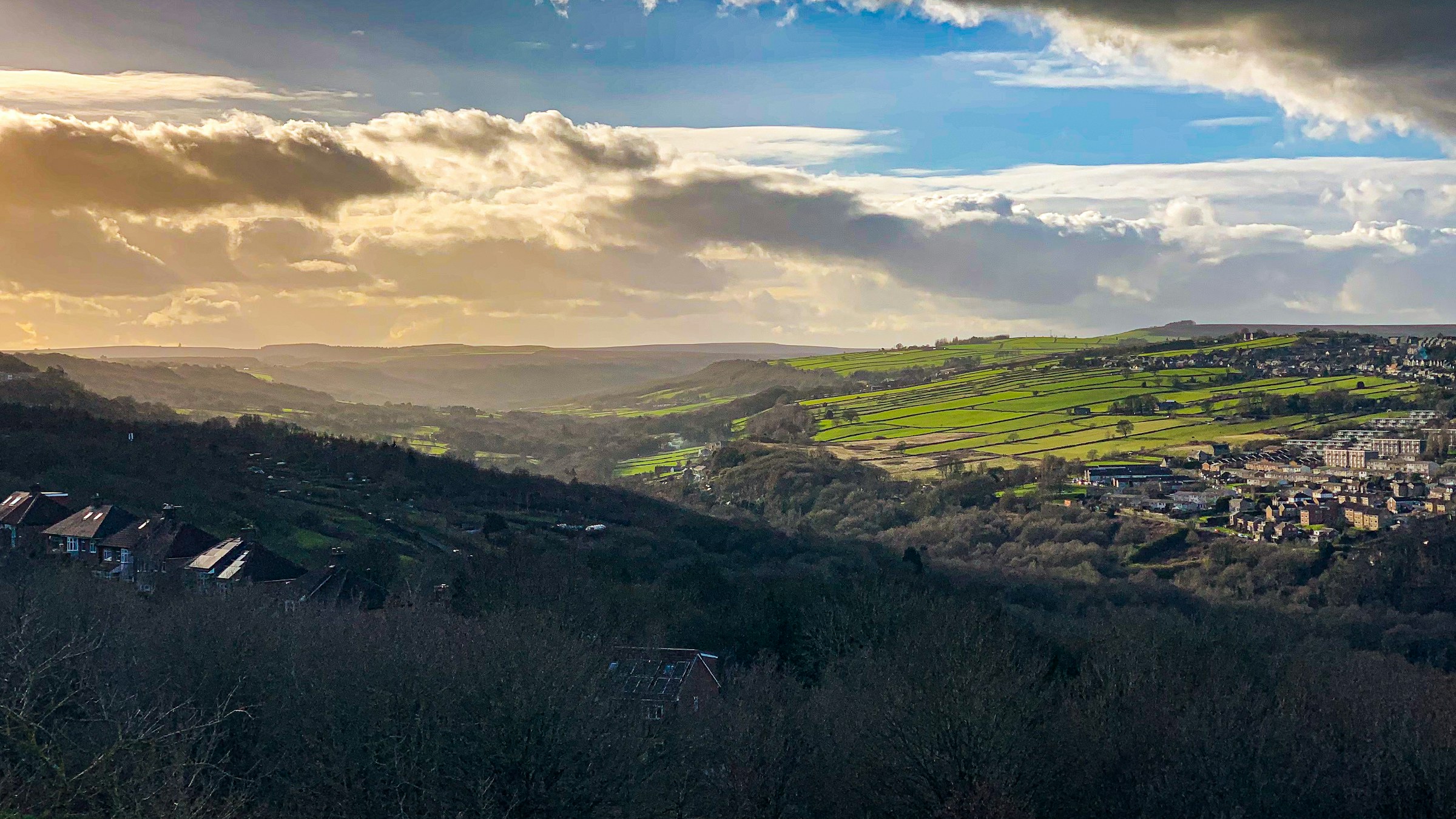
Photograph: Shane Rounce on Unsplash
All Sheffield areas · Open on the neighbourhood map
Sheffield neighbourhood
Lowfield, Sheffield
Inside the Lowfield boundary: 3 upcoming events, 4 businesses, 3 places, 6 charities.
Coming up in this neighbourhood

Event
Ruth Joy
Ruth Joy plays eclectic electronic music, house and jazz in Bar Takk at Hagglers Corner. Free before 10pm, £4 after.
Event
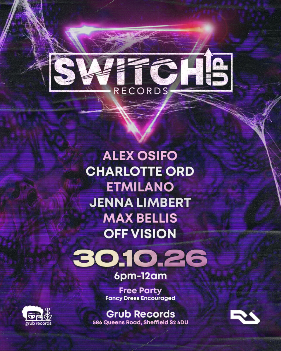
SWITCH:UP presents: Spooky SZN
SWITCH:UP holds its first Sheffield night at Grub Records with Alex Osifo and Charlotte Ord. Free entry, very limited capacity, fancy dress encouraged.

Event
ATTIKK PRESENTS: Trimtone
We're joining forces with Funk My Disco for a proper house music session in our Attikk on Friday 20th November!
Businesses and places
Place
Hagglers Corner
Hagglers Corner is a creative courtyard on Queens Road: independent studios and workshops around a yard that hosts markets, workshops and some of the city's most…
Place
Grub Records
Place
Asda Pharmacy – Queens Road
In-store pharmacy at a 7am-11pm supermarket just south of the city centre.
Charities based here
Charity
Baitul Mukarram Jame Masjid and Islamic Cultural Centre
The objective of the trust as set out in its governing document is to advance the religion of Islam andIslamic Culture.The charity's main objective is to…
Charity
Roshni Sheffield Asian Women’S Resource
Roshni is a resource centre for South Asian women living in Sheffield. The aim of the organisation is to advance the welfare and education of women…
Charity
The Eden Dora Trust for Children With Encephalitis Ltd
The Trust provides support to children and their families/carers affected by Encephalitis and the subsequent Acquired Brain Injury. We aim to raise awareness and fund research…

Charity
Sheffield Samaritans
Sheffield Samaritans provides confidential emotional support, by telephone, face to face, email and letter. We provide assistance to individuals who are suicidal, despairing or in distress…
Charity
Hallam Home Care
What the charity does:General Charitable PurposesDisabilityWho the charity helps:Children/young PeopleElderly/old PeoplePeople With DisabilitiesThe General Public/mankind

Charity
The Potter’S House Christian Fellowship UK Sheffield Church
we are a Christian organisation seeking to help our community with the love of Jesus. we work with people from all walks of life, from trouble…
Scorecard 1 card
How Lowfield scores
Overall 64 out of 100, ranked 23 of 147 neighbourhoods, from 6 of 7 dimensions. Each score is a percentile rank against the other neighbourhoods, not a measurement.
- 10Quiet 3 inputs
- 34Green 4 inputs
- 88Connected 5 inputs
- 85Affordable 4 inputs
- –Safe not scored
- 80Lively 4 inputs
- 89Served 7 inputs
How these scores are worked out
Each input is a percentile rank: the share of the other neighbourhoods this one is at least as good as (direction per input). A dimension is the percentile rank of the mean of its available input ranks and needs at least two inputs; the overall score is the mean of the scored dimensions. Points are placed by point-in-polygon against the Data for Action boundaries; per-head figures use Census 2021 residents for neighbourhoods with their own census areas; noise shares sample an even grid of points inside each polygon against the Defra Lden bands; distances are straight lines from the polygon centre. Lowfield covers 0.43 km² with 3,620 residents (Census 2021); noise was sampled at 56 points.
| Dimension | Input | Value | Rank | Better | Source | Licence |
|---|---|---|---|---|---|---|
| Quiet | Sampled points inside a Defra road-noise band (55 dB Lden and over) | 7.1% | 29 | lower | noise | Open Government Licence v3.0 |
| Quiet | Sampled points inside a Defra rail-noise band (55 dB Lden and over) | 12.5% | 3 | lower | noise | Open Government Licence v3.0 |
| Quiet | Daily vehicles at DfT count points inside the boundary (sum of AADT; 0 when no counted major road is inside) | 34,400 vehicles a day | 15 | lower | roads | Open Government Licence v3.0 |
| Green | Nature and green sites inside the boundary: Natural England reserves, SSSIs, ancient woodland and open access land, plus council historic parks | 0 per km² | 49 | higher | land, council_more | Open Government Licence v3.0 |
| Green | Council community-forestry trees planted inside the boundary | 4.66 per km² | 68 | higher | council_more | Open Government Licence v3.0 |
| Green | Recent wildlife observations inside the boundary (iNaturalist and GBIF; counts only) | 0 per km² | 75 | higher | nature | Per record: CC0, CC BY or CC BY-NC |
| Green | Playgrounds, sports pitches and dog parks on OpenStreetMap | 0.83 per 1,000 residents | 36 | higher | osm_amenities | ODbL 1.0 |
| Connected | NaPTAN bus and coach stops inside the boundary | 37.30 per km² | 95 | higher | naptan | Open Government Licence v3.0 |
| Connected | NaPTAN bus and coach stops inside the boundary | 4.42 per 1,000 residents | 39 | higher | naptan | Open Government Licence v3.0 |
| Connected | Straight-line distance from the neighbourhood centre to the nearest tram stop | 972 m | 62 | lower | naptan | Open Government Licence v3.0 |
| Connected | Straight-line distance from the neighbourhood centre to the nearest rail station entrance | 1,540 m | 83 | lower | naptan | Open Government Licence v3.0 |
| Connected | Premises able to get gigabit broadband (Ofcom Connected Nations) | 98.4% | 60 | higher | connectivity | Open Government Licence v3.0 |
| Affordable | Median sold price over the last twelve months (standard sales, at least five) | £117,500 | 91 | lower | pricepaid | Open Government Licence v3.0 |
| Affordable | Median sold price against the Sheffield median for the same mix of property types (1.0 = Sheffield) | 0.68 | 87 | lower | pricepaid | Open Government Licence v3.0 |
| Affordable | Median sold price of a terraced house (at least five sales) | £158,500 | 68 | lower | pricepaid | Open Government Licence v3.0 |
| Affordable | Households renting (council, other social and private), Census 2021, as a proxy for rented supply | 65.2% | 82 | higher | census_more | Open Government Licence v3.0 |
| Safe | Recorded street-level crimes over the last twelve months | – No street-level crime rows are stored. | – | lower | police | Open Government Licence v3.0 |
| Safe | Violence and sexual offences over the last twelve months | – No street-level crime rows are stored. | – | lower | police | Open Government Licence v3.0 |
| Safe | Burglaries over the last twelve months | – No street-level crime rows are stored. | – | lower | police | Open Government Licence v3.0 |
| Safe | Anti-social behaviour reports over the last twelve months | – No street-level crime rows are stored. | – | lower | police | Open Government Licence v3.0 |
| Safe | The stored police data holds neighbourhood meetings and priorities only; street-level crime counts are deliberately not stored, so no neighbourhood has a safety score yet. | |||||
| Lively | Upcoming events and classes on Sheffield Events located inside the boundary | 1.38 per 1,000 residents | 77 | higher | neighbourhoods | CC BY 4.0 (Sheffield Events listings inside Data for Action boundaries) |
| Lively | Businesses and places in the Sheffield Events directory located inside the boundary | 1.93 per 1,000 residents | 89 | higher | neighbourhoods | CC BY 4.0 (Sheffield Events listings inside Data for Action boundaries) |
| Lively | Real ale pubs on OpenStreetMap | 0 per 1,000 residents | 84 | higher | osm_amenities | ODbL 1.0 |
| Lively | Community centres on OpenStreetMap | 0 per 1,000 residents | 50 | higher | osm_amenities | ODbL 1.0 |
| Served | Straight-line distance from the neighbourhood centre to the nearest GP practice (NHS ODS) | 172 m | 92 | lower | nhs | Open Government Licence v3.0 |
| Served | Community pharmacies inside the boundary (NHS ODS) | 0 per 1,000 residents | 39 | higher | nhs | Open Government Licence v3.0 |
| Served | Open primary and all-through schools inside the boundary (Get Information about Schools) | 1.62 per 1,000 under-15s | 63 | higher | schools | Open Government Licence v3.0 |
| Served | Straight-line distance from the neighbourhood centre to the nearest library (Sheffield City Council) | 327 m | 88 | lower | council | Open Government Licence v3.0 |
| Served | Public defibrillators on OpenStreetMap inside the boundary | 9.32 per km² | 92 | higher | osm_amenities | ODbL 1.0 |
| Served | Public toilets inside the boundary (OpenStreetMap and the Toilet Map) | 0 per km² | 60 | higher | osm_amenities | ODbL 1.0 and CC BY 4.0 |
| Served | Electric vehicle chargers on OpenStreetMap inside the boundary | 0 per km² | 86 | higher | osm_amenities | ODbL 1.0 |
Areas like this
- Wicker 72
- Highfield 65
- Philadelphia 69
- Castlegate 55
- City Centre 66
Neighbourhood scorecards by Sheffield Events, CC BY 4.0, derived from Defra noise mapping, DfT traffic counts, Natural England, Sheffield City Council, iNaturalist and GBIF, OpenStreetMap contributors (ODbL), the Toilet Map, NaPTAN, Ofcom, HM Land Registry, ONS Census 2021, NHS ODS, Get Information about Schools and the Data for Action neighbourhood boundaries; each input keeps its own licence. CC BY 4.0 · All data sources · Download the scores (API)
Living here 6 cards
Census 2021
How people here live
Travel, homes, origins, faith, qualifications and health for the 3,619 residents of Lowfield, with the Sheffield figure beside each, from 2 census areas.
- Most common way to work
- Driving 31.7% Sheffield Driving 45.2%
- Owner-occupied homes
- 34.7% Sheffield 58.6%
- Households without a car
- 43.1% Sheffield 29.2%
- Born outside the UK
- 33.8% Sheffield 14.9%
- Most common answer on religion
- Muslim 40.4% Sheffield No religion 43.4%
- Degree-level qualified, 16 and over
- 36.7% Sheffield 33.4%
- In very good health
- 46.8% Sheffield 46.7%
Source: Office for National Statistics, Census 2021, via Nomis, Open Government Licence v3.0. Neighbourhood figures sum the census areas whose population-weighted centres (ONS Open Geography, contains OS data © Crown copyright and database right 2026) fall inside each boundary. Census 2021 on Nomis · All data sources
Deprivation here
2 small areas (LSOAs) have their population centre inside this boundary; their average IMD 2019 decile is 2.5 (1 is most deprived, 10 least).
Deprivation: English Indices of Deprivation 2019 by LSOA (MHCLG) with ONS population-weighted centroids, Open Government Licence v3.0. Decile 1 is the most deprived tenth of England. Indices of Deprivation 2019 · ONS Open Geography Portal · All data sources
Schools here
1 open nursery, school or college whose registered position is inside this boundary, from the Department for Education register.
- Primary Lowfield Community Primary School ages 5 to 11 · Community school · S2 4NJ Website
Ofcom Connected Nations 2025
Broadband and mobile in Lowfield
1,385 premises in 9 census output areas whose population centres fall inside this boundary, as reported to Ofcom for July 2025.
Fixed broadband availability
- Gigabit-capable
- 98% Sheffield 93%
- 300 Mbit/s or faster
- 98% Sheffield 94%
- Superfast (30 Mbit/s or faster)
- 100% Sheffield 98%
- Cannot get 10 Mbit/s
- 0% Sheffield 0%
- Below the broadband USO
- 0% Sheffield 0%
Mobile signal
Mobile coverage is published for Sheffield as a whole: outdoor 4G from all four operators reaches 99.8% of premises, 5G from at least one operator 99.7%, and a good outdoor 4G or 5G signal from every operator 96.1%.
Availability means a service could be ordered at the address in July 2025; it is not a measured speed. Data edition: Ofcom Connected Nations 2025, published 19 November 2025.
Source: Ofcom Connected Nations 2025 data downloads (data for July 2025, published 19 November 2025), Ofcom copyright, reproduced under Ofcom's terms of use and the Open Government Licence v3.0. Output areas placed with ONS Open Geography lookups and population-weighted centroids, contains OS data © Crown copyright and database right 2026. Ofcom Connected Nations 2025 data · All data sources
Homes and prices
What sold in Lowfield
Completed sales registered from 27 Oct 2025 to 28 Aug 2026. 16 standard sales inside this boundary.
- Median price
- £117,500
- Middle half of sales
- £90,000 to £165,000
- Sheffield median
- £215,000
- Terraced
- £158,500 10 sales
- Flat or maisonette
- £103,000 6 sales
Most recent registered sales
- Aug 2026 Shoreham Street Terraced £217,000
- Jul 2026 Glover Road Terraced, leasehold £160,000
- Jul 2026 Shoreham Street Terraced, leasehold £190,000
- Jul 2026 Witney Street Terraced, leasehold £157,000
- Jun 2026 Abbeydale Road Terraced £250,000
- May 2026 Abbeydale Road Terraced £130,000
- May 2026 Bramall Lane Flat or maisonette, leasehold £105,000
- Apr 2026 Wolseley Road Terraced £82,500
Contains HM Land Registry data © Crown copyright and database right 2026. This data is licensed under the Open Government Licence v3.0. Medians use standard sales only; the Land Registry’s additional category (for example buy-to-let and repossessions) is excluded. These are actual registered sales, not the mix-adjusted UK House Price Index estimate. Data is published one to two months in arrears and does not include every sale. Checked 25 Oct 2026. Price Paid Data · All data sources
Census 2021
Who lives in Lowfield
3,620 residents in 1,314 households, from 2 census areas whose population centres fall inside this boundary.
Ages
- Under 15
- 17% Sheffield 17%
- 15 to 24
- 25% Sheffield 16%
- 25 to 44
- 39% Sheffield 26%
- 45 to 64
- 13% Sheffield 24%
- 65 and over
- 6% Sheffield 17%
Homes
- Owned
- 35% Sheffield 59%
- Social rented
- 11% Sheffield 23%
- Private rented
- 55% Sheffield 19%
- One-person households
- 31% Sheffield 33%
- Detached
- 4% Sheffield 15%
- Semi-detached
- 10% Sheffield 38%
- Terraced
- 53% Sheffield 26%
- Flats
- 33% Sheffield 21%
Work and study, residents aged 16 and over
- In work
- 54% Sheffield 53%
- Full-time students
- 25% Sheffield 14%
- Retired
- 6% Sheffield 20%
- Unemployed
- 8% Sheffield 4%
Source: Office for National Statistics licensed under the Open Government Licence v.3.0. Census 2021 tables via Nomis; population-weighted centroids from ONS Open Geography, contains OS data © Crown copyright and database right 2026. Census 2021 on Nomis · All data sources
People and health 1 card
NHS services here
GP practices, pharmacies and dentists whose postcode centre is inside this boundary, from the NHS organisation register. For urgent help call 999 or 111.
- Dental practice Abbeydale Dental Centre 281 Abbeydale Road, Sheffield S7 1FJ
Getting around 2 cards
Traffic counted here
2 DfT count points inside this boundary. Busiest: A61 A621 to A621 with 20,305 motor vehicles a day in 2025. Quietest: A621 B6068 to A61 with 14,095. Most cyclists counted: A621 B6068 to A61, 307 a day.
- Count point A61 A621 to A621 20,305 motor vehicles a day (2025) · 233 cyclists · estimated
- Count point A621 B6068 to A61 14,095 motor vehicles a day (2025) · 307 cyclists · counted
Department for Transport STATS19
Road collisions here, 2021 to 2025
40 road collisions with someone hurt were recorded in this neighbourhood, 2021 to 2025: 0 fatal, 14 serious and 26 slight. 11 pedestrians and 5 cyclists were among the 51 people hurt.
- Collisions
- 40
- Fatal
- 0
- Serious
- 14
- Slight
- 26
- People hurt
- 51
- Pedestrians hurt
- 11
- Cyclists hurt
- 5
- 2021: 0 fatal, 0 serious, 6 slight7 hurt (pedestrians 3, cyclists 0)
- 2022: 0 fatal, 2 serious, 6 slight10 hurt (pedestrians 1, cyclists 0)
- 2023: 0 fatal, 6 serious, 5 slight14 hurt (pedestrians 2, cyclists 0)
- 2024: 0 fatal, 2 serious, 5 slight11 hurt (pedestrians 0, cyclists 4)
- 2025: 0 fatal, 4 serious, 4 slight9 hurt (pedestrians 5, cyclists 1)
Road collisions across Sheffield · On the Local Map
Road collision data from the Department for Transport (STATS19 road safety open data), Open Government Licence v3.0 Open Government Licence v3.0. Checked 12 Oct 2026. Road safety open data · All data sources
Environment and sky 6 cards
Noise here
About 13% of this area is mapped at 55 dB or more from road traffic; the loudest band here is 70 to 75 dB, covering about 6%. About 12% of this area is mapped at 55 dB or more from railways; the loudest band here is 75 dB or more, covering about 1%.
Rain and rivers here
Nearest rain gauge: Ringinglow, 5.1 km away. 59.6 mm of rain in the last 7 days, wettest day Saturday 24 Oct with 27.3 mm.
Air quality here
No sensor inside this boundary; the nearest is shown.
- Within WHO guideline Sensor 21258 PM2.5 6.0, PM10 26.4 µg/m³ · 630 m from the centre of the area · read 29 Oct 05:24
British Geological Survey
The ground beneath Lowfield
At the centre of Lowfield the bedrock is the Pennine Lower Coal Measures Formation: mudstone, siltstone, sandstone, coal, ironstone and ferricrete, Carboniferous, Langsettian (Westphalian A), about 316 to 314 million years ago, on the BGS 1:625 000 bedrock map (unit PSLCM). The 1:625 000 map is a regional overview generalised from more detailed sheets: it describes the ground under a neighbourhood as a whole and is not a site investigation.
Contains British Geological Survey materials © UKRI 2026. Open Government Licence v3.0. Checked 10 Oct 2026. BGS Geology 625k bedrock · All data sources
Recorded flood outlines
Floods recorded here
The Environment Agency has mapped 2 floods reaching part of Lowfield, the earliest in 1973. The outlines show where water got to those times, not where it will go next, and floods that nobody surveyed are not recorded.
- 2007 River Sheaf Lowfields15 to 30 Jun 2007 · 1 outline · main river · channel capacity exceeded
- July 1973 – R.Sheaf Sheffield15 to 31 Jul 1973 · 7 outlines · main river · channel capacity exceeded
The outlines on the Local Map · Today's river levels
Recorded Flood Outlines, © Environment Agency copyright and/or database right 2025. Open Government Licence v3.0. Checked 12 Oct 2026. Recorded Flood Outlines dataset · All data sources
Ordnance Survey, OS Open Greenspace
Pitches, courts and greens here
- Play spaces
- 1
- Other sports grounds
- 1
- Gates and entrances
- 11
Across Sheffield · On the Local Map
Contains OS data © Crown copyright and database right 2026. OS Open Greenspace, Open Government Licence v3.0. Checked 12 Oct 2026. Dataset: OS Open Greenspace, 2026-04 release · All data sources
Heritage and culture 2 cards
On Wikipedia and Commons
3 Wikipedia articles, placed inside this boundary.
- Olive Grove Olive Grove was The Wednesday F.C.'s first permanent football ground, home to the club for just over a decade at the end of the 19th century.
- Madina Mosque, Sheffield
- Sheaf House (stadium)
Landmarks and heritage
7 listed buildings, landmarks and plaques whose recorded position is inside this boundary, from Wikidata and Open Plaques.
- Listed or scheduled Boundary Walls, Railings And Gates To Lowfield Junior And Infant Schools Grade II listed building wall in Sheffield, South Yorkshire, England, UK Heritage List entry
- Listed or scheduled Lowfield Junior And Infant Schools And Attached Caretakers House Grade II listed building architectural structure in Sheffield, South Yorkshire, England, UK Heritage List entry
- Listed or scheduled Rear Range To Lowerfield Junior And Infant Schools Grade II listed building architectural structure in Sheffield, South Yorkshire, England, UK Heritage List entry
- Listed or scheduled Sheaf House Public House Grade II listed building pub in Sheffield, South Yorkshire, England, UK Photo on Commons · Heritage List entry
- Listed or scheduled Trustee Savings Bank Grade II listed building Sheffield, South Yorkshire, S2 Heritage List entry
- Listed or scheduled Hoffman Kiln between Aizlewood Road and Cutts Terrace scheduled ancient monument kiln in Sheffield, South Yorkshire, England, UK Heritage List entry
- Landmark Madina Masjid Mosque Architectural structure · since 2006 Mosque in Sheffield, South Yorkshire, England Wikipedia · Photo on Commons


Council and democracy 4 cards
Council data for this area
What Sheffield City Council's open data records inside this boundary.
- Trees 2 community forestry trees mostly Carpinus betulus 'Lucas'
- 20 mph zone London Road C20
- 20 mph zone London Road C20
- Local heritage Loxleys Printing Works
- School crossing Lowfield Primary LONDON RD/QUEENS RD
- Litter bins 20 council litter bins on the streets here
Planning applications here
4 applications lodged in the last 12 weeks, 4 still undecided.
- UndecidedLand At Junction With Charlotte Road And Queens Road Highfield Sheffield S2 4DG
- UndecidedLand At Junction With Charlotte Road And Queens Road Highfield Sheffield S2 4DG
- UndecidedAluminium Systems And Surface Treatments Aizlewood Road Sheffield S8 0YX
- UndecidedShahla Hair Salon 448 London Road Sheffield S2 4HP
Planning applications: UK PlanIt, aggregated from Sheffield City Council. Check the council record before relying on any detail; documents are linked, never copied. UK PlanIt · All data sources
Planning constraints
Conservation areas and brownfield land here
6 sites on the brownfield land register sit here, 0.3 hectares in all put forward for housing.
- Partco Autoparts Markham Works 20 Broadfield Road Sheffield S8 0XJ
- Earl Of Arundel And Surrey Hotel 528 Queens Road
- A A Design LTD Unit 2 Aizlewood Road Sheffield S8 0YX
- 250 Lancing Road Sheffield S2 4EX
- K.P. Plumbing And Heating Supplies 223 – 225 Abbeydale Road Sheffield S7 1FJ
- Kashish, 115 – 117 Wolseley Road, Sheffield
Contains planning.data.gov.uk data published by Sheffield City Council and neighbouring planning authorities under the Open Government Licence v3.0; conservation area boundaries © Historic England, containing Ordnance Survey data © Crown copyright and database right. Open Government Licence v3.0. Checked 10 Oct 2026. planning.data.gov.uk · All data sources
Valuation Office Agency
Council tax bands here
The 2 small areas (LSOAs) whose population centres fall in this neighbourhood hold about 1,560 homes on the council tax list; 78% are in Band A, against 58% across Sheffield. The average full bill across these homes before discounts is about £1,799 a year in 2026-27, worked out from the Band D figure. A few very small counts are withheld by the VOA, so the bands add up to slightly fewer homes than the total.
| Area | Band A | Band B | Band C | Bands D to H |
|---|---|---|---|---|
| Lowfield | 77.6% | 9.6% | 3.2% | 9.6% |
| Sheffield | 58% | 16.3% | 12.7% | 13% |
- Homes
- 1,560
- Band A
- 78%
- Band B
- 10%
- Band C
- 3%
- Bands D to H
- 10%
- Band A: 1,210 homes (77.6%)Valued up to £40,000 in 1991 · £1,673.44 full bill, 2026-27
- Band B: 150 homes (9.6%)Valued £40,001 to £52,000 in 1991 · £1,952.35 full bill, 2026-27
- Band C: 50 homes (3.2%)Valued £52,001 to £68,000 in 1991 · £2,231.25 full bill, 2026-27
- Band D: 150 homes (9.6%)Valued £68,001 to £88,000 in 1991 · £2,510.16 full bill, 2026-27
- Band E: 0 homes (0.0%)Valued £88,001 to £120,000 in 1991 · £3,067.97 full bill, 2026-27
- Band F: 0 homes (0.0%)Valued £120,001 to £160,000 in 1991 · £3,625.79 full bill, 2026-27
- Band G: 0 homes (0.0%)Valued £160,001 to £320,000 in 1991 · £4,183.60 full bill, 2026-27
- Band H: 0 homes (0.0%)Valued over £320,000 in 1991 · £5,020.32 full bill, 2026-27
Council tax bands across Sheffield · On the Local Map
Council tax stock of properties (table CTSOP1.1) from the Valuation Office Agency, Open Government Licence v3.0 Open Government Licence v3.0. Checked 12 Oct 2026. Valuation Office council tax statistics · Background notes · All data sources
Money and energy 3 cards
National Lottery grant database
Lottery money in Nether Edge and Sharrow ward
Awards filed to recipients in Nether Edge and Sharrow ward, the ward this area sits in. Awards to individuals are counted in the figures and never named.
- Awards since 1995
- 538
- Awarded in total
- £21.9m
- Awards since 2022
- 110
- Awarded since 2022
- £4.9m
Latest awards to organisations here
- Barrel Organ · £28,206Aimless Altruists: An R&D Exploring the Value of Money vs. Connection · National Lottery Project Grants · Arts Council England · 29 Jul 2026
- CCNATTERS LIMITED · £20,000Zero Waste Hub · National Lottery Awards for All England · The National Lottery Community Fund · 9 Jun 2026
- Tommy Frank Boxing Academy Limited · £20,000Tommy Frank Boxing Academy · National Lottery Awards for All England · The National Lottery Community Fund · 19 Mar 2026
Lottery money across Sheffield
National Lottery grant data from the Department for Culture, Media and Sport, Open Government Licence v3.0. Checked 28 Oct 2026. National Lottery grant database · Sheffield export (CSV) · All data sources
Office for National Statistics via Nomis
Work in this area
Lowfield sits in Nether Edge and Sharrow ward. The claimant count is the number of people there on Universal Credit or Jobseeker's Allowance who are required to look for work, as a share of residents aged 16 to 64; the ward series begins in January 2026.
- Claimants in Nether Edge and Sharrow ward
- 985Sep 2026
- Share of residents aged 16 to 64
- 5.4%Sep 2026
- Sheffield
- 4.4%16,785 claimants, Sep 2026
| Month | Nether Edge and Sharrow | Sheffield |
|---|---|---|
| Jan 2026 | 4.9 % | 4.2 % |
| Feb 2026 | 5.1 % | 4.3 % |
| Mar 2026 | 5.2 % | 4.3 % |
| Apr 2026 | 5.2 % | 4.3 % |
| May 2026 | 5 % | 4.3 % |
| Jun 2026 | 5.1 % | 4.3 % |
| Jul 2026 | 5.2 % | 4.3 % |
| Aug 2026 | 5.3 % | 4.3 % |
| Sep 2026 | 5.4 % | 4.4 % |
Source: Office for National Statistics licensed under the Open Government Licence v3.0, via Nomis. Ward boundaries from ONS Open Geography, OGL v3.0. Checked 26 Oct 2026. Claimant count on Nomis · Nomis · All data sources
Sheffield City Council business rates
Rated business premises here
233 premises in Lowfield are on the business rates list, with a combined rateable value of £5,185,650.
- Rated premises
- 233
- Total rateable value
- £5,185,650
- Middle rateable value
- £7,400
- Shops and retail
- 84
- Offices
- 61
- Workshops, warehouses and industry
- 58
- Pubs, restaurants, cafes and hotels
- 11
Commonest kinds
- Offices And Premises59 premises
- Shop And Premises58 premises
- Workshop And Premises27 premises
- Warehouse And Premises18 premises
- Showroom And Premises13 premises
Streets with the most premises
- Queens Road, S252 rated premises
- London Road, S248 rated premises
- Abbeydale Road, S729 rated premises
- Broadfield Road, S822 rated premises
- Chippinghouse Road, S816 rated premises
- Guernsey Road, S215 rated premises
Highest rateable values here
- B & Q, Queens Road, S2 4DRRetail Warehouse And Premises · rateable value £940,000 · rates paid by B & Q Plc
- 17 Guernsey Road, S2 4HGLeisure Centre And Premises · rateable value £228,000 · rates paid by X4l Gyms Ltd
- Big Yellow Self Storage, 515 Queens Road, S2 4DRWarehouse And Premises · rateable value £194,000 · rates paid by Big Yellow Group Plc
- 10 Guernsey Road, S2 4HGRetail Warehouse And Premises · rateable value £126,000 · rates paid by Halfords Ltd The Property Administrator
- 515 Queens Road, S2 4DSWarehouse And Premises · rateable value £116,000 · rates paid by Travis Perkins Plc T/A Keyline Builders Merchants
Business premises across Sheffield · On the Local Map
Business rates public dataset from Sheffield City Council via Data Mill North, Open Government Licence v3. Checked 12 Oct 2026. Business rates on Data Mill North · All data sources
Sport and facilities 1 card
Somewhere to play here
2 sites inside this boundary, with 4 facilities between them.
- Bar Takk at Hagglers Corner Artificial Grass Pitch, Health and Fitness Gym, Studio · pay and play
- Hybrid 3 Studios Health and Fitness Gym · Commercial
Community 2 cards
Around here
23 everyday places mapped inside this boundary by OpenStreetMap volunteers and the Toilet Map.
- Nearest defibrillator Defibrillator 120 m away from the centre of the area
- Nearest toilets Toilets 330 m away from the centre of the area
- Nearest drinking water Drinking water 980 m away from the centre of the area
- Nearest cycle parking Cycle parking 10 m away from the centre of the area
- Nearest ev charger ChargePoint 590 m away from the centre of the area
Ofsted management information
School inspections near here
The newest Ofsted inspection of 1 state-funded school or college registered inside this boundary, as at 30 Sep 2026, with any earlier inspection Ofsted still lists.
- Primary Lowfield Community Primary SchoolUngraded inspection: School remains Good · inspected 22 Jun 2022, published 21 Sep 2022
School inspections across Sheffield · Schools here on the Local Map
Inspection outcomes from Ofsted management information on state-funded schools and further education and skills providers, Open Government Licence v3.0. Checked 26 Oct 2026. School inspection management information · FE and skills management information · All data sources
Charts 1 card
More 3 cards
Recorded crime here, August 2026
50 offences were recorded inside this boundary in August 2026.
| Offence type | Recorded |
|---|---|
| Anti-social behaviour | 12 |
| Violence and sexual offences | 10 |
| Robbery | 8 |
| Criminal damage and arson | 6 |
| Shoplifting | 5 |
| Bicycle theft | 2 |
| Drugs | 2 |
| Other theft | 2 |
Offences recorded by South Yorkshire Police in August 2026, counted into this neighbourhood. Locations published by the Home Office are approximate by design, so this is a count for the area, never for a street or an address.
Problems people reported here
34 problems reported to the council through FixMyStreet in the last 60 days. Each one is somebody's report, not a verified fact.
- Pavements/footpaths still open on FixMyStreet · reported 4 days ago
- Flytipping still open on FixMyStreet · reported 5 days ago
- Roads/highways still open on FixMyStreet · reported 6 days ago
- Road traffic signs still open on FixMyStreet · reported 1 week ago
- Street cleaning still open on FixMyStreet · reported 1 week ago
- Flytipping still open on FixMyStreet · reported 2 weeks ago
- Roads/highways still open on FixMyStreet · reported 2 weeks ago
- Flytipping still open on FixMyStreet · reported 2 weeks ago
- Abandoned vehicles still open on FixMyStreet · reported 2 weeks ago
- Flytipping still open on FixMyStreet · reported 2 weeks ago
- Flytipping still open on FixMyStreet · reported 2 weeks ago
- Flytipping still open on FixMyStreet · reported 2 weeks ago
Alerts
Follow Lowfield and hear what happens here: new events and places listed, planning applications, roadworks, storm overflows, floods and poor air. Floods and overflows arrive straight away; the rest come as one round-up at 8am, grouped by area.
Yorkshire Water (CC BY 4.0), Environment Agency (OGL v3), UK PlanIt and TomTom via the live map.
34 listings have also been filed under the Lowfield area tag.
Lowfield: your questions answered
What is on in Lowfield soon?
3 upcoming events are located inside the Lowfield boundary, starting with Ruth Joy (30 October), SWITCH:UP presents: Spooky SZN (30 October), ATTIKK PRESENTS: Trimtone (20 November). Every listing has the venue, a map and the organiser's link.
Which venues and businesses are in Lowfield?
7 directory entries sit inside Lowfield, including Hagglers Corner, 17 Asline Rd, Lowfield, Sheffield S2 4UJ, Grub Records, Bar Takk at Hagglers Corner, Asda Pharmacy – Queens Road. Each has its address, opening details where published and its upcoming events.
Which areas are next to Lowfield?
The areas nearest to Lowfield are Highfield, Heeley, Sharrow, Nether Edge, Norfolk Park. Each has its own page with the events and places inside it.
How is the Lowfield boundary defined?
The boundary is the Lowfield polygon from the Sheffield neighbourhoods dataset published by Data for Action, one of 147 across the city. Events, businesses, places and charities are placed inside it by their coordinates, so a venue just over the line appears on the neighbouring page instead.
Neighbouring areas
Neighbourhood boundaries by Data for Action, licensed CC BY 4.0 and used with credit. Snapshot 946d748, published 16 Dec 2025, last checked 13 Oct 2026. Records are placed by their stored coordinates; a point on a shared boundary belongs to the first neighbourhood in the source file. All data sources