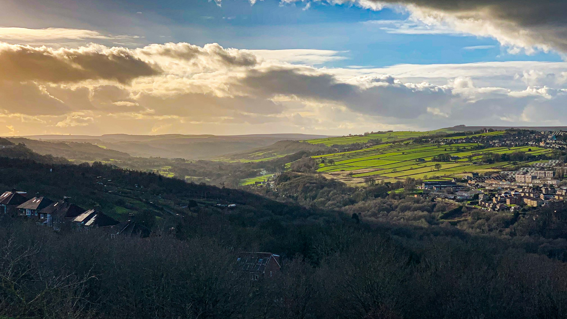
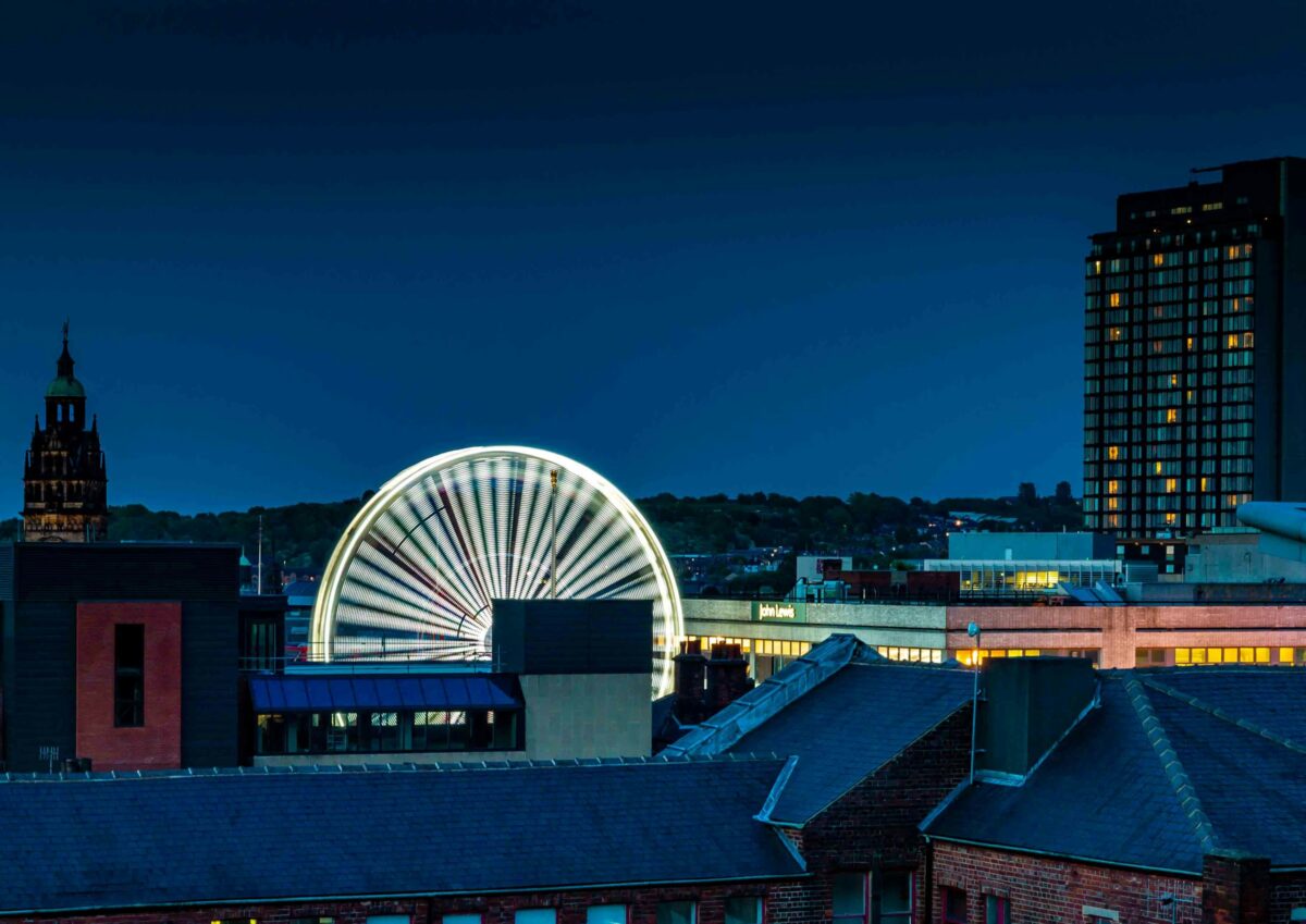
Photograph: Shane Rounce on Unsplash
All Sheffield areas · Open on the neighbourhood map
Sheffield neighbourhood
Castlegate, Sheffield
Inside the Castlegate boundary: 35 upcoming events, 19 businesses, 10 places, 17 charities.
Also known as Victoria Quays, Riverside.
Castlegate is the oldest part of Sheffield, where the Don meets the Sheaf and where Sheffield Castle once stood. The castle site is being opened up as a public park, Victoria Quays canal basin sits at the eastern edge, and the Wicker arches and Lady's Bridge mark the river crossings. The Castlegate Festival in September is the area's big annual programme, and the quays and riverside host markets and walks through the year.
Coming up in this neighbourhood
Showing 12 of 35.

Event
Dr Banana + Locky + dj sweet6teen
Things get a little strange after dark. Dr Banana, Locky + DJ Sweet6teen. Halloween at FORGE Warehouse, while Auditory takeover the Workroom
Event
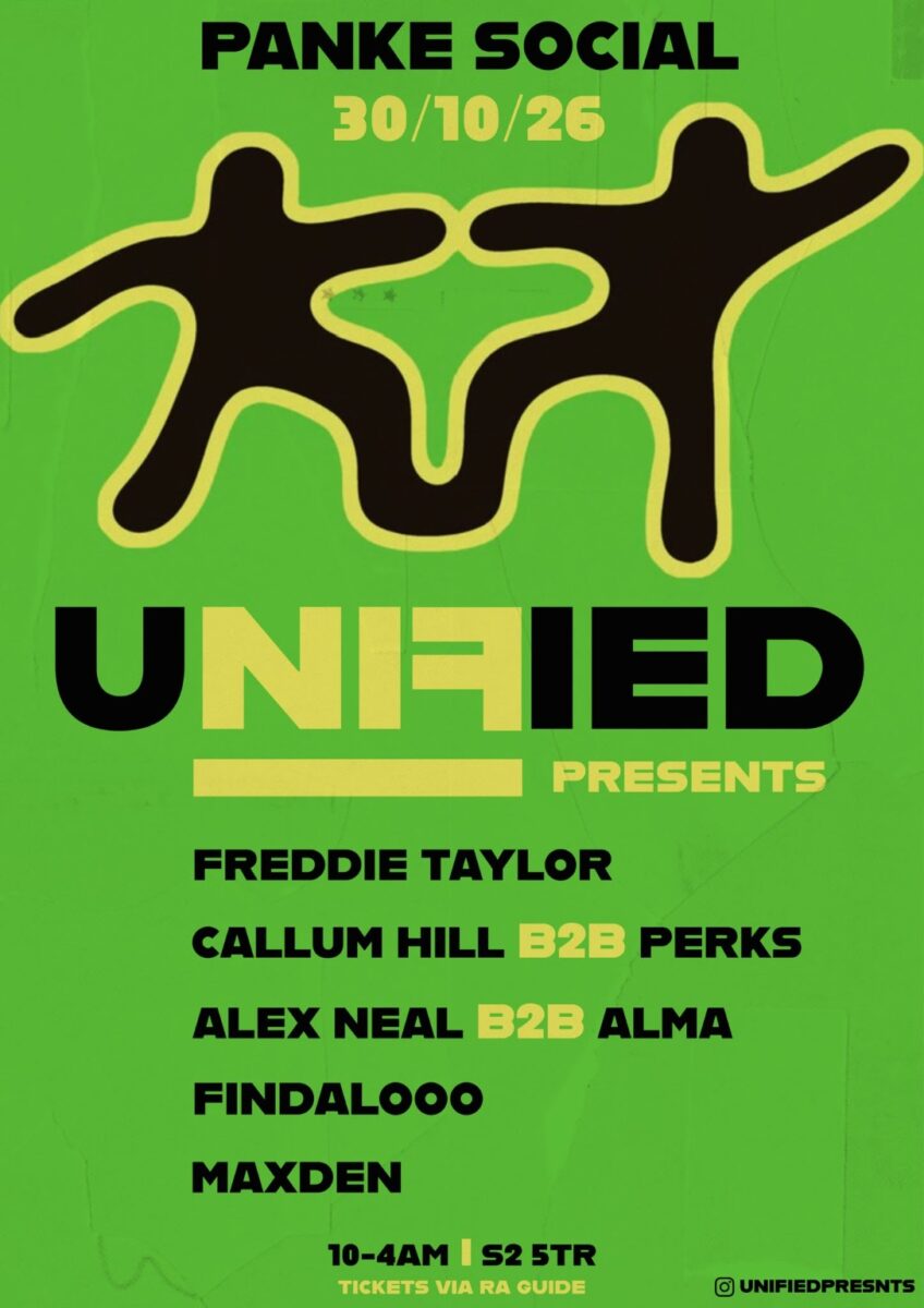
Unified presents: Halloweekend Takeover
Unified makes its debut at Panke Social with a night of house and garage from local and regional selectors. Fancy dress welcome.
Event
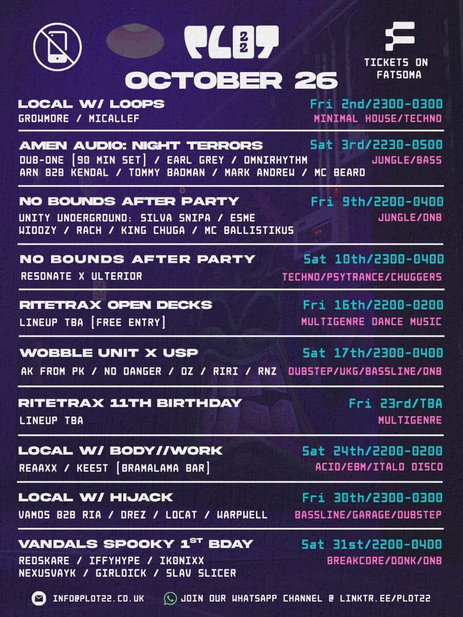
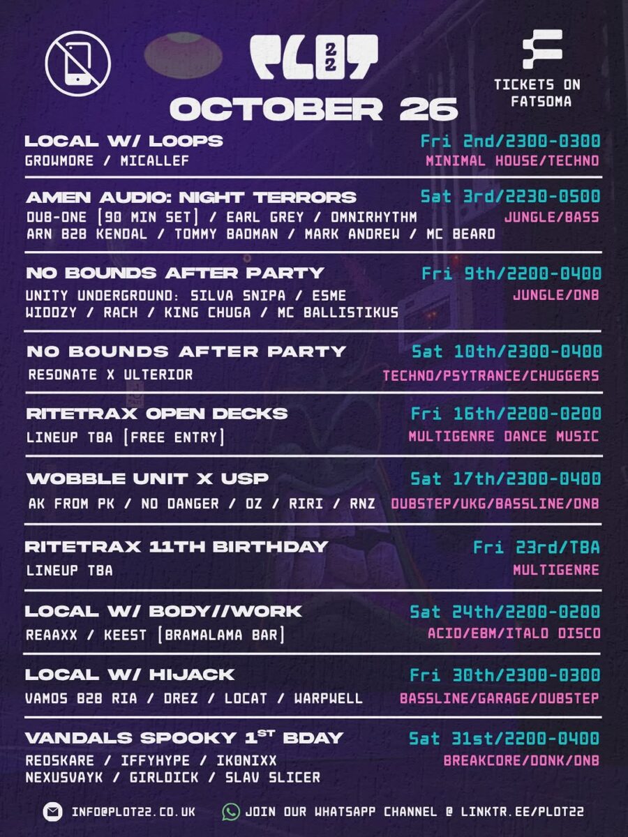
LOCAL w/ HIJACK
This event is a collaboration between Plot 22 and HIJACK another instalment of our LOCAL series.
Event
Curious Cabaret: Halloween Cabaret
A Halloween night of cabaret at Raccoon Studios with a live jazz band, belly dancing, circus, spoken word, comedy and other unexpected performances.Come dressed for Halloween…

Event
Ride The Underground: Halloween Lockdown Spooktacular
Speed garage, Bassline & House DIDI & RAZ – RYAN K & DJ SPOOKY – TRICKSTER & SCORPION – BASSLINE BROS – RICH G & DJ…
Event
FEARFEST After Party
The party doesn't end when the main event closes! AFTER PARTY at FORGE Warehouse!!
Event
CLUBLAND Halloween x Sheffield x Daytime Rave!
This Halloween the legendary CLUBLAND flies into SHEFFIELD with a MONSTER line up! Bringing you a SPINE TINGLING Daytime Rave like no other!
Event
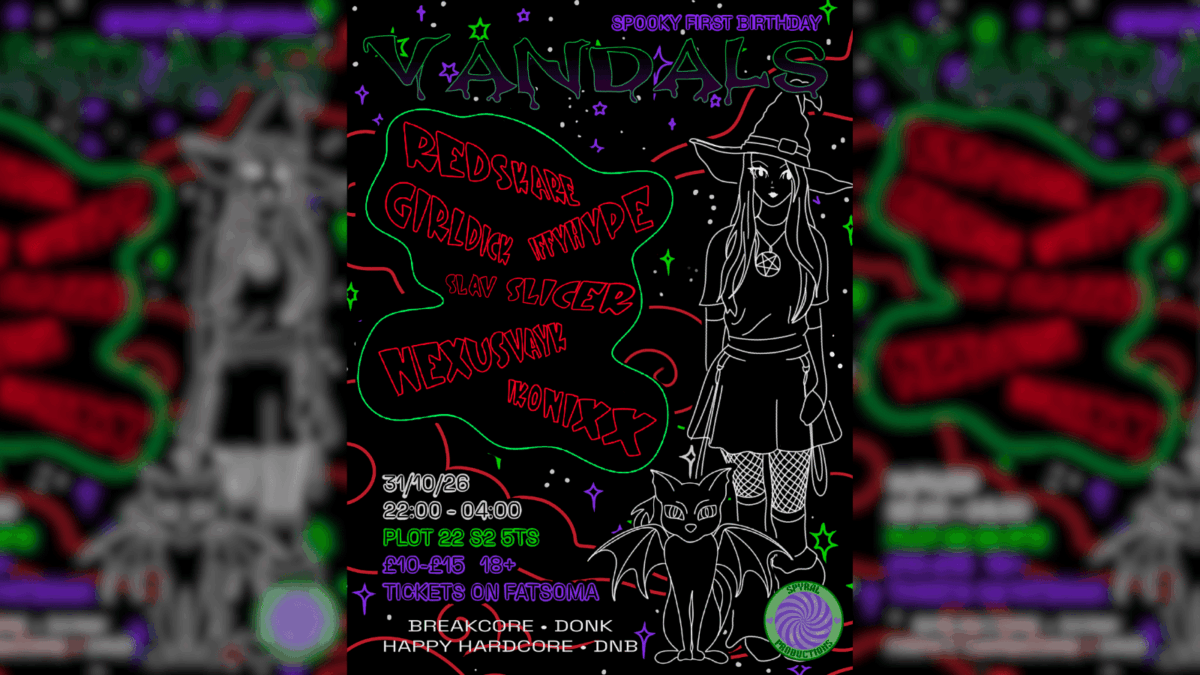
Spyral Productions presents Vandals 5
Spyral Productions return to Plot 22 for a Halloween night of breakcore, donk, happy hardcore and drum and bass. Dress as you wish.
Event
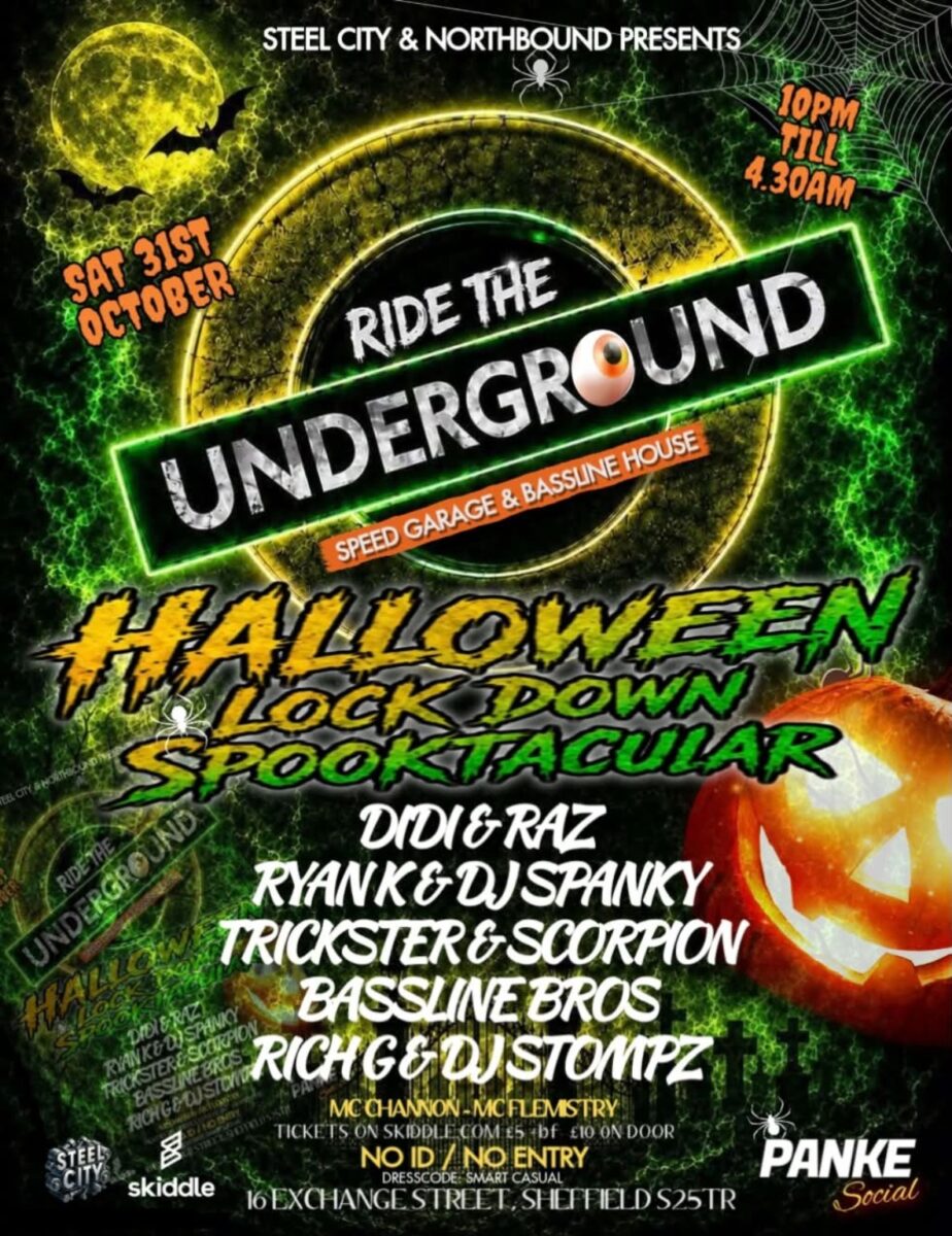
Ride The Underground: Halloween Lock Down
Steel City and Northbound bring Ride The Underground to Panke Social for a Halloween night of speed garage and bassline house. No ID, no entry.
Event
Spyral Productions 1st Birthday: Halloween
Spyral Productions celebrate their first birthday at Plot 22 on Halloween with breakcore, donk, happy hardcore and drum and bass. Phone-free dancefloor.
Businesses and places
Showing 12 of 29.
Place
Quayside Market
An independent waterside market bringing together street food, small traders, drinks and live music at Victoria Quays.
Place
Delicious Clam
Delicious Clam is an artist-run DIY space, label and community that has become one of the most quietly influential rooms in Sheffield music. Intimate, chaotic and…
Place
PANKE SOCIAL
Place
Southbank Warehouse
Place
FORGE
Place
FORGE Warehouse
Place
Plot 22
Plot 22 is an independent venue on Exchange Street in Sheffield city centre, a regular home for the city's underground electronic scene: house, bassline, jungle, drum…
Place
Victoria Quays
Place
Canada House
Place
Raccoon Studios
Charities based here
Showing 12 of 17.
Charity
The George Woofindin Almshouses
To provide accommodation in accordance with the aims and principles of the George Woofindin Almshouses.
Charity
Autism Plus Limited
The charity provides Residential and Supported Living services for adults with autism and other disabilities. Other key associated services includes Adult Learning, Employment and Training Programs,…
Charity
Sheffield Association for the Voluntary Teaching of English
Through providing opportunities to learn English, SAVTE aims to; * Reduce the isolation of the most excluded members of our community * Encourage their participation in…
Charity
Changing Our Lives Ltd
Changing Our Lives is a rights-based organisation that works in co-production with disabled people and people with lived experience of mental health difficulties of all ages…
Charity
The Jordan River Foundation
During the year 2015 the trustees reviewed the role of the Charity both through its own efforts and how it can work with other charities and…
Charity
C3 Trust UK
We are a pentecostal church bringing hope to the cities of England; providing inspirational biblical teaching and spiritual guidance.
Charity
June Hancock Mesothelioma Research Fund
The Fund was created in 1997 to raise awareness of mesothelioma, fund research, support patients and carers and, more recently, to campaign for the Mesothelioma Charter.
Charity
Irwin Mitchell Charities Foundation
The primary objects of the are:1. Promotion of charitable purposes for the benefit of the community generally;2. The relief of poverty in cases of need, hardship…
Charity
The Snowdrop Project
Snowdrop Project exists to empower survivors of human trafficking to live lives that are no longer defined by their past and we work to reduce the…
Charity
The Gregson Family Foundation
The Trustees shall hold the capital and income of the Trust Fund upon trust to apply the income and all or such part or parts of…
Scorecard 1 card
How Castlegate scores
Overall 55 out of 100, ranked 51 of 147 neighbourhoods, from 5 of 7 dimensions. Each score is a percentile rank against the other neighbourhoods, not a measurement.
- 4Quiet 3 inputs
- 41Green 3 inputs
- 84Connected 4 inputs
- 61Affordable 2 inputs
- –Safe not scored
- –Lively not scored
- 86Served 5 inputs
How these scores are worked out
Each input is a percentile rank: the share of the other neighbourhoods this one is at least as good as (direction per input). A dimension is the percentile rank of the mean of its available input ranks and needs at least two inputs; the overall score is the mean of the scored dimensions. Points are placed by point-in-polygon against the Data for Action boundaries; per-head figures use Census 2021 residents for neighbourhoods with their own census areas; noise shares sample an even grid of points inside each polygon against the Defra Lden bands; distances are straight lines from the polygon centre. Castlegate covers 0.55 km² and borrows its census figures from the nearest census area, so per-head inputs are not ranked; noise was sampled at 70 points.
| Dimension | Input | Value | Rank | Better | Source | Licence |
|---|---|---|---|---|---|---|
| Quiet | Sampled points inside a Defra road-noise band (55 dB Lden and over) | 12.9% | 13 | lower | noise | Open Government Licence v3.0 |
| Quiet | Sampled points inside a Defra rail-noise band (55 dB Lden and over) | 5.7% | 10 | lower | noise | Open Government Licence v3.0 |
| Quiet | Daily vehicles at DfT count points inside the boundary (sum of AADT; 0 when no counted major road is inside) | 132,627 vehicles a day | 3 | lower | roads | Open Government Licence v3.0 |
| Green | Nature and green sites inside the boundary: Natural England reserves, SSSIs, ancient woodland and open access land, plus council historic parks | 0 per km² | 49 | higher | land, council_more | Open Government Licence v3.0 |
| Green | Council community-forestry trees planted inside the boundary | 0 per km² | 43 | higher | council_more | Open Government Licence v3.0 |
| Green | Recent wildlife observations inside the boundary (iNaturalist and GBIF; counts only) | 1.81 per km² | 87 | higher | nature | Per record: CC0, CC BY or CC BY-NC |
| Green | Playgrounds, sports pitches and dog parks on OpenStreetMap | – No own census population (figures for this neighbourhood are borrowed from the nearest census area). | – | higher | osm_amenities | ODbL 1.0 |
| Connected | NaPTAN bus and coach stops inside the boundary | 28.93 per km² | 82 | higher | naptan | Open Government Licence v3.0 |
| Connected | NaPTAN bus and coach stops inside the boundary | – No own census population (figures for this neighbourhood are borrowed from the nearest census area). | – | higher | naptan | Open Government Licence v3.0 |
| Connected | Straight-line distance from the neighbourhood centre to the nearest tram stop | 431 m | 84 | lower | naptan | Open Government Licence v3.0 |
| Connected | Straight-line distance from the neighbourhood centre to the nearest rail station entrance | 913 m | 92 | lower | naptan | Open Government Licence v3.0 |
| Connected | Premises able to get gigabit broadband (Ofcom Connected Nations) | 54.7% | 6 | higher | connectivity | Open Government Licence v3.0 |
| Affordable | Median sold price over the last twelve months (standard sales, at least five) | £148,000 | 80 | lower | pricepaid | Open Government Licence v3.0 |
| Affordable | Median sold price against the Sheffield median for the same mix of property types (1.0 = Sheffield) | 1.06 | 40 | lower | pricepaid | Open Government Licence v3.0 |
| Affordable | Median sold price of a terraced house (at least five sales) | – Fewer than five sales in the window. | – | lower | pricepaid | Open Government Licence v3.0 |
| Affordable | Households renting (council, other social and private), Census 2021, as a proxy for rented supply | – Figures for this neighbourhood are borrowed from a neighbour, so it is not ranked on them. | – | higher | census_more | Open Government Licence v3.0 |
| Safe | Recorded street-level crimes over the last twelve months | – No street-level crime rows are stored. | – | lower | police | Open Government Licence v3.0 |
| Safe | Violence and sexual offences over the last twelve months | – No street-level crime rows are stored. | – | lower | police | Open Government Licence v3.0 |
| Safe | Burglaries over the last twelve months | – No street-level crime rows are stored. | – | lower | police | Open Government Licence v3.0 |
| Safe | Anti-social behaviour reports over the last twelve months | – No street-level crime rows are stored. | – | lower | police | Open Government Licence v3.0 |
| Safe | The stored police data holds neighbourhood meetings and priorities only; street-level crime counts are deliberately not stored, so no neighbourhood has a safety score yet. | |||||
| Lively | Upcoming events and classes on Sheffield Events located inside the boundary | – No own census population (figures for this neighbourhood are borrowed from the nearest census area). | – | higher | neighbourhoods | CC BY 4.0 (Sheffield Events listings inside Data for Action boundaries) |
| Lively | Businesses and places in the Sheffield Events directory located inside the boundary | – No own census population (figures for this neighbourhood are borrowed from the nearest census area). | – | higher | neighbourhoods | CC BY 4.0 (Sheffield Events listings inside Data for Action boundaries) |
| Lively | Real ale pubs on OpenStreetMap | – No own census population (figures for this neighbourhood are borrowed from the nearest census area). | – | higher | osm_amenities | ODbL 1.0 |
| Lively | Community centres on OpenStreetMap | – No own census population (figures for this neighbourhood are borrowed from the nearest census area). | – | higher | osm_amenities | ODbL 1.0 |
| Served | Straight-line distance from the neighbourhood centre to the nearest GP practice (NHS ODS) | 524 m | 47 | lower | nhs | Open Government Licence v3.0 |
| Served | Community pharmacies inside the boundary (NHS ODS) | – No own census population (figures for this neighbourhood are borrowed from the nearest census area). | – | higher | nhs | Open Government Licence v3.0 |
| Served | Open primary and all-through schools inside the boundary (Get Information about Schools) | – No own census population (figures for this neighbourhood are borrowed from the nearest census area). | – | higher | schools | Open Government Licence v3.0 |
| Served | Straight-line distance from the neighbourhood centre to the nearest library (Sheffield City Council) | 629 m | 73 | lower | council | Open Government Licence v3.0 |
| Served | Public defibrillators on OpenStreetMap inside the boundary | 12.66 per km² | 96 | higher | osm_amenities | ODbL 1.0 |
| Served | Public toilets inside the boundary (OpenStreetMap and the Toilet Map) | 0 per km² | 60 | higher | osm_amenities | ODbL 1.0 and CC BY 4.0 |
| Served | Electric vehicle chargers on OpenStreetMap inside the boundary | 0 per km² | 86 | higher | osm_amenities | ODbL 1.0 |
Areas like this
- Highfield 65
- Brightside 50
- Lowfield 64
- Park Hill 57
- Philadelphia 69
Neighbourhood scorecards by Sheffield Events, CC BY 4.0, derived from Defra noise mapping, DfT traffic counts, Natural England, Sheffield City Council, iNaturalist and GBIF, OpenStreetMap contributors (ODbL), the Toilet Map, NaPTAN, Ofcom, HM Land Registry, ONS Census 2021, NHS ODS, Get Information about Schools and the Data for Action neighbourhood boundaries; each input keeps its own licence. CC BY 4.0 · All data sources · Download the scores (API)
Living here 4 cards
Census 2021
How people here live
Castlegate is smaller than a census area, so these figures describe the census area whose population centre is nearest to it (Sheffield 075G).
- Most common way to work
- Working from home 35.3% Sheffield Driving 45.2%
- Owner-occupied homes
- 25.1% Sheffield 58.6%
- Households without a car
- 53.5% Sheffield 29.2%
- Born outside the UK
- 29.7% Sheffield 14.9%
- Most common answer on religion
- No religion 47.3% Sheffield No religion 43.4%
- Degree-level qualified, 16 and over
- 35.3% Sheffield 33.4%
- In very good health
- 42% Sheffield 46.7%
Source: Office for National Statistics, Census 2021, via Nomis, Open Government Licence v3.0. Neighbourhood figures sum the census areas whose population-weighted centres (ONS Open Geography, contains OS data © Crown copyright and database right 2026) fall inside each boundary. Census 2021 on Nomis · All data sources
Ofcom Connected Nations 2025
Broadband and mobile in Castlegate
970 premises in 3 census output areas whose population centres fall inside this boundary, as reported to Ofcom for July 2025.
Fixed broadband availability
- Gigabit-capable
- 55% Sheffield 93%
- 300 Mbit/s or faster
- 55% Sheffield 94%
- Superfast (30 Mbit/s or faster)
- 73% Sheffield 98%
- Cannot get 10 Mbit/s
- 25% Sheffield 0%
- Below the broadband USO
- 0% Sheffield 0%
Mobile signal
Mobile coverage is published for Sheffield as a whole: outdoor 4G from all four operators reaches 99.8% of premises, 5G from at least one operator 99.7%, and a good outdoor 4G or 5G signal from every operator 96.1%.
Availability means a service could be ordered at the address in July 2025; it is not a measured speed. Data edition: Ofcom Connected Nations 2025, published 19 November 2025.
Source: Ofcom Connected Nations 2025 data downloads (data for July 2025, published 19 November 2025), Ofcom copyright, reproduced under Ofcom's terms of use and the Open Government Licence v3.0. Output areas placed with ONS Open Geography lookups and population-weighted centroids, contains OS data © Crown copyright and database right 2026. Ofcom Connected Nations 2025 data · All data sources
Homes and prices
What sold in Castlegate
Completed sales registered from 27 Oct 2025 to 28 Aug 2026. 5 standard sales inside this boundary.
- Median price
- £148,000
- Middle half of sales
- £115,000 to £164,000
- Sheffield median
- £215,000
- Flat or maisonette
- £148,000 5 sales
Most recent registered sales
- Jul 2026 Millsands Flat or maisonette, leasehold £148,000
- Jan 2026 Victoria Quays Flat or maisonette, leasehold £164,000
- Dec 2025 Millsands Flat or maisonette, leasehold £109,000
- Dec 2025 Victoria Quays Flat or maisonette, leasehold £200,000
- Nov 2025 Millsands Flat or maisonette, leasehold £115,000
Contains HM Land Registry data © Crown copyright and database right 2026. This data is licensed under the Open Government Licence v3.0. Medians use standard sales only; the Land Registry’s additional category (for example buy-to-let and repossessions) is excluded. These are actual registered sales, not the mix-adjusted UK House Price Index estimate. Data is published one to two months in arrears and does not include every sale. Checked 25 Oct 2026. Price Paid Data · All data sources
Census 2021
Who lives in Castlegate
Castlegate is smaller than a census area, so these figures describe the census area whose population centre is nearest to it (Sheffield 075G, 2,674 residents).
Ages
- Under 15
- 8% Sheffield 17%
- 15 to 24
- 34% Sheffield 16%
- 25 to 44
- 33% Sheffield 26%
- 45 to 64
- 16% Sheffield 24%
- 65 and over
- 9% Sheffield 17%
Homes
- Owned
- 25% Sheffield 59%
- Social rented
- 44% Sheffield 23%
- Private rented
- 31% Sheffield 19%
- One-person households
- 47% Sheffield 33%
- Detached
- 2% Sheffield 15%
- Semi-detached
- 10% Sheffield 38%
- Terraced
- 7% Sheffield 26%
- Flats
- 81% Sheffield 21%
Work and study, residents aged 16 and over
- In work
- 46% Sheffield 53%
- Full-time students
- 35% Sheffield 14%
- Retired
- 9% Sheffield 20%
- Unemployed
- 8% Sheffield 4%
Source: Office for National Statistics licensed under the Open Government Licence v.3.0. Census 2021 tables via Nomis; population-weighted centroids from ONS Open Geography, contains OS data © Crown copyright and database right 2026. Census 2021 on Nomis · All data sources
Getting around 3 cards
Traffic counted here
3 DfT count points inside this boundary. Busiest: A61 B6539 to C761 Nursery Street with 47,520 motor vehicles a day in 2025. Quietest: A57 B6070 Park Square to A61 with 39,044. Most cyclists counted: A61 B6539 to C761 Nursery Street, 199 a day.
- Count point A61 B6539 to C761 Nursery Street 47,520 motor vehicles a day (2025) · 199 cyclists · estimated
- Count point A61 A6135 to A57 46,063 motor vehicles a day (2025) · 5 cyclists · estimated
- Count point A57 B6070 Park Square to A61 39,044 motor vehicles a day (2025) · 23 cyclists · estimated
Department for Transport STATS19
Road collisions here, 2021 to 2025
33 road collisions with someone hurt were recorded in this neighbourhood, 2021 to 2025: 0 fatal, 9 serious and 24 slight. 9 pedestrians and 5 cyclists were among the 40 people hurt.
- Collisions
- 33
- Fatal
- 0
- Serious
- 9
- Slight
- 24
- People hurt
- 40
- Pedestrians hurt
- 9
- Cyclists hurt
- 5
- 2021: 0 fatal, 0 serious, 6 slight6 hurt (pedestrians 2, cyclists 3)
- 2022: 0 fatal, 3 serious, 3 slight8 hurt (pedestrians 2, cyclists 0)
- 2023: 0 fatal, 3 serious, 6 slight10 hurt (pedestrians 2, cyclists 0)
- 2024: 0 fatal, 2 serious, 7 slight13 hurt (pedestrians 3, cyclists 2)
- 2025: 0 fatal, 1 serious, 2 slight3 hurt (pedestrians 0, cyclists 0)
Road collisions across Sheffield · On the Local Map
Road collision data from the Department for Transport (STATS19 road safety open data), Open Government Licence v3.0 Open Government Licence v3.0. Checked 12 Oct 2026. Road safety open data · All data sources
National Cycle Network
Signed cycle routes here
2.3 km of the National Cycle Network pass through this neighbourhood (Route 627, Route 6).
- 5 segments Route 6271.3 km in Sheffield · 100% traffic-free · 100% lit · mostly block paving, asphalt, paving slabs
- 10 segments Route 61.0 km in Sheffield · 97% traffic-free · 97% lit · mostly asphalt, paving slabs, block paving
National Cycle Network data from the Walk Wheel Cycle Trust (formerly Sustrans) under the Open Government Licence v3.0. Contains Ordnance Survey data © Crown copyright and database rights 2018. Open Government Licence v3.0. Checked 26 Oct 2026. The dataset on ArcGIS · All data sources
Environment and sky 10 cards
Noise here
About 16% of this area is mapped at 55 dB or more from road traffic; the loudest band here is 75 dB or more, covering about 5%. About 4% of this area is mapped at 55 dB or more from railways; the loudest band here is 70 to 75 dB, covering about 2%.
Rain and rivers here
Nearest rain gauge: Ringinglow, 6.8 km away. 59.6 mm of rain in the last 7 days, wettest day Saturday 24 Oct with 27.3 mm.
- River level River Don at Sheffield Lady's Bridge 0.46 m, falling
Storm overflows here
4 monitored storm overflows inside this boundary. None is discharging now or has in the last 48 hours.
- 🟢 Not discharging River Don Not discharging · last discharge ended 17 Jan 02:18
- 🟢 Not discharging River Don Not discharging · last discharge ended 23 Apr 12:22
- 🟢 Not discharging River Don Not discharging · last discharge ended 8 Jul 21:16
- ⚪ Monitor offline River Don Monitor offline
Air quality here
No sensor inside this boundary; the nearest is shown.
- Within WHO guideline Sensor 21258 PM2.5 6.0, PM10 26.4 µg/m³ · 2.9 km from the centre of the area · read 29 Oct 05:24
British Geological Survey
The ground beneath Castlegate
At the centre of Castlegate the bedrock is the Pennine Lower Coal Measures Formation: mudstone, siltstone, sandstone, coal, ironstone and ferricrete, Carboniferous, Langsettian (Westphalian A), about 316 to 314 million years ago, on the BGS 1:625 000 bedrock map (unit PSLCM). The 1:625 000 map is a regional overview generalised from more detailed sheets: it describes the ground under a neighbourhood as a whole and is not a site investigation.
Contains British Geological Survey materials © UKRI 2026. Open Government Licence v3.0. Checked 10 Oct 2026. BGS Geology 625k bedrock · All data sources
Recorded flood outlines
Floods recorded here
The Environment Agency has mapped 3 floods reaching part of Castlegate / Victoria Quays / Riverside, the earliest in 2007. The outlines show where water got to those times, not where it will go next, and floods that nobody surveyed are not recorded.
- 2019 November Flood Incident7 to 8 Nov 2019 · 1 outline · main river · channel capacity exceeded
- 2007 River Don – Wadlesy Bridge to Philadelphia15 to 30 Jun 2007 · 1 outline · main river · channel capacity exceeded
- 2007 River Don Valley Development to Rawmarsh15 to 30 Jun 2007 · 1 outline · main river · channel capacity exceeded
The outlines on the Local Map · Today's river levels
Recorded Flood Outlines, © Environment Agency copyright and/or database right 2025. Open Government Licence v3.0. Checked 12 Oct 2026. Recorded Flood Outlines dataset · All data sources
Ordnance Survey, OS Open Greenspace
Pitches, courts and greens here
- Other sports grounds
- 1
- Gates and entrances
- 1
Across Sheffield · On the Local Map
Contains OS data © Crown copyright and database right 2026. OS Open Greenspace, Open Government Licence v3.0. Checked 12 Oct 2026. Dataset: OS Open Greenspace, 2026-04 release · All data sources
Mining Remediation Authority
Coal mining legacy here
About 5.5% of Castlegate / Victoria Quays / Riverside, roughly 3.0 hectares, lies in a coal mining Development High Risk Area: recorded shafts, adits or shallow workings are at or near the surface, so new building there needs a coal mining risk assessment.
- Land in a high risk area
- 5.5%about 3.0 hectares
- Sheffield as a whole
- 17.1%
This is a planning designation drawn from recorded features, not a survey of any one property, and being in an area does not mean the ground there is unsafe. Buying or building? Ask the authority itself. Check if a property is affected by coal mining · Coal mining risk assessments for planning · Report a coal mine hazard (24 hours)
Contains Mining Remediation Authority data, Crown copyright, Open Government Licence v3.0. Checked 26 Oct 2026. Dataset: Coal mining Development High Risk Area · All data sources
Wildlife recorded here
1 dated observation inside this boundary in the last twelve months, from GBIF and iNaturalist. Each is a sighting on the day shown by the person credited; it is not a guarantee that the species is still there.
- Bird Common Merganser Mergus merganser 28 Jan 2026 · User 928516 · GBIF, CC BY-NC 4.0
Benches and geocaches here
1 memorial bench with its inscription from OpenBenches, at recorded positions inside this boundary.
- Bench This is the bench where Neill Robbins performed the loudest fart ever recorded. recorded May 2022
Heritage and culture 4 cards
On Wikipedia and Commons
20 Wikipedia articles, placed inside this boundary.
- Attercliffe Road railway station Attercliffe Road railway station is a former railway station in Sheffield, South Yorkshire, England.
- Castle Market Castle Market was an indoor market in Sheffield city centre, England.
- City Goods station City Goods Station (also known as Wharf Street Goods Depot) was a goods station, in Sheffield, Yorkshire belonging to the London and North Western Railway, after Nationalisation it came under the auspices of British Railways.
- Great Sheffield Flood The Great Sheffield Flood was a flood that devastated parts of Sheffield, England, on 11 March 1864, when the Dale Dyke Dam broke as its reservoir was being filled for the first time.
- Park Square Bridge Park Square Bridge, also known as the Supertram Bridge, is a prominent bridge in the city of Sheffield, England.
- River Sheaf The River Sheaf in Sheffield, South Yorkshire, England, flows northwards, past Dore, through Abbeydale and north of Heeley.
- Sheffield Castle Sheffield Castle was a castle in Sheffield, England, constructed at the confluence of the River Sheaf and the River Don, possibly on the site of a former Anglo-Saxon long house, and dominating the early town.
- Sheffield Victoria railway station Sheffield Victoria was one of the main railway stations in Sheffield, South Yorkshire, England, until 1970; it was a principal stop on the Great Central Railway.
- Victoria Quays Victoria Quays (formerly Sheffield Canal Basin) is a large canal basin in Sheffield, England.
- 2 Haymarket
- All 20 articles on the map
Landmarks and heritage
27 listed buildings, landmarks and plaques whose recorded position is inside this boundary, from Wikidata and Open Plaques.
- Listed or scheduled Sheffield United Gas Light Company Offices Grade II* listed building architectural structure in Sheffield, South Yorkshire, England, UK Wikipedia · Photo on Commons · Heritage List entry
- Listed or scheduled Terminal Warehouse Grade II* listed building listed building at the end of Victoria Quays, Sheffield Photo on Commons · Heritage List entry
- Listed or scheduled 11-20, Canal Wharf Grade II listed building building in Sheffield, South Yorkshire, England, UK Photo on Commons · Heritage List entry
- Listed or scheduled 12 And 13, Wharf Street Grade II listed building building in Sheffield, South Yorkshire, England, UK Photo on Commons · Heritage List entry
- Listed or scheduled 2 Haymarket Grade II listed building · since 1871 Grade II listed building in Sheffield City Centre in England Wikipedia · Photo on Commons · Heritage List entry
- Listed or scheduled Attercliffe Sipelia Works Grade II listed building architectural structure in Sheffield, South Yorkshire, England, UK Heritage List entry
- Listed or scheduled Cadman Street Canal Bridge Sheffield And Tinsley Canal Grade II listed building bridge in Sheffield, South Yorkshire, England, UK Heritage List entry
- Listed or scheduled Castle House Grade II listed building retail building in Sheffield, South Yorkshire, England, UK Photo on Commons · Heritage List entry
- Listed or scheduled Crucible Steel Works Occupied By Cdk Precision Engineers Grade II listed building architectural structure in Sheffield, South Yorkshire, England, UK Heritage List entry
- Listed or scheduled Grain Warehouse Grade II listed building warehouse in Sheffield, South Yorkshire, England, UK Photo on Commons · Heritage List entry
- Listed or scheduled Remains Of Sheffield Castle Benaeth Castle Market (2) Grade II listed building architectural structure in Sheffield, South Yorkshire, England, UK Heritage List entry
- Listed or scheduled Remains Of Sheffield Castle Beneath Castle Market (1) Grade II listed building architectural structure in Sheffield, South Yorkshire, England, UK Heritage List entry
- All 20 listed buildings and monuments on the map
- Landmark Attercliffe Road railway station Railway station railway station in South Yorkshire, England, UK, now closed Wikipedia
- Landmark Castle Market Market indoor market in Sheffield, England Wikipedia
- Landmark City Goods station Railway station railway station in Sheffield, the UK Wikipedia · Photo on Commons
- Landmark National Videogame Museum Computer museum · since 2018 British video game museum based in Sheffield Wikipedia · Photo on Commons
- Landmark Sheffield Law Courts Court · since 1996 Judicial building in Sheffield, England Wikipedia · Photo on Commons
- Landmark Sheffield Victoria railway station Railway station railway station in South Yorkshire, England, UK, now closed Wikipedia · Photo on Commons
- Landmark Victoria Quays Wharf wharf in Sheffield, UK Wikipedia · Photo on Commons


Museums and galleries here
1 museum or gallery inside this boundary.
- National Videogame Museum Computer museum · opened 2018 · The BGI
Canal & River Trust
The canal here
The Sheffield and Tinsley Canal passes through this neighbourhood with 8 bridges, 1 wharf, 1 slipway on the Trust's register.
- Sheffield Basin WharfWharf · FT-001-001
- Sheffield Basin Swing BridgeTowpath or swing bridge · FT-001-006
- Site Of Old Railway BridgeRemains of a former bridge · FT-001-007
- Sheffield Inner Ring Road BridgeRoad bridge · FT-001-008
- Sheffield Victoria Railway ViaductRailway bridge · FT-001-009
- Sheffield Boatyard SlipwaySlipway · FT-001-012
- Bridge 3, Cadman Street BridgeRoad bridge · FT-001-013
- Midland Railway Bridge 4Railway bridge · FT-001-014
- Footbridge over Drydock GatesFootbridge · FT-001-032-01
- Cadman Street Gas Pipe BridgePipe crossing · FT-001-050
Lock, bridge, wharf, weir and slipway locations from the Canal & River Trust asset register, published on the Trust's open data hub under the Open Government Licence v3.0. Open Government Licence v3.0. Checked 26 Oct 2026. The dataset on the Trust's open data hub · All data sources
Council and democracy 4 cards
Council data for this area
What Sheffield City Council's open data records inside this boundary.
- Local heritage Gas Company office extension
- Local heritage Marshall's Steelworks' Cementation Furnaces
- Local heritage The Davy Building, Castle Street
- Litter bins 52 council litter bins on the streets here
Planning applications here
13 applications lodged in the last 12 weeks, 11 still undecided.
- UndecidedStraddle Wharf Street Victoria Quays Sheffield S2 5SY
- Undecided2 Haymarket (and 5 To 7 Commercial Street) Sheffield S1 1PF
- UndecidedStraddle Wharf Street Victoria Quays Sheffield S2 5SY
- UndecidedNorth Quay Side Wharf Street Victoria Quays Sheffield
- UndecidedThe Adsetts Partnership 2 Bridge Street Sheffield S3 8NS
- UndecidedHealth And Safety Executive Foundry House 3 Millsands Sheffield S3 8NH
- Undecided12 – 18 Haymarket Sheffield S1 2AX
- UndecidedCMS South Quay 1 Wharf Street Victoria Quays Sheffield S2 5SY
- All 13 applications on the map
Planning applications: UK PlanIt, aggregated from Sheffield City Council. Check the council record before relying on any detail; documents are linked, never copied. UK PlanIt · All data sources
Planning constraints
Conservation areas and brownfield land here
2 conservation areas cover part or all of this neighbourhood, so changes to buildings, trees and frontages there need extra care and often permission. 6 sites on the brownfield land register sit here, 0.3 hectares in all put forward for housing.
- Court House, Waingate
- 51-57 High Street And Second Floor Of 59-73 High Street
- 2 Haymarket And 5-7 Commercial Street Sheffield S1 1PF
- 23-25 Haymarket Sheffield S1 2AW
- First Floor To Third Floors 19 – 21 Haymarket Sheffield S1 2AW
- Quicksilver 32 Castle Street Sheffield S3 8LT
Contains planning.data.gov.uk data published by Sheffield City Council and neighbouring planning authorities under the Open Government Licence v3.0; conservation area boundaries © Historic England, containing Ordnance Survey data © Crown copyright and database right. Open Government Licence v3.0. Checked 10 Oct 2026. planning.data.gov.uk · All data sources
Draft Sheffield Plan
Sites the plan allocates here
9 sites in this neighbourhood are allocated in the draft Sheffield Plan, with room for 763 new homes in all. It is a draft at Main Modifications stage with a further round of changes still to settle, so sites and numbers can change. About the Sheffield Plan
- CW03 West Bar Square, S3 8NWStrategic Mixed Use Site · 525 homes · 3.13 ha · brownfield
- CW11 51-57 High Street And Second Floor Of 59-73 High Street, s1 2GDHousing Site · 97 homes · 0.07 ha · brownfield
- CW04 Buildings at Dixon Lane and Haymarket, S2 5TSMixed Use Site · 75 homes · 0.83 ha · brownfield
- CW18 23-25 Haymarket, S1 2AWHousing Site · 28 homes · 0.04 ha · brownfield
- CW06 29-57 King Street, S3 8LFMixed Use Site · 19 homes · 0.11 ha · brownfield
- CW19 Sheaf Quay, 1 North Quay Drive, Victoria Quay, Sheffield, S4 7SWHousing Site · 16 homes · 0.45 ha · brownfield
- CW08 First Floor To Third Floors, 19 – 21 Haymarket, S1 2AWMixed Use Site · 3 homes · 0.03 ha · brownfield
- CW01 Castlegate (Exchange Place)Strategic Employment Site · Office · 0.12 ha · brownfield
- CW02 Castlegate (Shude Hill)Strategic Employment Site · Office · 0.31 ha · brownfield
Site allocations: Sheffield City Council, Main Modifications Sheffield Plan Policies Map, under the Open Government Licence v3.0. Contains Ordnance Survey data © Crown copyright and database right. Checked 12 Oct 2026. Dataset: Site Allocation · All data sources
Money and energy 3 cards
National Lottery grant database
Lottery money in City ward
Awards filed to recipients in City ward, the ward this area sits in. Awards to individuals are counted in the figures and never named.
- Awards since 1995
- 1,504
- Awarded in total
- £227.0m
- Awards since 2022
- 262
- Awarded since 2022
- £37.7m
Latest awards to organisations here
- South Yorkshire Mayoral Combined Authority · £531,045South Yorkshire's People's Forest · The National Lottery Heritage Fund · 8 Sep 2026
- The Counselling and Therapy Hub CIC · £20,000Peer Support and Training for Neurodivergent Adults · National Lottery Awards for All England · The National Lottery Community Fund · 3 Sep 2026
- Roots Mbili Theatre · £250,000Theatre Breakthrough Fund (North) Stage Two Application · Theatre Breakthrough Fund (North) · Arts Council England · 27 Aug 2026
Lottery money across Sheffield
National Lottery grant data from the Department for Culture, Media and Sport, Open Government Licence v3.0. Checked 28 Oct 2026. National Lottery grant database · Sheffield export (CSV) · All data sources
Office for National Statistics via Nomis
Work in this area
Castlegate sits in City (Sheffield) ward. The claimant count is the number of people there on Universal Credit or Jobseeker's Allowance who are required to look for work, as a share of residents aged 16 to 64; the ward series begins in January 2026.
- Claimants in City (Sheffield) ward
- 845Sep 2026
- Share of residents aged 16 to 64
- 3.1%Sep 2026
- Sheffield
- 4.4%16,785 claimants, Sep 2026
| Month | City (Sheffield) | Sheffield |
|---|---|---|
| Jan 2026 | 2.8 % | 4.2 % |
| Feb 2026 | 2.8 % | 4.3 % |
| Mar 2026 | 2.9 % | 4.3 % |
| Apr 2026 | 2.9 % | 4.3 % |
| May 2026 | 3 % | 4.3 % |
| Jun 2026 | 2.9 % | 4.3 % |
| Jul 2026 | 2.9 % | 4.3 % |
| Aug 2026 | 3.1 % | 4.3 % |
| Sep 2026 | 3.1 % | 4.4 % |
Source: Office for National Statistics licensed under the Open Government Licence v3.0, via Nomis. Ward boundaries from ONS Open Geography, OGL v3.0. Checked 26 Oct 2026. Claimant count on Nomis · Nomis · All data sources
Sheffield City Council business rates
Rated business premises here
385 premises in Castlegate / Victoria Quays / Riverside are on the business rates list, with a combined rateable value of £22,988,135.
- Rated premises
- 385
- Total rateable value
- £22,988,135
- Middle rateable value
- £8,100
- Shops and retail
- 53
- Offices
- 152
- Workshops, warehouses and industry
- 119
- Pubs, restaurants, cafes and hotels
- 29
Commonest kinds
- Offices And Premises147 premises
- Workshop And Premises49 premises
- Shop And Premises46 premises
- Store And Premises27 premises
- Warehouse And Premises20 premises
Streets with the most premises
- Exchange Street, S275 rated premises
- Effingham Road, S446 rated premises
- Sussex Street, S426 rated premises
- Cadman Street, S421 rated premises
- Wharf Street, S220 rated premises
- Furnival Road, S418 rated premises
Highest rateable values here
- Sycc Incinerator, Bernard Road, S4 7YXEnergy Recovery Facility And Premises · rateable value £2,640,000 · rates paid by Veolia Enviromental Services Sheffield Ltd
- Vulcan House, 6 Millsands, S3 8NUOffices And Premises · rateable value £2,440,000 · rates paid by The Government Property Agency
- Sheffield Combined & Family, Court Centre, 48/50, West Bar, S3 8PHLaw Court And Premises · rateable value £1,920,000 · rates paid by Court Service Agency Aplrd,
- Riverside East, 2 Millsands, S3 8DTOffices And Premises · rateable value £1,430,000 · rates paid by Irwin Mitchell Llp
- 2 Cutlers Gate, S4 7TLOffices And Premises · rateable value £720,000 · rates paid by Capita Business Services Ltd
Business premises across Sheffield · On the Local Map
Business rates public dataset from Sheffield City Council via Data Mill North, Open Government Licence v3. Checked 12 Oct 2026. Business rates on Data Mill North · All data sources
Sport and facilities 1 card
Somewhere to play here
3 sites inside this boundary, with 6 facilities between them.
- Quayside Market Health and Fitness Gym, Studio, Swimming Pool · Commercial
- Padel Elite (Sheffield) 2 × Padel · pay and play
- FORGE Warehouse Health and Fitness Gym · Commercial
Community 3 cards
Around here
63 everyday places mapped inside this boundary by OpenStreetMap volunteers and the Toilet Map.
- 31 cycle parking stands
- 11 public artworks
- 7 defibrillators
- 3 cash machines
- 3 memorials
- 3 post boxes
- 2 community centres
- 2 shelters
- 1 fountain
- Nearest defibrillator Defibrillator 340 m away from the centre of the area
- Nearest toilets Toilets 520 m away from the centre of the area
- Nearest drinking water Drinking water 510 m away from the centre of the area
- Nearest cycle parking Cycle parking 140 m away from the centre of the area
- Nearest ev charger EV charger 210 m away from the centre of the area
Legal aid offices here
- Anti Trafficking And Labour Exploitation Unit · 020 7700 7311Housing, Debt, Immigration and asylum, Actions against the police, Public law, Modern slavery · S3 8LT
- Howells Solicitors Limited · 0114 249 6666Family, Crime, Actions against the police, Clinical negligence · S3 8NL
- Irwin Mitchell LLP · 0870 1500 100Crime, Community care, Education, Public law · S3 8DT
Directory of legal aid providers, Legal Aid Agency (Ministry of Justice), Open Government Licence v3.0. All legal aid offices in Sheffield
Co-operatives UK open data
Co-operatives and societies registered here
1 co-operative, society or community business on the Co-operatives UK register gives a postcode in this neighbourhood.
- Sheffield Live · CastlegateSociety · Art, culture and education · founded 2012 · Cityturnover £204k, 114 members, 5 employees (accounts to Mar 2022)
Co-operative register and economy data from Co-operatives UK open data, ODC-By v1.0. Checked 12 Oct 2026. Co-operatives UK open data · All data sources
Charts 1 card
In numbers
Castlegate in numbers
The same census and Land Registry figures shown above, drawn so the shape is easier to see, and set against every other Sheffield neighbourhood. Hover or tab to a bar for its value; every chart has its data as a table.
Ages
Homes
| Area | Owned | Social rented | Private rented |
|---|---|---|---|
| Castlegate | 25.1% | 44.3% | 30.6% |
| Sheffield | 58.6% | 22.6% | 18.8% |
| Area | Detached | Semi-detached | Terraced | Flats |
|---|---|---|---|---|
| Castlegate | 2% | 9.6% | 7.4% | 81% |
| Sheffield | 15% | 38% | 26% | 21% |
Sold prices by month
Only 5 sales were registered inside Castlegate in the last twelve months; the monthly chart needs at least 12.
| Area | Lower quartile | Median | Upper quartile | Sales |
|---|---|---|---|---|
| Castlegate | £115,000 | £148,000 | £164,000 | 5 |
| Sheffield | £161,875 | £215,000 | £300,000 | 4,388 |
How this neighbourhood compares
Castlegate is smaller than a census area, so it borrows a neighbour’s figures and is left out of the comparisons rather than counted twice.
Source: Office for National Statistics licensed under the Open Government Licence v.3.0. Census 2021 tables via Nomis; population-weighted centroids from ONS Open Geography, contains OS data © Crown copyright and database right 2026. Contains HM Land Registry data © Crown copyright and database right 2026. This data is licensed under the Open Government Licence v3.0. All data sources
More 3 cards
Recorded crime here, August 2026
67 offences were recorded inside this boundary in August 2026.
| Offence type | Recorded |
|---|---|
| Public order | 15 |
| Anti-social behaviour | 11 |
| Shoplifting | 9 |
| Other theft | 8 |
| Violence and sexual offences | 8 |
| Criminal damage and arson | 5 |
| Other crime | 5 |
| Burglary | 4 |
Offences recorded by South Yorkshire Police in August 2026, counted into this neighbourhood. Locations published by the Home Office are approximate by design, so this is a count for the area, never for a street or an address.
Problems people reported here
13 problems reported to the council through FixMyStreet in the last 60 days. Each one is somebody's report, not a verified fact.
- Flytipping still open on FixMyStreet · reported 2 weeks ago
- Road traffic signs still open on FixMyStreet · reported 2 weeks ago
- Flytipping closed on FixMyStreet · reported 2 weeks ago
- Flytipping still open on FixMyStreet · reported 2 weeks ago
- Trees still open on FixMyStreet · reported 2 weeks ago
- Trees still open on FixMyStreet · reported 2 weeks ago
- Flytipping still open on FixMyStreet · reported 3 weeks ago
- Bus stops still open on FixMyStreet · reported 3 weeks ago
- Rubbish (refuse and recycling) still open on FixMyStreet · reported 3 weeks ago
- Rubbish (refuse and recycling) still open on FixMyStreet · reported 4 weeks ago
- Rubbish (refuse and recycling) still open on FixMyStreet · reported 4 weeks ago
- Flytipping still open on FixMyStreet · reported 1 month ago
Alerts
Follow Castlegate / Victoria Quays / Riverside and hear what happens here: new events and places listed, planning applications, roadworks, storm overflows, floods and poor air. Floods and overflows arrive straight away; the rest come as one round-up at 8am, grouped by area.
Yorkshire Water (CC BY 4.0), Environment Agency (OGL v3), UK PlanIt and TomTom via the live map.
60 listings have also been filed under the Castlegate area tag.
Castlegate: your questions answered
What is on in Castlegate soon?
35 upcoming events are located inside the Castlegate boundary, starting with Dr Banana + Locky + dj sweet6teen (30 October), Unified presents: Halloweekend Takeover (30 October), Hijack at Plot 22 (30 October). Every listing has the venue, a map and the organiser's link.
Which venues and businesses are in Castlegate?
29 directory entries sit inside Castlegate, including Quayside Market, Delicious Clam, PANKE SOCIAL, Southbank Warehouse, National Videogame Museum. Each has its address, opening details where published and its upcoming events.
Which areas are next to Castlegate?
The areas nearest to Castlegate are Wicker, Hyde Park, Park Hill, Cathedral Quarter, City Centre. Each has its own page with the events and places inside it.
How is the Castlegate boundary defined?
The boundary is the Castlegate polygon from the Sheffield neighbourhoods dataset published by Data for Action, one of 147 across the city. Events, businesses, places and charities are placed inside it by their coordinates, so a venue just over the line appears on the neighbouring page instead.
Neighbouring areas
- Wicker 25
- Hyde Park 4
- Park Hill 10
- Cathedral Quarter 52
- City Centre 1,250
- Kelham 22
- Saint Vincent's and Shalesmoor 15
- Wybourn 16
Neighbourhood boundaries by Data for Action, licensed CC BY 4.0 and used with credit. Snapshot 946d748, published 16 Dec 2025, last checked 13 Oct 2026. Records are placed by their stored coordinates; a point on a shared boundary belongs to the first neighbourhood in the source file. All data sources