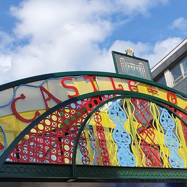
12 September 2026 · 12:00 – 21:00
Quayside Market: Castlegate Festival Special
Victoria Quays
The canal basin market pulls out the stops for the festival: award-winning street food, local makers, live music, a pop-up bar and free family games from midday right through to 9pm. The Sheffield Community Bike Project are servicing bikes for free between 1pm and 4pm, so wheel yours down.
Part of Castlegate Festival 2026 (12 to 20 September), the free celebration of heritage, arts, music and markets in Sheffield’s oldest quarter, organised by Sheffield City Council and Sheffield BID. Full programme (PDF).
Getting there and what to expect
Weather
- Sunset 19:29, dark from 20:05 (Sunset and dusk computed for the venue)
Getting there
- Stops: Exchange Place/CG15 (27597) (85 m); Exchange Place/CG14 (27596) (107 m); Broad Street/Blast Lane (adj) (225 m) (Stops: NaPTAN, Department for Transport (OGL v3); lines: bustimes.org / Bus Open Data (OGL v3))
- Sheffield Rail Station 700 m away, tram at Fitzalan Square 260 m away (Stops: NaPTAN, Department for Transport (OGL v3); lines: bustimes.org / Bus Open Data (OGL v3))
- Parking: Castlegate 130 m, 403 spaces (OpenStreetMap contributors (ODbL))
- Cycle parking 40 m, EV charger 240 m (OpenStreetMap contributors (ODbL))
- On the roads within 1 km: Road works B6073: Roadworks; Road works B6073: Roadworks; Road closed: Closed (Traffic: TomTom)
- About 9 min walk from the city centre (750 m, straight-line estimate) (Straight-line estimate at 5 km/h; streets are longer)
- Open on the main map with this event pinned (Sheffield Events live map)
- Can I get there and back? Put your postcode into the tool below for the last bus and tram, the walk home, and the car parks. (Timetables: Bus Open Data Service (Department for Transport). Contains public sector information licensed under the Open Government Licence v3.0.)
Around the venue
- Air quality within WHO guideline (PM2.5 5.7, PM10 12.6 µg/m³, sensor 2.6 km away) (Air quality: Sensor.Community (ODbL, indicative) and DEFRA UK-AIR (OGL v3))
- Defibrillator 120 m, toilets 290 m (OpenStreetMap contributors (ODbL))
- No storm overflow discharging within 1 km (Storm overflows: Yorkshire Water (CC BY 4.0))
What is on around it
- Seeds that Travel: foraging and image-making with Al-Wah’at (12:00, 140 m away) (Sheffield Events listings)
- Gambo FM presents “Urban Foot Patrol” (19:00, 190 m away) (Sheffield Events listings)
- Harmony Works at Canada House: the plans, the photos, the Memory Cafe (12:00, 250 m away) (Sheffield Events listings)
Can I get there and back
The last bus and tram, the walk, what is recorded about step-free access and the car parks.
- Nearest defibrillator Defibrillator 120 m away · 24/7
- Nearest toilets Toilets 290 m away · free
- Nearest cycle parking Cycle parking 40 m away · 4 spaces
- Nearest EV charger EV charger 240 m away
Read about this area on Wikipedia
- Victoria Quays
Victoria Quays (formerly Sheffield Canal Basin) is a large canal basin in Sheffield, England.
- City Goods station
City Goods Station (also known as Wharf Street Goods Depot) was a goods station, in Sheffield, Yorkshire belonging to the London and North Western Railway, after Nationalisation it came under the auspices of British Railways.
- Castlegate Quarter
- River Sheaf
The River Sheaf in Sheffield, South Yorkshire, England, flows northwards, past Dore, through Abbeydale and north of Heeley.
- Park Square, Sheffield
Article titles and extracts from Wikipedia, CC BY-SA 4.0; each links to its article.
- 2 to Sheffield Centre 0.2 km away, 8 min late
- X17 to Chesterfield 0.3 km away, 1 min late
- 120 to Halfway 0.4 km away, 4 min late
- 30A to Plumbley 0.5 km away, 7 min late
Around the same time
You might also like
Your event memories
Check in, add a photo and build your Sheffield journey.